
Cowles Mountain and Pyles Peak
 WOW! For a very short, around eight miles, this in-town ride packs a
lot of punch. There are several ways to do this ride, with the most
popular being starting from Barker Way and climbing right up the 1.4 mile fire
road to the top. It is a very steep climb to with some sections having
as much as a 22% grade. There are typically some rather large ruts in the road. This place is known for draining extremely well and it
is one of the first places in the county to dry out. The route I
describe here includes the Mesa and Big Rock Park singletracks as well as the
Pyle's Peak out and back trail which gets you pretty much all of the legal singletrack on the mountain.
WOW! For a very short, around eight miles, this in-town ride packs a
lot of punch. There are several ways to do this ride, with the most
popular being starting from Barker Way and climbing right up the 1.4 mile fire
road to the top. It is a very steep climb to with some sections having
as much as a 22% grade. There are typically some rather large ruts in the road. This place is known for draining extremely well and it
is one of the first places in the county to dry out. The route I
describe here includes the Mesa and Big Rock Park singletracks as well as the
Pyle's Peak out and back trail which gets you pretty much all of the legal singletrack on the mountain.
PDF Map of the Cowles Mountain area. Electronic GEO Files: TOPO!, GPX, GDB, KML
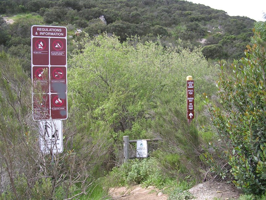
Directions:
|
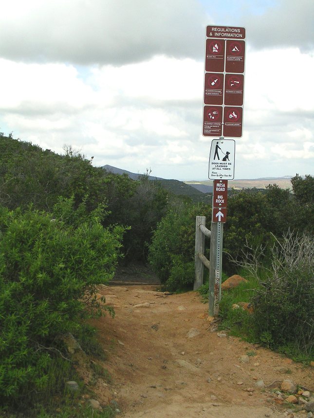
From Areas North: From Hwy 52, take the Mission Gorge Road exit in Santee. Turn west and proceed 0.4 miles to Mesa Road. Turn south onto Mesa Road. After the first stop sign, look for the the Big Rock Park trail on your right just past the school playground, you will be coming out here. Continue up the paved road for maybe a 1/4 mile until the pavement ends. There is parking right here or you can continue 1/2 mile further up the dirt road to the trailhead. There is limited parking at the trail head so you may want to park where the pavement ends. | |
|
From Areas South: From Interstate 8 - Take the Mission Gorge/Fairmount exit. Turn north onto Mission Gorge Road. Proceed on Mission Gorge Road for 7.5 miles to Mesa Road. Turn south onto Mesa Road. After the first stop sign, look for the the Big Rock Park trail on your right just past the school playground, you will be coming out here. Continue up the paved road for maybe a 1/4 mile until the pavement ends. There is parking right here or you can continue 1/2 mile further up the dirt road to the trailhead. There is limited parking at the trail head so you may want to park where the pavement ends. | |
|
There are additional directions and trailhead options on the Mission Trails Regional Park website. |
Ride Notes: My mileage readings start from the parking area where the pavement ends on Mesa Road.
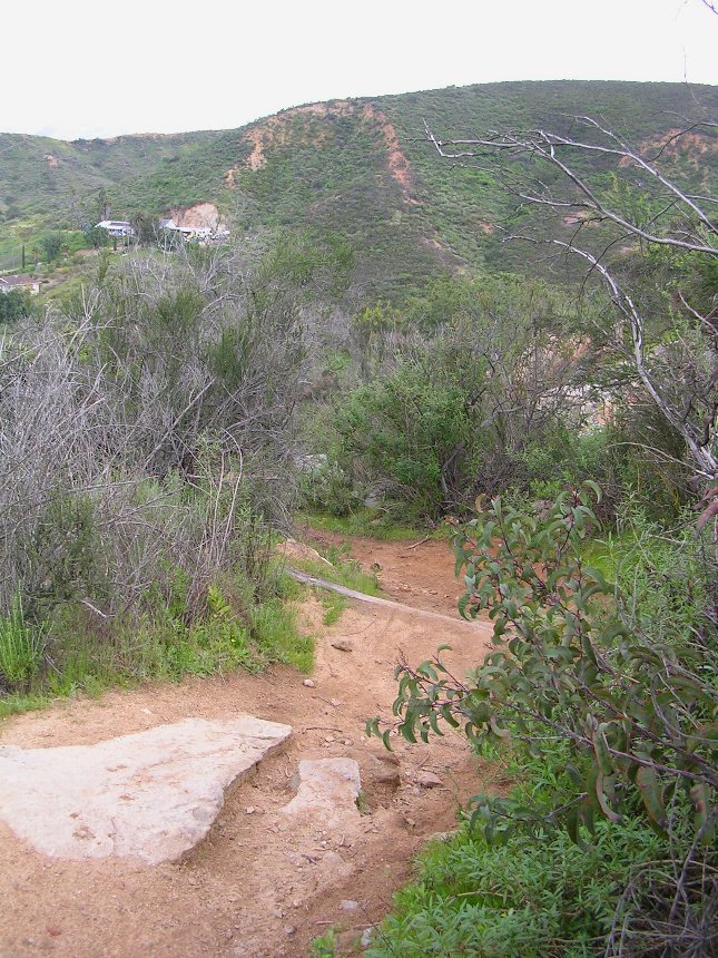
 From
the parking area at the end of the pavement proceed up the now dirt road for
about 1/4 of a mile and go around the closed gate. About 100 yards up the
fireroad you will see a small trail heading down to a rocky waterfall area.
Don't take this trail, continue further up the fire road another 100 yards or so
until you see another trail heading off to the right. Take this
trail were you will quickly cross a seasonal stream. Your mileage should
be around .38 miles.
From
the parking area at the end of the pavement proceed up the now dirt road for
about 1/4 of a mile and go around the closed gate. About 100 yards up the
fireroad you will see a small trail heading down to a rocky waterfall area.
Don't take this trail, continue further up the fire road another 100 yards or so
until you see another trail heading off to the right. Take this
trail were you will quickly cross a seasonal stream. Your mileage should
be around .38 miles.
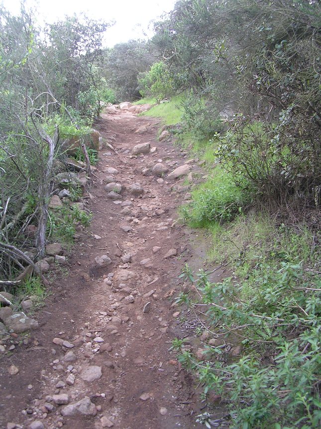
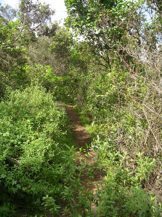 The
single track gets pretty tough as it has a significant grade and there are
a number of water bars made out of old railroad ties that will cause you to expend
some extra energy on technical moves to get up and over them. The
vegetation is quite thick and in many spots the chaparral is high enough that
you travel through a veggie tunnel. You may find that you do not get
to fully enjoy this as you are busting your lungs and legs to try and clean
all of these waterbars.
The
single track gets pretty tough as it has a significant grade and there are
a number of water bars made out of old railroad ties that will cause you to expend
some extra energy on technical moves to get up and over them. The
vegetation is quite thick and in many spots the chaparral is high enough that
you travel through a veggie tunnel. You may find that you do not get
to fully enjoy this as you are busting your lungs and legs to try and clean
all of these waterbars.
 At
around 1 mile you will come out to a T-junction with the Big Rock Park
singletrack. Hang a left and continue uphill were more water bars
and rocks await you. Over the next .6 miles the singletrack gets as
steep as 18% in sections while keeping up with the water bars, rocks and
switchbacks theme.
At
around 1 mile you will come out to a T-junction with the Big Rock Park
singletrack. Hang a left and continue uphill were more water bars
and rocks await you. Over the next .6 miles the singletrack gets as
steep as 18% in sections while keeping up with the water bars, rocks and
switchbacks theme.
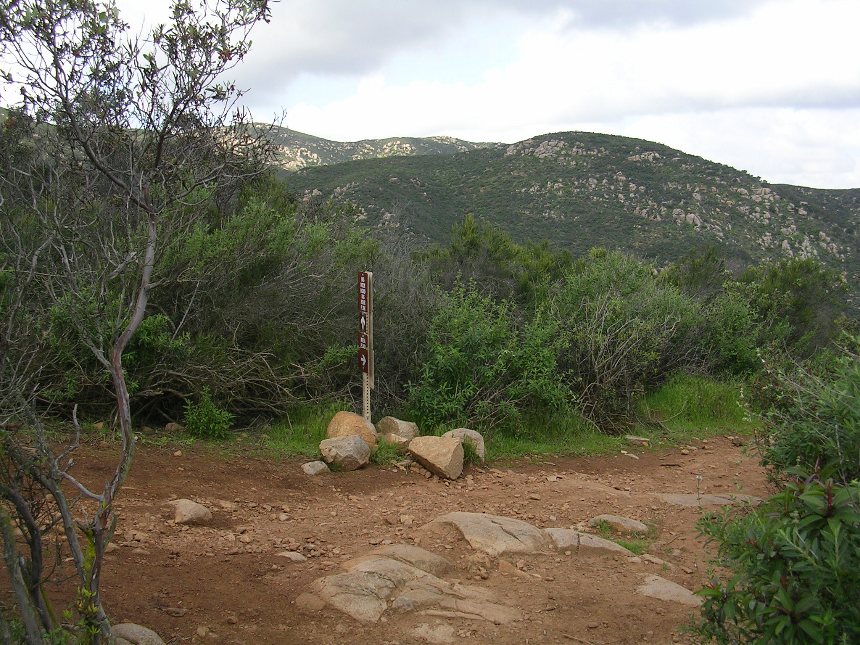
 At
around 1.7 miles you come out onto the Cowles Mountain fire road. Please
take a good look around as this single track is easy to miss when coming
down the fireroad on your back. Once you have the location locked into
your melon hang
a right and go uphill on the fireroad. Just as you crest out into a
flat spot take a look over you shoulder just to make sure you have an additional
visual on where the singletrack turns off is at.
At
around 1.7 miles you come out onto the Cowles Mountain fire road. Please
take a good look around as this single track is easy to miss when coming
down the fireroad on your back. Once you have the location locked into
your melon hang
a right and go uphill on the fireroad. Just as you crest out into a
flat spot take a look over you shoulder just to make sure you have an additional
visual on where the singletrack turns off is at.
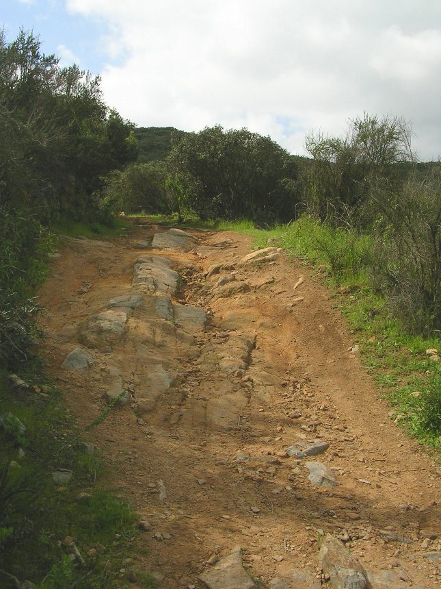
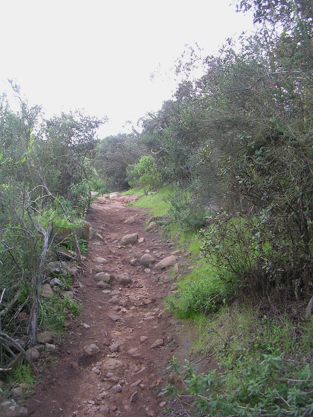
Right after you get to a flat spot your main goal will be in plan sight, as well as the route to get up to it. The fire road heading up to the Cowles Mountain peak gets brutally steep. In some spots the grade is as high as 22 percent near the top. There are also some nasty ruts in the steeper sections that are quite challenging in your momentum deprived state. I think just about any riders would call it a good day to clean the entire climb.
 Once
you make it to the top your mileage should be around 2.5 miles and you will have
climbed about 1300 feet. Steep in just about everyone's book.
Particularly considering you climbed 300 fee in the last 3/10ths of a mile alone.
Your reward is some really nice views and a real sense of accomplishment (This
route is considered a challenging hike so wither you cleaned it or did a good
deal of pushing, you have earned a little rest at the top.
Once
you make it to the top your mileage should be around 2.5 miles and you will have
climbed about 1300 feet. Steep in just about everyone's book.
Particularly considering you climbed 300 fee in the last 3/10ths of a mile alone.
Your reward is some really nice views and a real sense of accomplishment (This
route is considered a challenging hike so wither you cleaned it or did a good
deal of pushing, you have earned a little rest at the top.
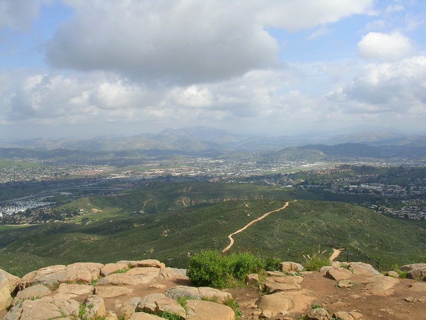
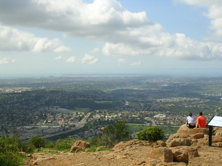
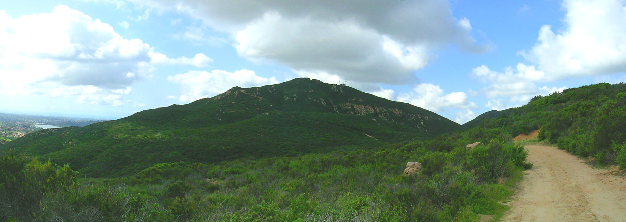
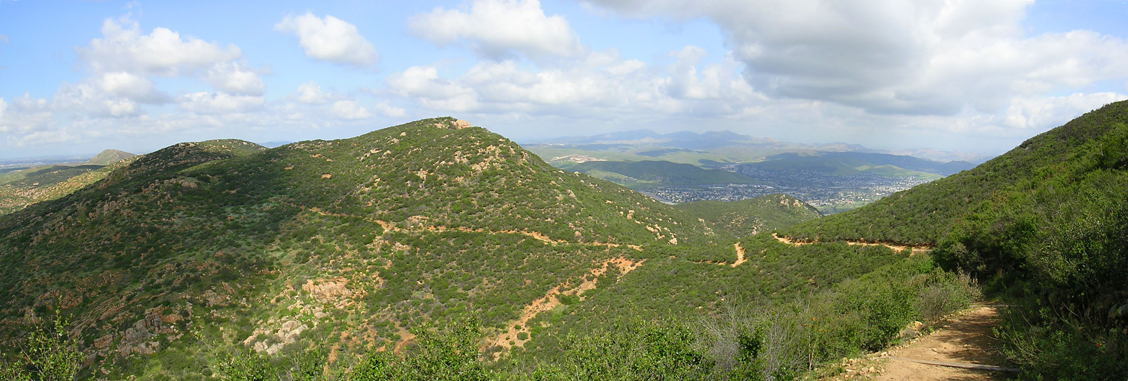
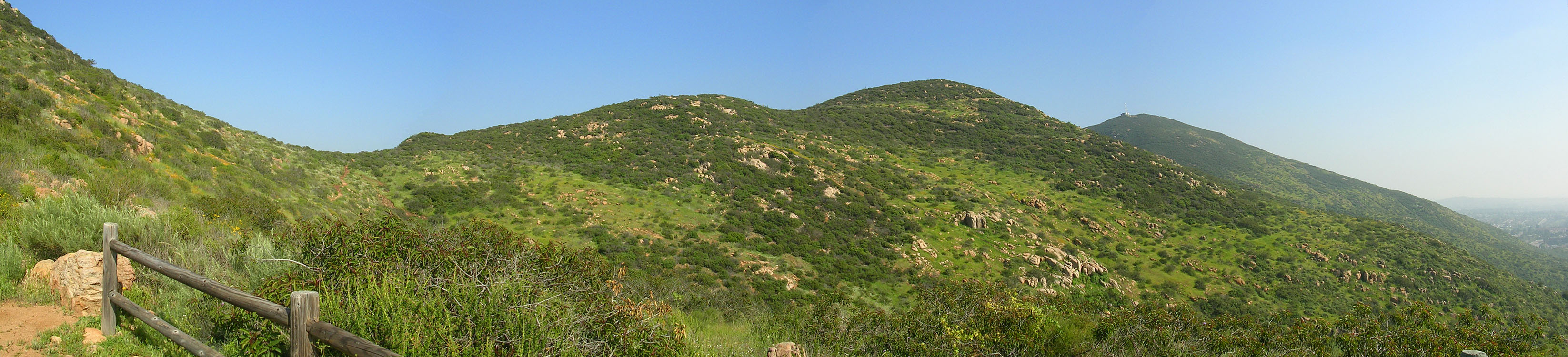
Various views from the summit
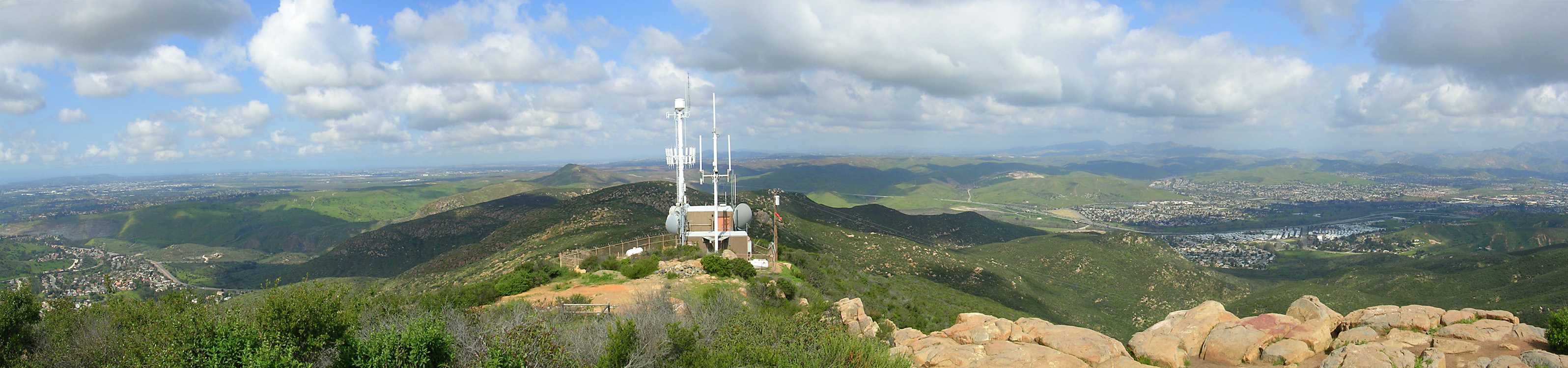 A pan shot from the summit of Cowles Mountain
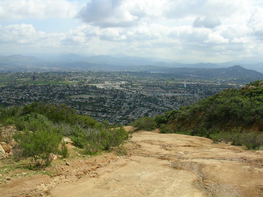
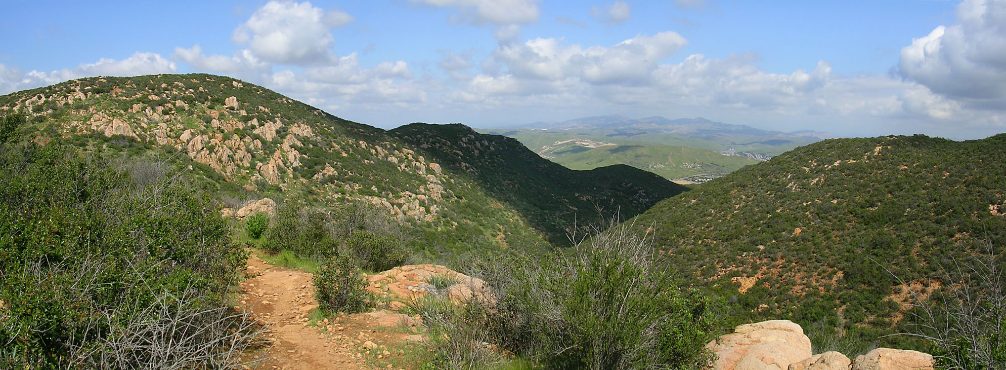
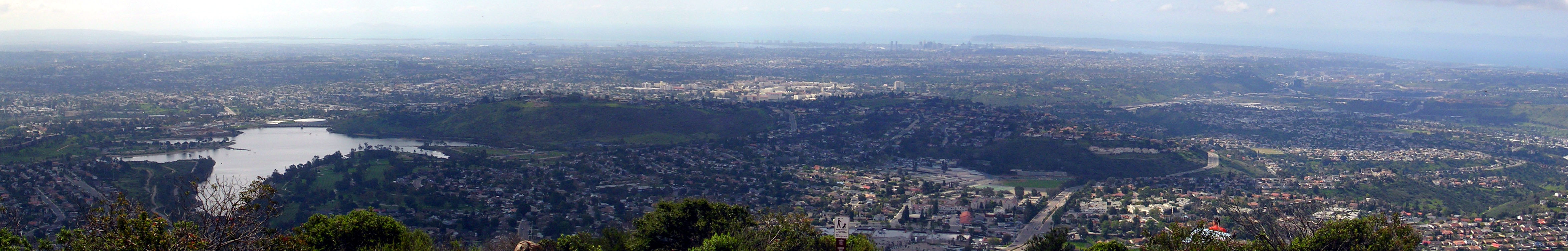 The view towards Lake Murray and Point Loma
 After
you have had you fill of the views and a bit of rest. Look for the Pyle's
peak trail that is about 30 yards over the summit off the left hand side of the
fire road that heads over to the radio towers. You will soon get to enjoy
the water bars going in the other direction as this singletrack sheds off quite
a bit of elevation as you head down the northwest side of Cowles Mountain.
After
you have had you fill of the views and a bit of rest. Look for the Pyle's
peak trail that is about 30 yards over the summit off the left hand side of the
fire road that heads over to the radio towers. You will soon get to enjoy
the water bars going in the other direction as this singletrack sheds off quite
a bit of elevation as you head down the northwest side of Cowles Mountain.
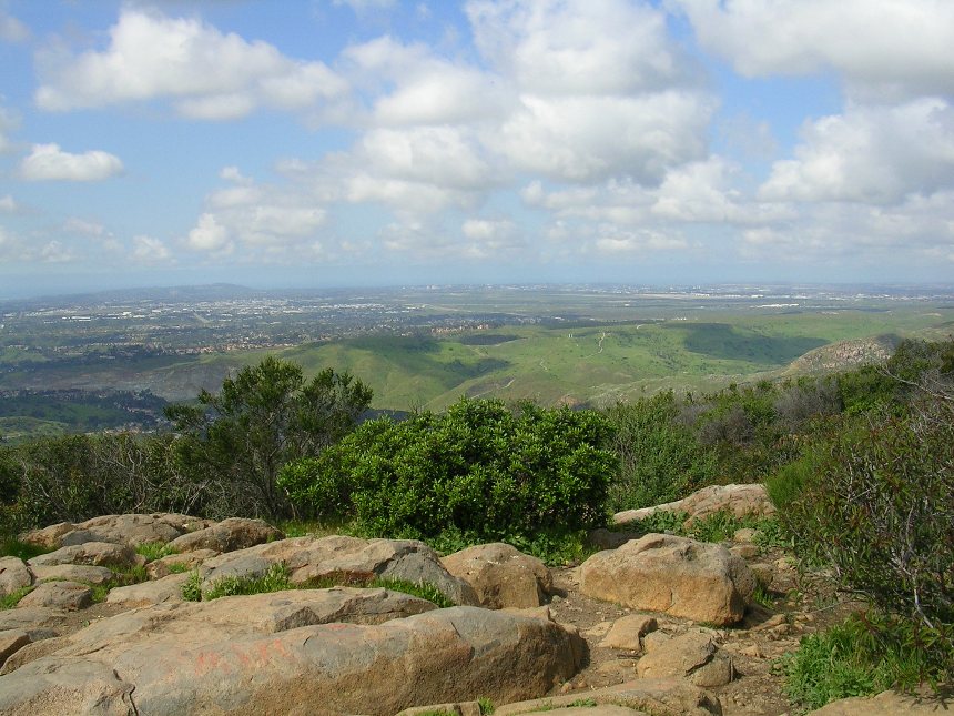
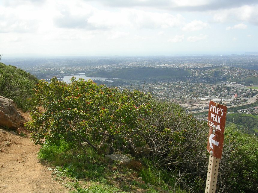
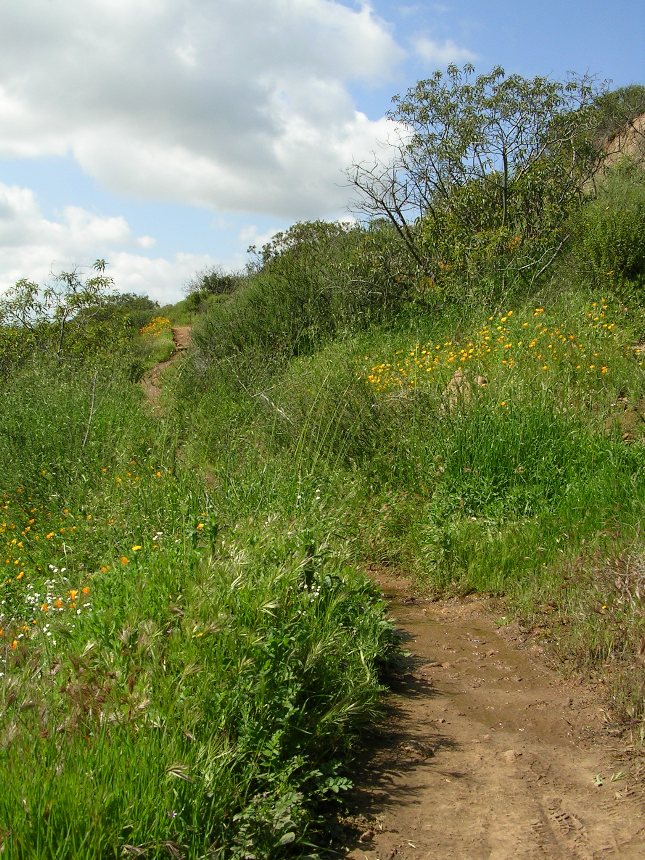
 The Pyles Peak trail from the Northwest slope of Cowles Mountain
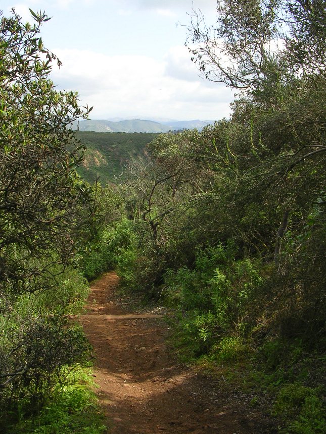
 Soon
you will ride down to a saddle and from here you get to do some contour riding
for change but there is plenty of technical ups and downs coupled with the
ever-present waterbars to keep your heart
pumping. I have to give you what I call is the "San Diego
Spring Disclaimer" at this point. We have had record amounts of rain over
the winter which has created the most lush and green springtime flora in well
over a decade. It is not normally this green here.
Soon
you will ride down to a saddle and from here you get to do some contour riding
for change but there is plenty of technical ups and downs coupled with the
ever-present waterbars to keep your heart
pumping. I have to give you what I call is the "San Diego
Spring Disclaimer" at this point. We have had record amounts of rain over
the winter which has created the most lush and green springtime flora in well
over a decade. It is not normally this green here.
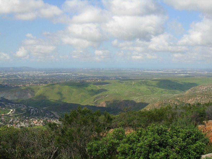
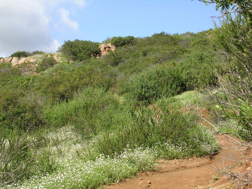
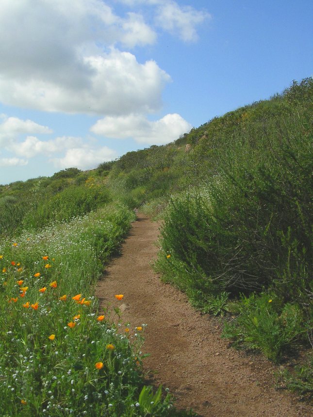
 The Pyles Peak Trail
The Pyles Peak trail is 1.25 miles long and it will eventually bring you out to very picturesque point below the peak. There is a hiking trail that goes up to the peak if you feel like leaving your bike at the turn around point.
 The end of the Pyles Peak trail
 From here you will retrace your route back up to Cowles Mountain
summit, which can be quite strenuous on its own. Once at the summit
continue retracing your steps and make sure to pick up the singletrack that you
joined the fireroad on. From here enjoy this singletrack as it is a blast
to go down. There are some great lines you can take with rocks and
waterbars combinations. Some people refer to this trail as "Baby Noble",
as it quite possibly most the most technical "in-town" trail we have, even if a
good bit of the technical features are installed waterbars.
From here you will retrace your route back up to Cowles Mountain
summit, which can be quite strenuous on its own. Once at the summit
continue retracing your steps and make sure to pick up the singletrack that you
joined the fireroad on. From here enjoy this singletrack as it is a blast
to go down. There are some great lines you can take with rocks and
waterbars combinations. Some people refer to this trail as "Baby Noble",
as it quite possibly most the most technical "in-town" trail we have, even if a
good bit of the technical features are installed waterbars.
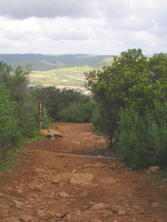
 You
will not follow the same route all the down this singletrack.
Remember during the climb when you came to a T-junction and turned left and when
uphill? On your way down you will not turn back on to that single
track instead you will continue straight on the main trail. If you
slow down enough at the junction you will see that the sign points to Big Rock
Park. Continue to enjoy the downhill rocks and waterbar action on
the Big Rock Park singletrack. As the trail starts to flatten out a little you
will come to a fork in the trail. Take the right fork and continue rolling
downhill. You will have a couple of quick steep rises then the trail will
work it's way back to Mesa Road coming out just past the stop signed
intersection you came through on your way to the trailhead. Hang a right
and head uphill to your vehicle. Your mileage should be around 8 miles or
so.
You
will not follow the same route all the down this singletrack.
Remember during the climb when you came to a T-junction and turned left and when
uphill? On your way down you will not turn back on to that single
track instead you will continue straight on the main trail. If you
slow down enough at the junction you will see that the sign points to Big Rock
Park. Continue to enjoy the downhill rocks and waterbar action on
the Big Rock Park singletrack. As the trail starts to flatten out a little you
will come to a fork in the trail. Take the right fork and continue rolling
downhill. You will have a couple of quick steep rises then the trail will
work it's way back to Mesa Road coming out just past the stop signed
intersection you came through on your way to the trailhead. Hang a right
and head uphill to your vehicle. Your mileage should be around 8 miles or
so.