Golden Eagle Trail - Liebre Mountain
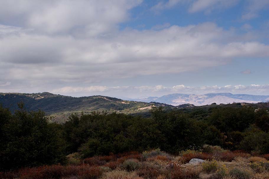
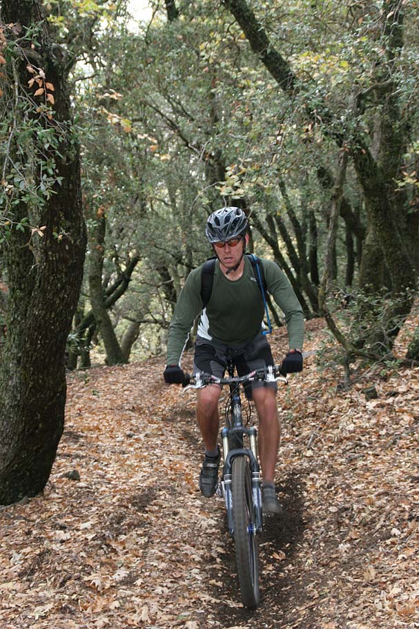
 The Golden Eagle trail, located in the Saugus District of the Angelus National Forest is a wonderful trail that offers some great riding across open grassland hillsides, through oak forests as well some classic southern california chaparral. Still considered part of the San Gabriel Mountains it is the far northwest extent of the range. There are at least a couple of ways to get up on Liebre Mountain where this trail resides. No matter which way you will first have to pay to play by climbing from,about 4,200 feet up to nearly 5,800 feet. According to how you do the route you can get anywhere from 13 to 21 plus miles in a days excursion. This is not a particularly challenging trail from a technical perspective but you will certainly earn your keep on the cardio front. While I was not here at the most opportune time of the year for colors, it is quite obvious that this place will be explosive with colors in the spring and fall. The Golden Eagle trail, located in the Saugus District of the Angelus National Forest is a wonderful trail that offers some great riding across open grassland hillsides, through oak forests as well some classic southern california chaparral. Still considered part of the San Gabriel Mountains it is the far northwest extent of the range. There are at least a couple of ways to get up on Liebre Mountain where this trail resides. No matter which way you will first have to pay to play by climbing from,about 4,200 feet up to nearly 5,800 feet. According to how you do the route you can get anywhere from 13 to 21 plus miles in a days excursion. This is not a particularly challenging trail from a technical perspective but you will certainly earn your keep on the cardio front. While I was not here at the most opportune time of the year for colors, it is quite obvious that this place will be explosive with colors in the spring and fall. |
||
|
||
|
||
| Hazards: Motos are allowed on the Golden Eagle Trail, and vehicles are allowed on the fireroads. This place can get really hot in the summer and there is no water along the route. | ||
| Ride Notes: There are several ways to do the first part of the ride. You can take up a fireroad the Golden Eagle trail up. The trail for the better part of the climbing up the mountain would be loose during the summer and other dry times of the year. The day we rode up this trail is was the morning after a good rain and the trail was packed perfectly. I simply do not see the conditions ever being better than the day we rode this trail. | ||
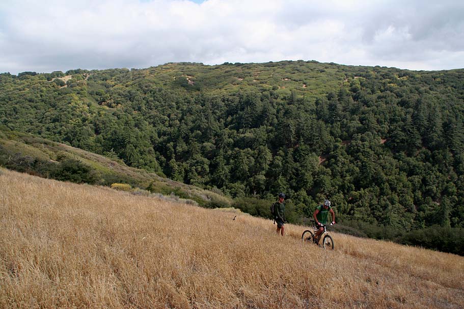
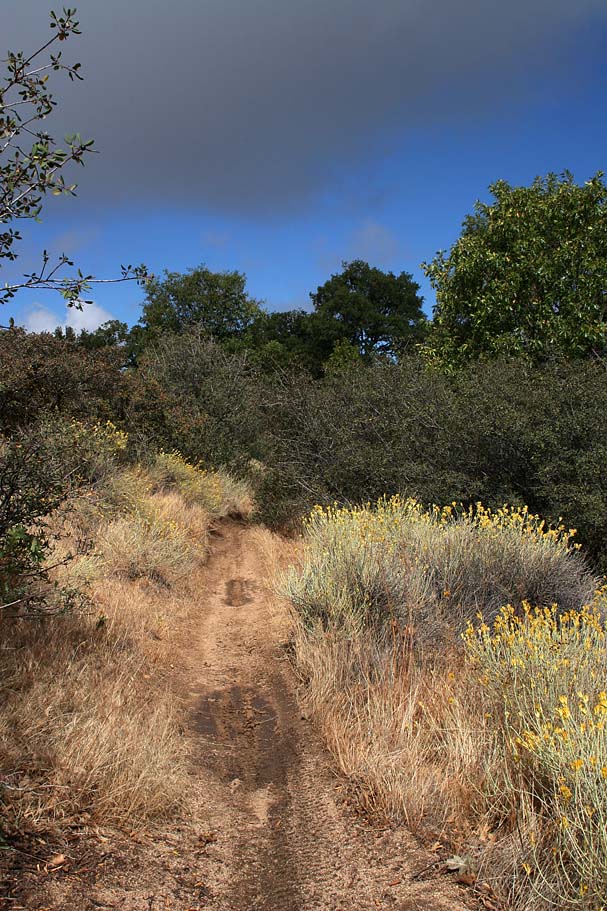
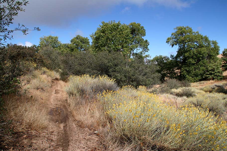 Taking the Singletrack up the mountain - Once again if the conditions are good this can be a really great but tough climb. If the conditions are a little dry this could be a miserable climb. A good bit of the rationale here is that a combination of the soil type, dry weather, and the tendenacy of novice moto types to over gas/rooster tail the turns can make this trail really loose. The climb from the start at Point A up onto the ridgeline at Point B is 2.6 miles with an 11% average grade. Taking the Singletrack up the mountain - Once again if the conditions are good this can be a really great but tough climb. If the conditions are a little dry this could be a miserable climb. A good bit of the rationale here is that a combination of the soil type, dry weather, and the tendenacy of novice moto types to over gas/rooster tail the turns can make this trail really loose. The climb from the start at Point A up onto the ridgeline at Point B is 2.6 miles with an 11% average grade. |
||
  This spells a bummer of a climb in dry loose conditions. If you do take this route you will be rewarded with ever increasingly nice views that you will not be able to fully appreciate during the descent. The climb will also allow you to get a good feel for your ripping downhill return later in the day. To start things off you need to locate the bottom of the trail. From the parking spot at Point A, if you are looking up the road, you will see a fireroad on your left. Less than 30 yards up this fireroad on the righthand side is the bottom of the Golden Eagle trail. (It is not marked). Get on it and start a climbing. There are not splits until you get up on the ridgeline at Point B where you cross fireroad 7N23. This spells a bummer of a climb in dry loose conditions. If you do take this route you will be rewarded with ever increasingly nice views that you will not be able to fully appreciate during the descent. The climb will also allow you to get a good feel for your ripping downhill return later in the day. To start things off you need to locate the bottom of the trail. From the parking spot at Point A, if you are looking up the road, you will see a fireroad on your left. Less than 30 yards up this fireroad on the righthand side is the bottom of the Golden Eagle trail. (It is not marked). Get on it and start a climbing. There are not splits until you get up on the ridgeline at Point B where you cross fireroad 7N23. |
||
| Fire Road Climb Option - (I scouted this route but did not ride it on the bike) From the parking spot/bottom of the trail at Point A, continue along the road that you came in on. After 1 mile of flat to gradual climbing, the road 8N04 will start descending. At 2.5 miles, (Point M) you will see a fireroad sharply turning off to your left, 7N23, take that fireroad. You will see a sign for the Sawmill Campground. (Note: Google Earth mislabels this fireroad 7N14, Mapquest has it right.) At 3.1 miles (Point N) there is fireroad going off to your right stay to the left and uphill on 7N23 and continue climbing. There are numerous off-shot roads along that climb, Stay on the main road. Keep grinding along until at 5.4 miles you get a short reprieve from the grunt work before getting back onto the climbing. At around the 6 mile mark you are over the significant climbing and up on the Liebre Mountain. Shortly there after at around 6.3 miles the Golden Eagle trail will cross the fireroad at Point B. | ||
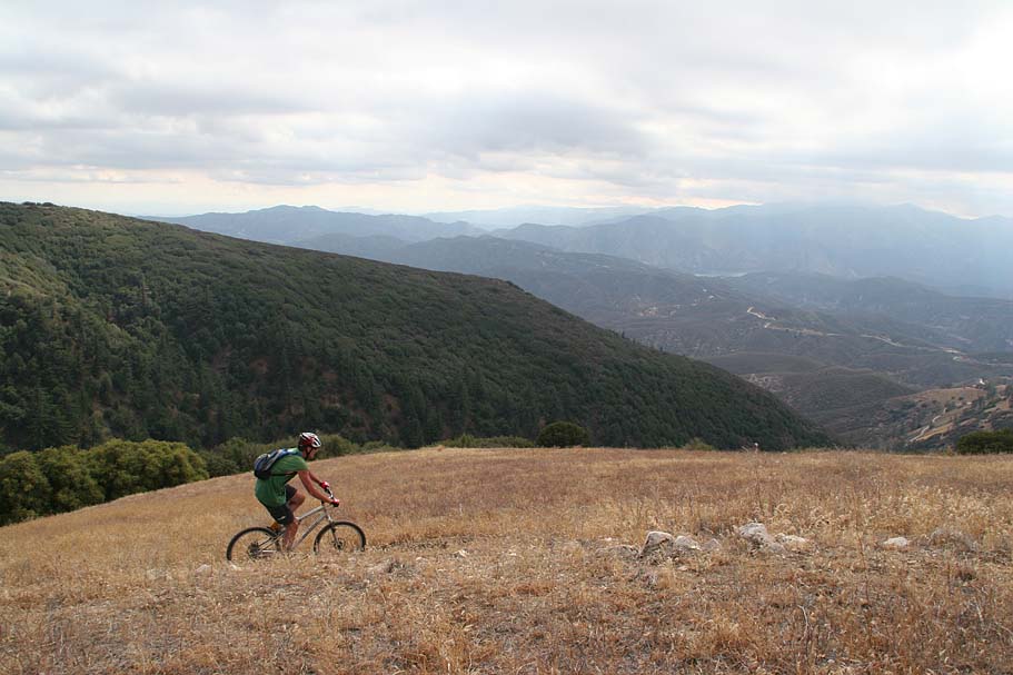
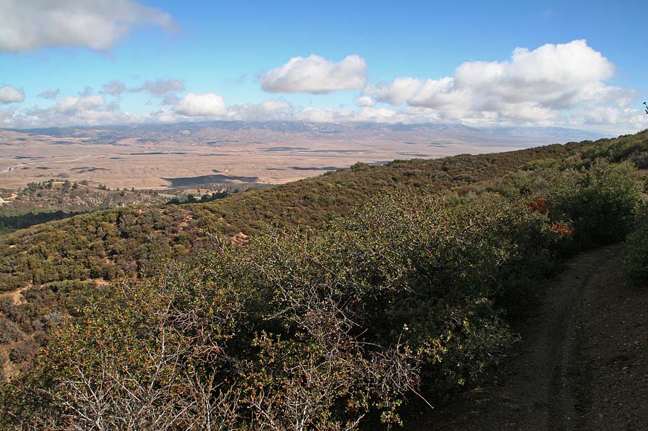
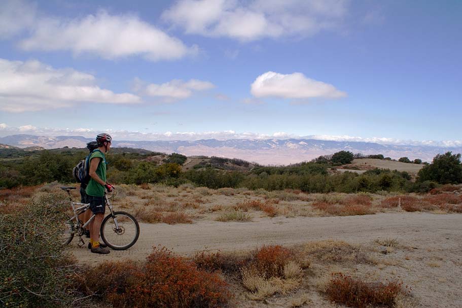
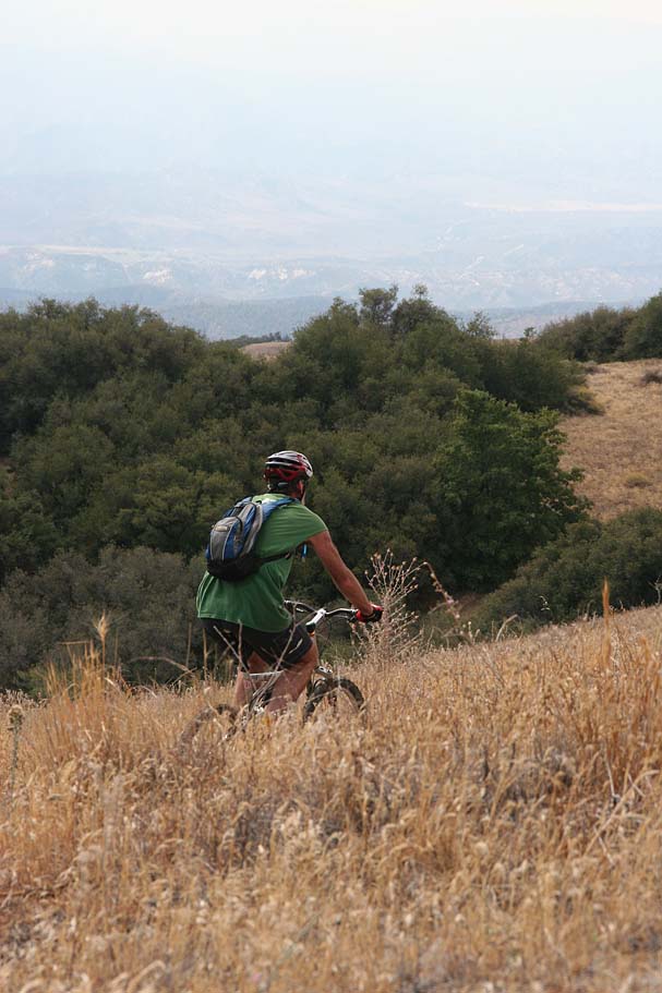
  From Point B onward - If you climbed up the singletrack you will cross the fireroad and pickup the singletrack on the other side. If you came up the fire road you will hang a right onto the singletrack. The mileage I describe from this point is based on if you climbed the singletrack up the mountain. If you took the fireroad up add about 2.4 miles to the description. From Point B you will roll across some open grass hillsides that are simply freaking pretty. You will also get a chance to feel gravity working with you for a change which is great after the work you have already done. From Point B onward - If you climbed up the singletrack you will cross the fireroad and pickup the singletrack on the other side. If you came up the fire road you will hang a right onto the singletrack. The mileage I describe from this point is based on if you climbed the singletrack up the mountain. If you took the fireroad up add about 2.4 miles to the description. From Point B you will roll across some open grass hillsides that are simply freaking pretty. You will also get a chance to feel gravity working with you for a change which is great after the work you have already done. |
||
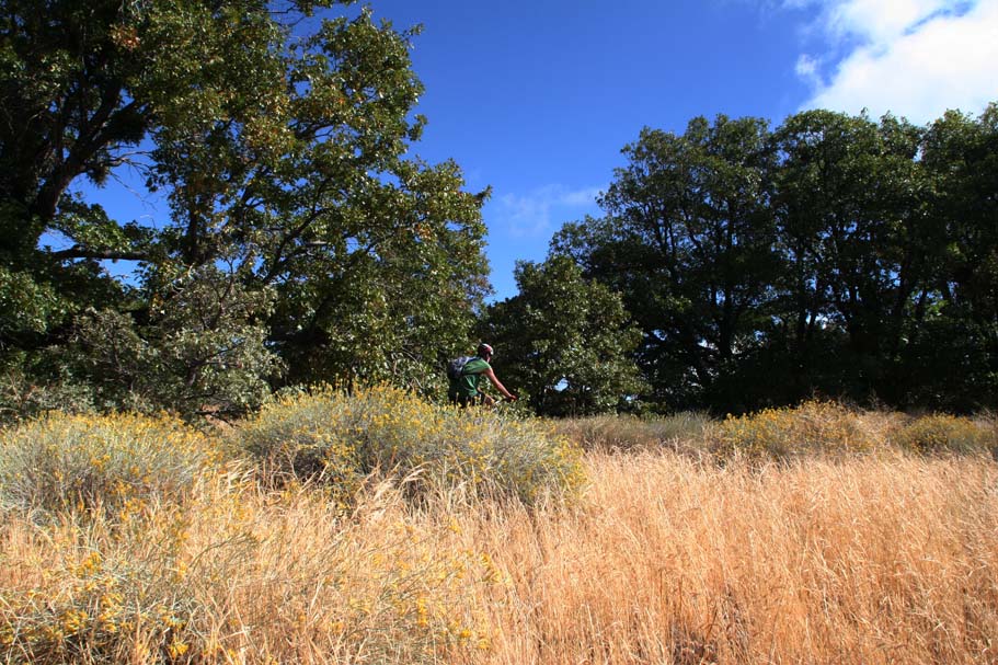
  The open hillside riding with last about 3/4ths of a mile before you transition into a mostly oak forest where you will have to get back onto the climbing for a bit. At 4.3 miles the trail goes very close by a fireroad and splits at Point C. The right hand split goes out onto the fireroad while the lefthand single track continues on. Remember this spot for later in the ride, as you will use the other split. You are going to save that bit of trail off to the right for the return trip when you will be mostly descending coming from the other direction. Take the lefthand split and continue on the singletrack for less than a quarter mile where you will come out onto the same fireroad from earlier. Continue in the direction you where going and uphill. Take a look at this close up aerial view of the area between Points C and D that should help to alleviate some confusion The open hillside riding with last about 3/4ths of a mile before you transition into a mostly oak forest where you will have to get back onto the climbing for a bit. At 4.3 miles the trail goes very close by a fireroad and splits at Point C. The right hand split goes out onto the fireroad while the lefthand single track continues on. Remember this spot for later in the ride, as you will use the other split. You are going to save that bit of trail off to the right for the return trip when you will be mostly descending coming from the other direction. Take the lefthand split and continue on the singletrack for less than a quarter mile where you will come out onto the same fireroad from earlier. Continue in the direction you where going and uphill. Take a look at this close up aerial view of the area between Points C and D that should help to alleviate some confusion |
||
  You will almost immediately come to a T-intersection (Point D) where you are going to make a right. You are back on fire road 7N23 again. From here you will mildly climb for about 1/2 mile before doing a short descent to Point E. Your mileage should be around 5.4 miles. Look for a singletrack crossing the trail. This is the Golden Eagle trail and you will bear to your left and get back on the singletrack. The single track through here does a little bit of mild up and down rolling and it follows the contours through the oaks for 3/4ths of a mile before coming out onto a fireroad at Point F. Your mileage should be around 6.2 miles. When the trail comes out onto the fireroad it is already bearing to your left and you will naturally want to roll down the fireroad for about 20 yards where the singletrack bears off to the right. You will almost immediately come to a T-intersection (Point D) where you are going to make a right. You are back on fire road 7N23 again. From here you will mildly climb for about 1/2 mile before doing a short descent to Point E. Your mileage should be around 5.4 miles. Look for a singletrack crossing the trail. This is the Golden Eagle trail and you will bear to your left and get back on the singletrack. The single track through here does a little bit of mild up and down rolling and it follows the contours through the oaks for 3/4ths of a mile before coming out onto a fireroad at Point F. Your mileage should be around 6.2 miles. When the trail comes out onto the fireroad it is already bearing to your left and you will naturally want to roll down the fireroad for about 20 yards where the singletrack bears off to the right. |
||
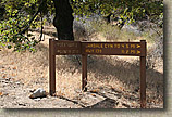  But Hold Up! This is where things can get confusing. There is a sign to your left if you are looking downhill on the fireroad. It is pictured to your left here. Just a little bit down the fire road is a sign for the Pacific Crest Trail. The PCT is basically a wide fireroad going down the hill at this point. What is missing here is anything mentioning the Golden Eagle trail we just came off or the Pacific Crest Trail. Now there are quite a few sections of the PCT where it is overlaid on top of another trail. Just because the PCT is "using" some other trail does not make that trail automatically off-limits to bikes. The Burkhart Trail the eastern reaches in the San Gabriels is a good example of this where a 1/4 mile section of the PCT was rerouted to use the Burkhart trail. The Burkhart trail is open to bikes to include the section that PCT is "borrowing". Of course there are certain user groups who would not like to see it that way, but that is another story. Digression aside, the fireroad/PCT certainly appeared to be open to jeep travel and the singletrack off to the right had just as much moto use as the trail we had just ridden. What I would later find out is that the single track going off to right and continuing east was indeed the Pacific Crest Trail. I have included the GPS data for the Pacific Crest Trail from the National Geographic's website on my map to help alleviate the confusion. But Hold Up! This is where things can get confusing. There is a sign to your left if you are looking downhill on the fireroad. It is pictured to your left here. Just a little bit down the fire road is a sign for the Pacific Crest Trail. The PCT is basically a wide fireroad going down the hill at this point. What is missing here is anything mentioning the Golden Eagle trail we just came off or the Pacific Crest Trail. Now there are quite a few sections of the PCT where it is overlaid on top of another trail. Just because the PCT is "using" some other trail does not make that trail automatically off-limits to bikes. The Burkhart Trail the eastern reaches in the San Gabriels is a good example of this where a 1/4 mile section of the PCT was rerouted to use the Burkhart trail. The Burkhart trail is open to bikes to include the section that PCT is "borrowing". Of course there are certain user groups who would not like to see it that way, but that is another story. Digression aside, the fireroad/PCT certainly appeared to be open to jeep travel and the singletrack off to the right had just as much moto use as the trail we had just ridden. What I would later find out is that the single track going off to right and continuing east was indeed the Pacific Crest Trail. I have included the GPS data for the Pacific Crest Trail from the National Geographic's website on my map to help alleviate the confusion. |
||
  This is a good spot to turn around but if you feel like getting some additional mileage you can go up the fireroad just a bit to Point G where you can turn left back onto 7N23 and continue east on the fire road along the top of Liebre Mountain. You can roll up and down hills just about as far as you care to go. We traveled about 2.7 miles further east to 7N19 where we went south for just a short bit up to a peak for a look see around before retracing our route back to Point F. On the way back we noticed that at Point H the PCT is clearly marked where it crosses the fireroad. This is a good spot to turn around but if you feel like getting some additional mileage you can go up the fireroad just a bit to Point G where you can turn left back onto 7N23 and continue east on the fire road along the top of Liebre Mountain. You can roll up and down hills just about as far as you care to go. We traveled about 2.7 miles further east to 7N19 where we went south for just a short bit up to a peak for a look see around before retracing our route back to Point F. On the way back we noticed that at Point H the PCT is clearly marked where it crosses the fireroad. |
||
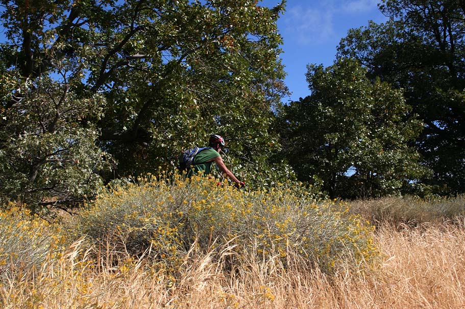
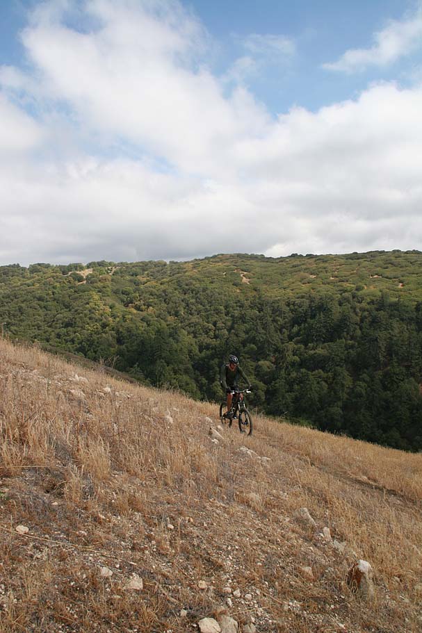
  Back at Point F we hopped back on the Golden Eagle trail and continued along it back to Point E. This time we went straight across the road and to rejoined the singletrack. The next section is an absolutely fun bit singletrack goodness where you flow from a little bit of forest to open hillside to chaparral all in the span of a single downhill mile. I have a big stupid grin on my face just typing about it. You will have to put it just about a quarter of a mile of moderate climbing to get back to Point C where you turned onto the fireroad earlier in the day. Back at Point F we hopped back on the Golden Eagle trail and continued along it back to Point E. This time we went straight across the road and to rejoined the singletrack. The next section is an absolutely fun bit singletrack goodness where you flow from a little bit of forest to open hillside to chaparral all in the span of a single downhill mile. I have a big stupid grin on my face just typing about it. You will have to put it just about a quarter of a mile of moderate climbing to get back to Point C where you turned onto the fireroad earlier in the day. |
||
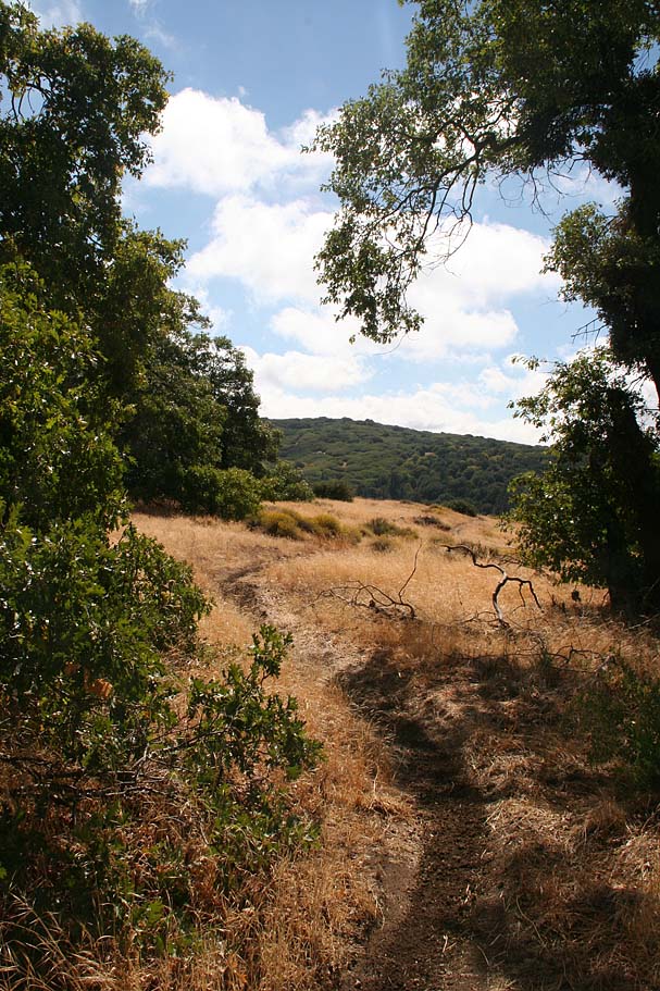
  Now you will continue on the singletrack and retrace you way back to Point B. The forested section on this return is a real ripper in this direction with exceptional flow. You most likely did not notice the brush on your way out on this trail earlier in the day as you where going slower, but the brush can get a little close in this stretch of trail. At speed, through here leaning into a turn too far can result in the extraction of some of your DNA. Once you get back to Point B it is simply a matter of heading back down the hill on the singletrack. There are also some sections on the descent where the brush is a little close as well so you may have a mild case of exfoliation when reach the bottom. If your descent ends up being anywhere near as fun as mine was you will not care in the least. Now you will continue on the singletrack and retrace you way back to Point B. The forested section on this return is a real ripper in this direction with exceptional flow. You most likely did not notice the brush on your way out on this trail earlier in the day as you where going slower, but the brush can get a little close in this stretch of trail. At speed, through here leaning into a turn too far can result in the extraction of some of your DNA. Once you get back to Point B it is simply a matter of heading back down the hill on the singletrack. There are also some sections on the descent where the brush is a little close as well so you may have a mild case of exfoliation when reach the bottom. If your descent ends up being anywhere near as fun as mine was you will not care in the least. |
||
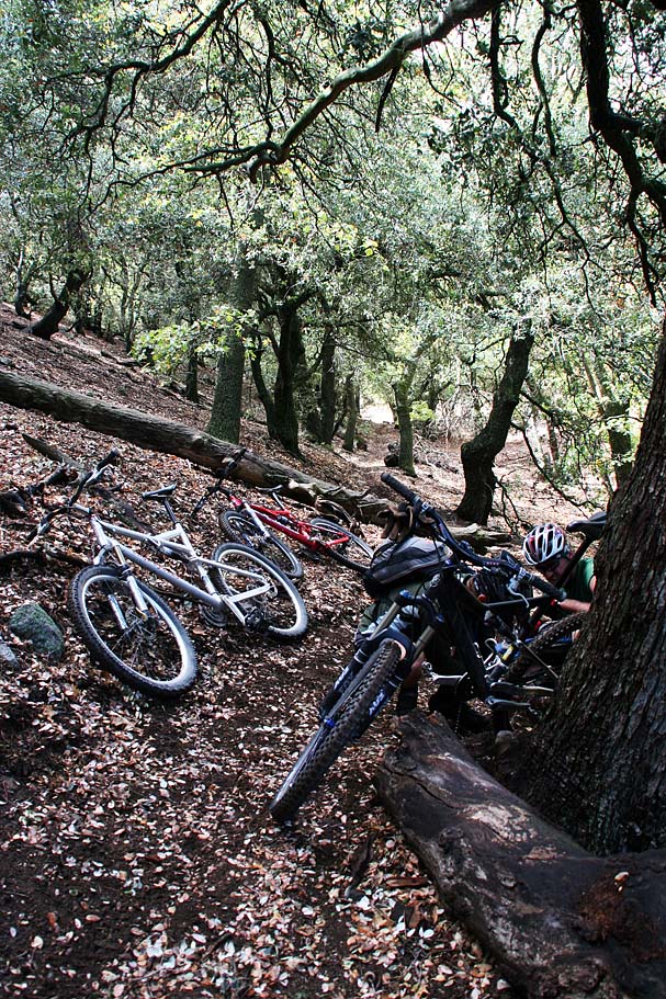
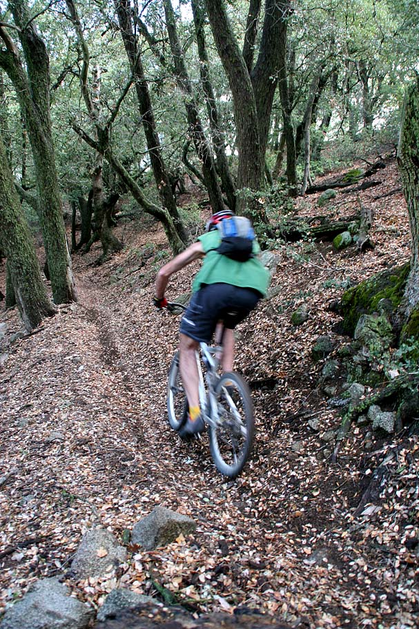
More Pictures from the Ride |
||
|
||