
Mission Trails Regional Park
Wedged in between Tierrasanta, Santee, La Mesa, and Miramar Marine Corp Air Station and a mere 8 miles from downtown San Diego, Mission Trails Regional Park encompasses nearly 5,800 acres of rugged hills, valleys and open areas that offer something for every level of rider.
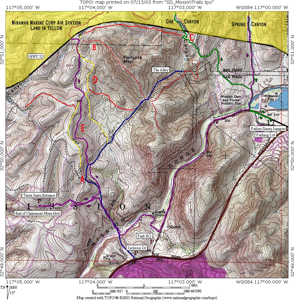 Here
is a map of the area. I have several points listed on the map that I refer
in the ride notes. Clicking on the thumbnail will open up the map in a new
browser wind. Also check out the interactive trail map on the Mission Trails
Regional Park's website.
Download the TOPO! File here.
Here
is a map of the area. I have several points listed on the map that I refer
in the ride notes. Clicking on the thumbnail will open up the map in a new
browser wind. Also check out the interactive trail map on the Mission Trails
Regional Park's website.
Download the TOPO! File here.
DIRECTIONS
| Jackson Drive Trailhead/Visitor Center: Take I-8 to the Mission Gorge Rd exit.
Take the exit, go left at the stoplight, and continue on Mission Gorge Rd
for 4.5 miles. Make a left at
Jackson drive into a dirt parking lot.
If you wish to park at the visitor center continue to the next light and
hang a left on the Father Junipero Serra Trail (paved road) and almost immediately
hang another left into the visitor
center parking lot. | |
| Clairemont Mesa Blvd/Tierrasanta Trailhead: From the I-15, take the Clairemont Mesa Blvd exit and head
east. Continue until the road dead
ends at the Tierrasanta entrance to the park. | |
|
Father Junipero Serra Trailhead: FROM THE 52 - Exit Mast Blvd. and south onto West Hills Parkway. Take West Hills Parkway to Father Junipero Serra Trail entrance (Also look for signs to Old Mission Dam and Kumeyaay Lake and Campground). Look for the parking lot on the left. If you planing not getting out of the park until |
RIDE NOTES
Mission Trails has many different trail options that allow you make the ride about as long as you like. The park is pretty much split down the middle by the North and South Fortuna Mountains. The eastern half of the park has the easier trails was and rolling grasslands while the western half has most of the single track and is much more technical. Many mountain bikers simply stick to the western half of the park. They however are missing out as some really great rides can be put together by linking both halves by going up and over the middle or around the Fortunas to the north.
One of the more interesting routes is to start at the Jackson Drive trailhead and head down the fire road that plummets down to the San Diego River. You cross the river and then proceed up a very steep gravel fire road up to Point A where you can take the views of the valley below.
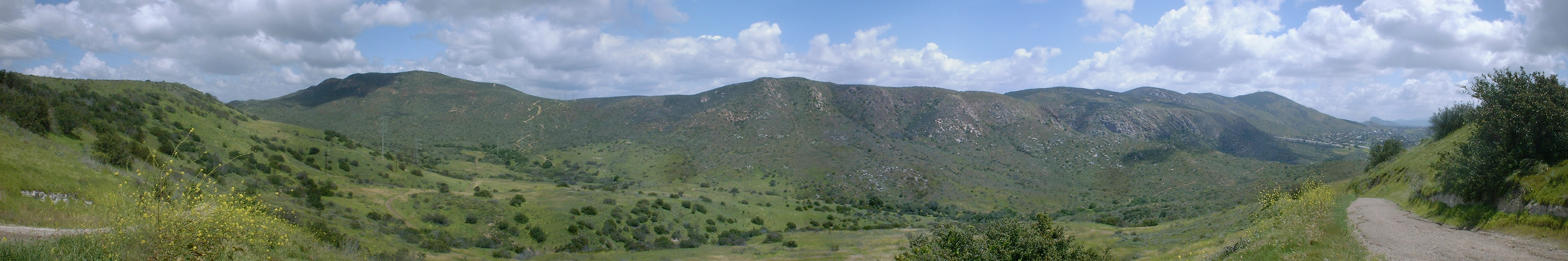
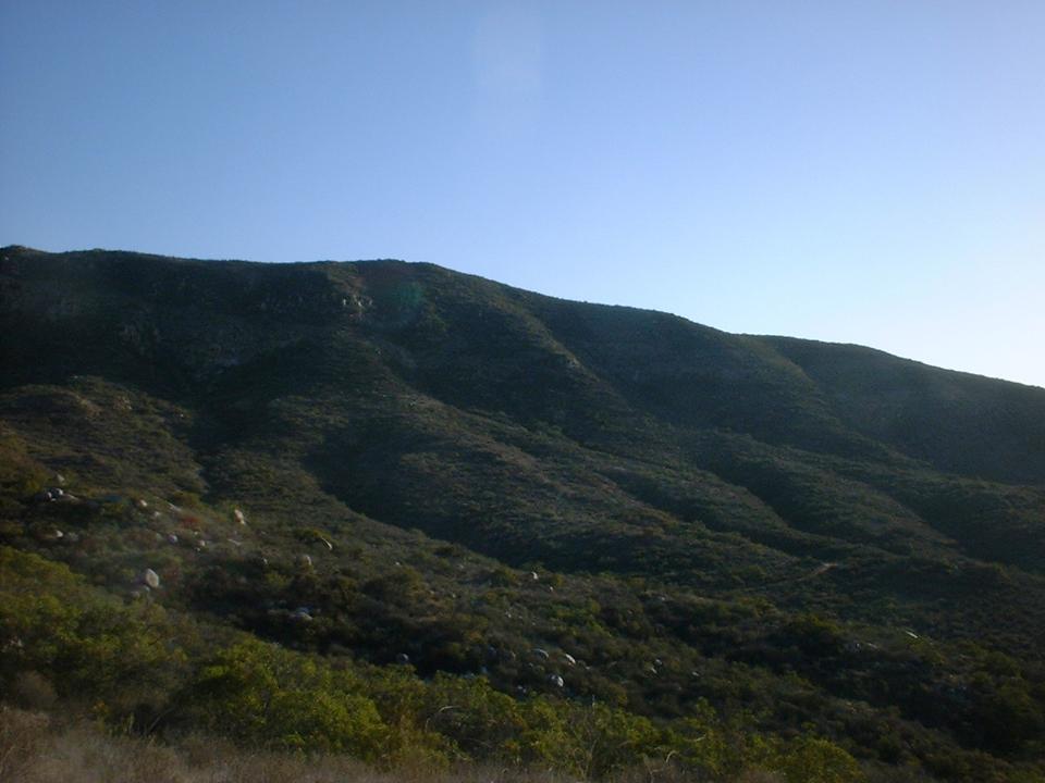
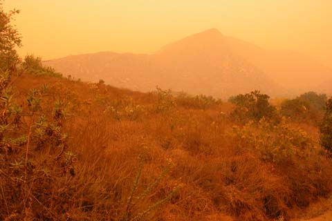
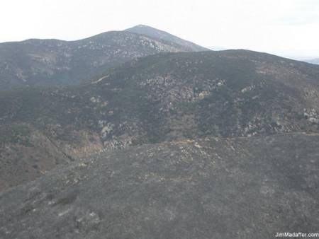
This is a pan shot near Point E looking at the Fortunas taken in
April of 2003. We had a very wet winter and spring brought out some nice
colors in the spring.
From there you drop down into the valley off to the right and hookup with Suycutt wash trail and head north up to the northern most part of the park. From there you then head back down into the valley. (There are a couple of trails coming out of the valley so you do not have to out and back it.).
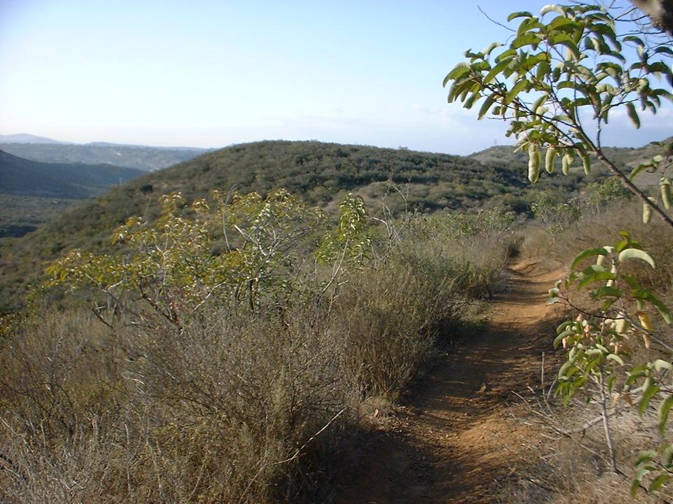
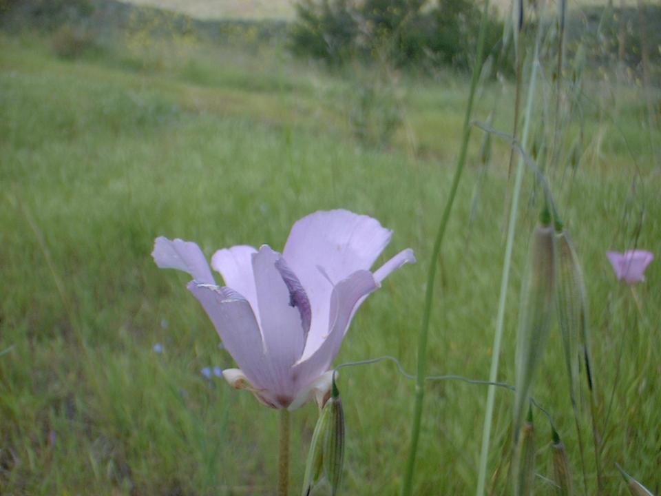 A
couple of spring time shot from Suycutt wash on the western half of the park.
A
couple of spring time shot from Suycutt wash on the western half of the park. 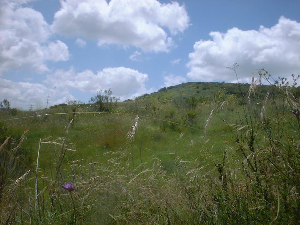
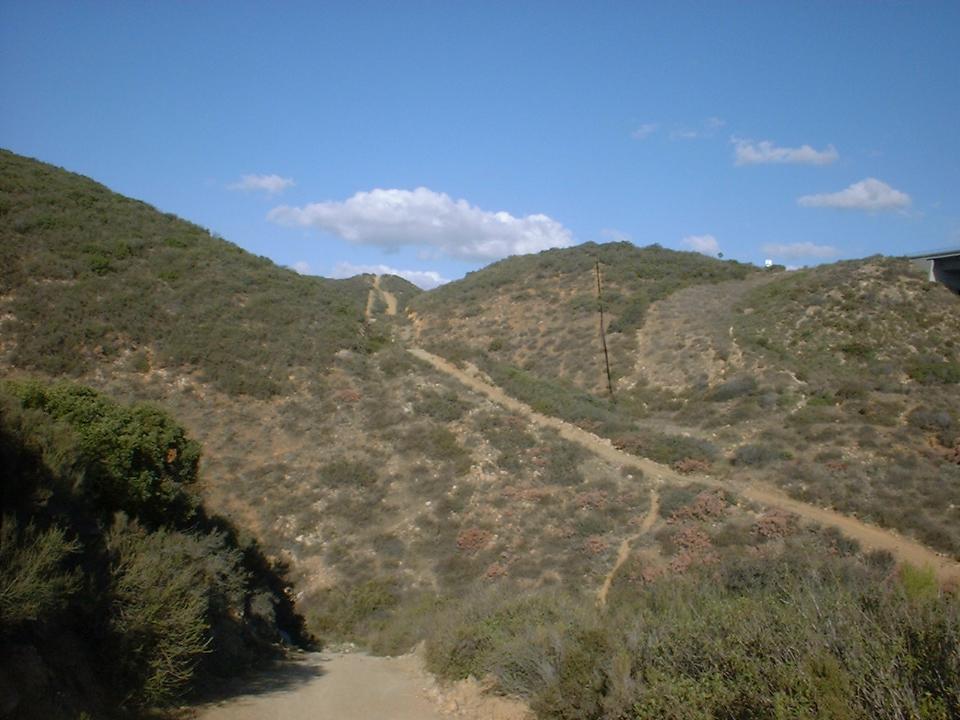
You then will catch the trail at the power lines that goes up to the saddle between the Fortunas. You will then bomb down the very steep fire road called the Alley and head into the eastern portion of the park. After riding around the hills on the northern portion of the eastern half you cut across the grasslands and hook up with the Father Junipero Serra trail (pavement) at the southwest portion of the park. You will then shoot down the pavement where it will take you out to Mission Gorge Road. Hang a right and 2/10ths of a mile later you will be back at Jackson drive where you parked.
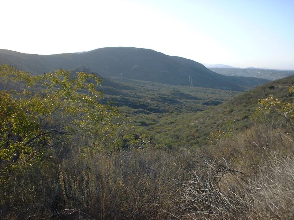
Below are some pictures from the upper end of the western half of the park above Suycutt wash in the area between Points B and D.
One of the other common route is to start at the Father Junipero Serra trailhead on the eastern side of the park. You tool through the grassland area and work you way northwest to the power lines. There you will face a brutal climb called "The Alley" that you take up to the Fortuna saddle. From there you will hang a right and take a trail up to the top of North Fortuna. From there you will continue on past the peak and come down at the far north end of the park by Point B.
 These
shots were taken on North Fortuna near Point B. The trail that runs from
the saddle between North and South Fortuna north over the top is quick
technical.
These
shots were taken on North Fortuna near Point B. The trail that runs from
the saddle between North and South Fortuna north over the top is quick
technical.
After you get off of North Fortuna (which entails a little hike-a-bike for most riders) you drop down into the wester half of park. After working you way south through the valley, You will have to climb up to the top of the Jackson drive fire road. From there you will bomb down to the San Diego River. After crossing the river you will hang a left and follow a trail up to the Father Junipero Serra Trail. From there you hang a left at climb up through Mission Gorge along the pavement back up to the trailhead you started at.
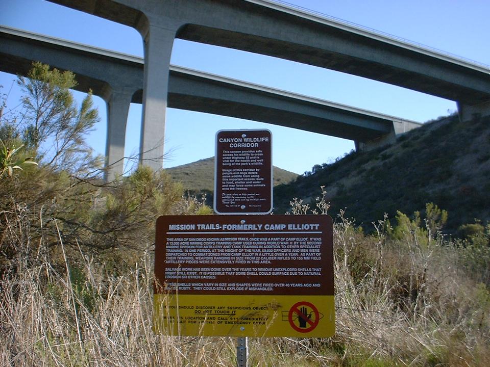
 The
picture to the left is the wildlife corridor that goes under the HWY 52 at Oak
Canyon (Point C). Notice the sign doe not say "No Trespassing",
just to be careful for unexploded ordnance. To the left is a picture
looking west from the east ridge above Oak Canyon (Point C). The fire road
on
the far side of the canyon is brutal trying to go up and loose scary going
down.
The
picture to the left is the wildlife corridor that goes under the HWY 52 at Oak
Canyon (Point C). Notice the sign doe not say "No Trespassing",
just to be careful for unexploded ordnance. To the left is a picture
looking west from the east ridge above Oak Canyon (Point C). The fire road
on
the far side of the canyon is brutal trying to go up and loose scary going
down.
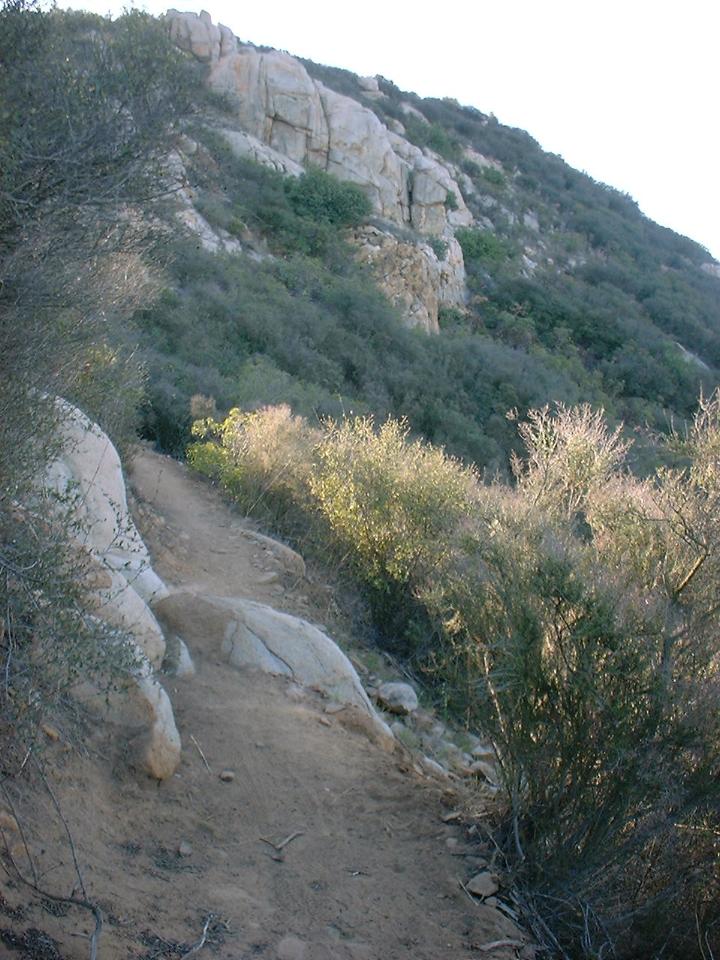
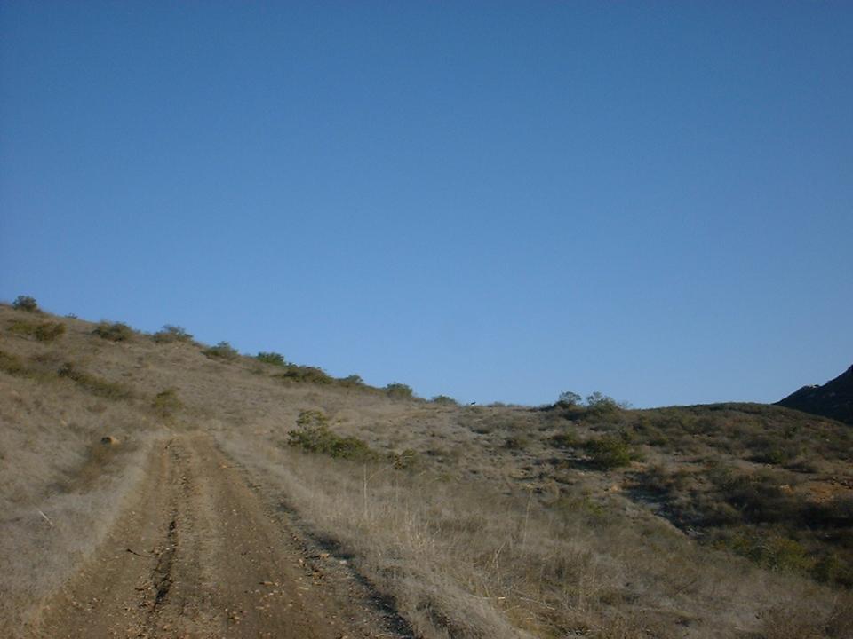
 This
shot was taken on the western side of the park on one of the single tracks down
the valley to the south.
This
shot was taken on the western side of the park on one of the single tracks down
the valley to the south.
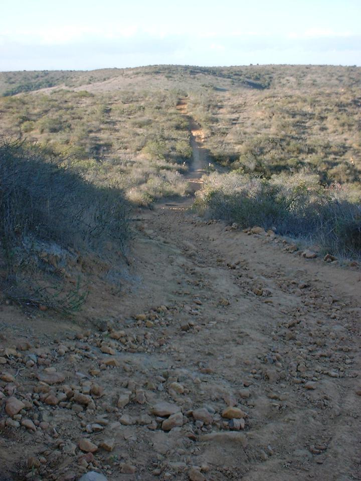
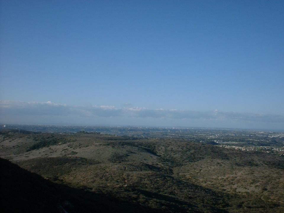
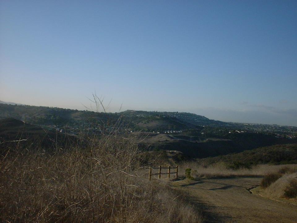 This
picture was taking looking south from Point A after climbing up Jackson Drive
(steep gravel fire road).
This
picture was taking looking south from Point A after climbing up Jackson Drive
(steep gravel fire road).
 This
was taken on west side of the park. If you look really close on the ridge
line, just a little right of center you can see a silhouette of a coyote
This
was taken on west side of the park. If you look really close on the ridge
line, just a little right of center you can see a silhouette of a coyote
Miramar Marine Corp Air Station borders the park on the north side of the 52 freeway. Cycling onto the station is prohibited, but the trails are some of the most used in the county. Particularly Spring and Oak Canyons which are accessed from the eastern side of the park. It is my understanding that the city the park and station have been discussing off and on over the years the transfer, sale or lease of the land to the park. Either way you are not supposed to ride on the north side of the 52. The station police can confiscate your bike if caught, but apparently it has been many moons since any enforcement has taken place there. Ride at your own risk, and I am not endorsing the poaching of what is said to be some of the best single track you can find this close to town.
The best way to experience Mission Trails is to hook up with one of the locals to show you around. The newsgroup alt.mountain-bike and the Passion discussion group on www.mtbr.com is a good way to hookup with other riders.
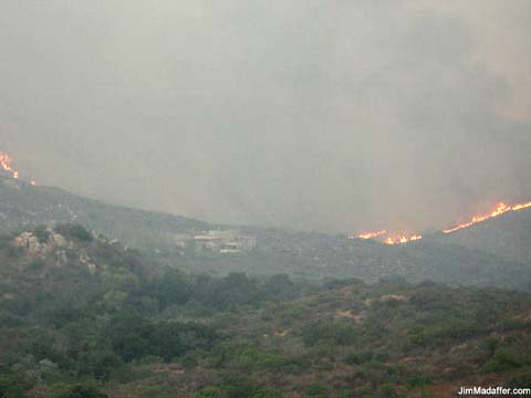
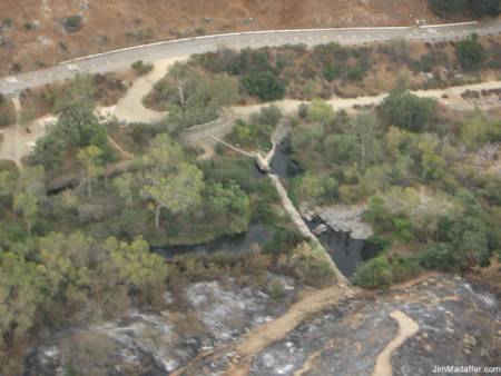
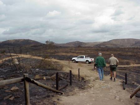
2003 Firestorm Pictures
These photos are from the Mission Trails Regional Park website. The photographer is listed below the photo
|
|
Fire along the west ridge of South Fortuna moving towards the Visitor Center in the center of the photo. |
|
Aerial view of Old Mission Dam after the fire. The hillside on the far side of the road burned in June 2002. |
|
|
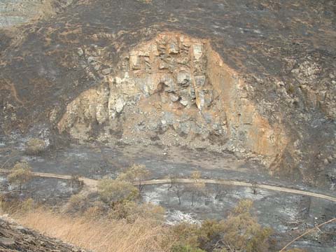
A portion of service road along the San Diego River. The rock face is an abandoned quarry. The river is hidden from view by the vegetation at the bottom of photo. |
|
Grasslands area looking north near Old Mission Dam overlook |
|
|
October 26, 2003 as fire begins to engulf the park. Near the Visitor Center looking toward South Fortuna. |
|
Looking toward Rim Trail near Tierrasanta from the Visitor Center |
|
|
Grasslands area looking north near Old Mission Dam overlook |
|
The Fortuna Mountain region of the park. |
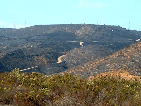

These photos where taken by Michael Paul
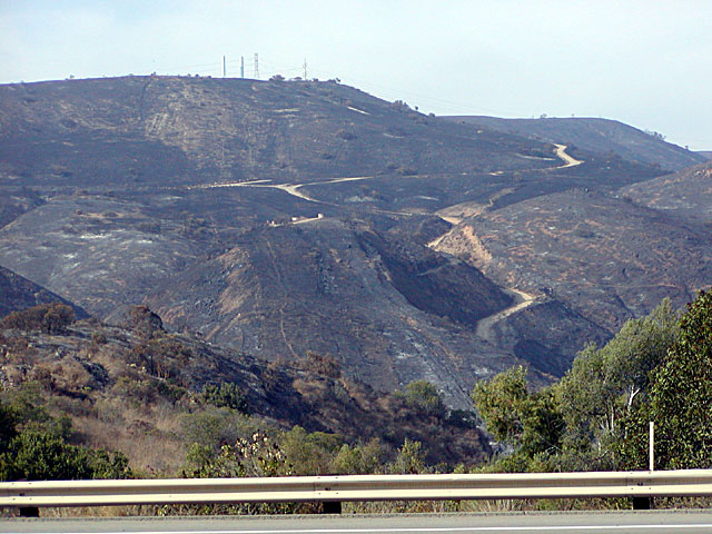
This is a view from Mission Gorge Road looking north at Jackson Drive fire
road going up the hill.
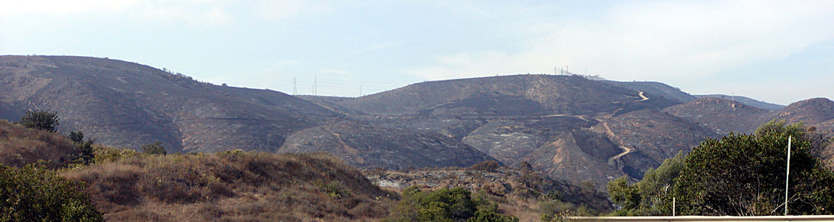
Here is a panoramic shot from the west side of the park. Compare the stark view of Michael's picture above to the picture I
took looking at the Fortunas in the Spring of 2003.