
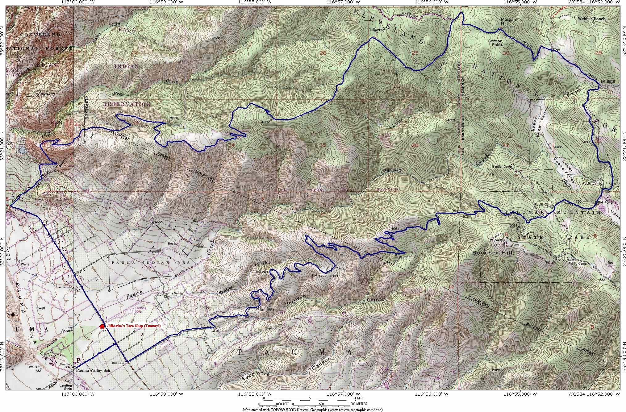
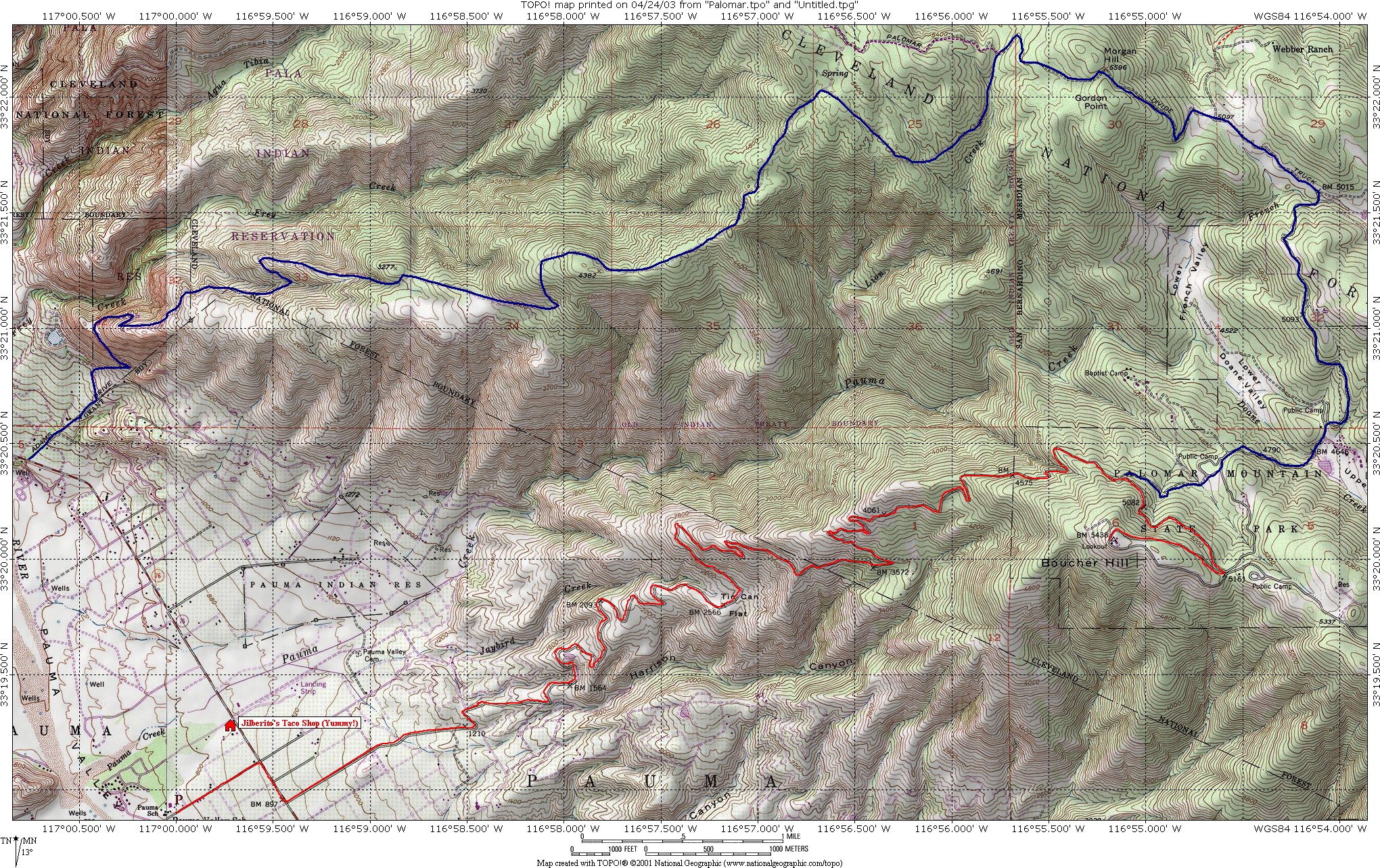
Palomar Mountain Epic Loop
 Low
Resolution Map of the Route
Low
Resolution Map of the Route
Download the TOPO! File
 High
Resolution version of the map. 2MB
High
Resolution version of the map. 2MB
![]() Elevation
Profile of the Route
Elevation
Profile of the Route
 I had been feeling like I owed the gravity gods an offering for some time so I
decided to go out and tackle the Nate
Harrision Grade with some additional exploration mileage. The 11 mile
climb with an average grade of 8 percent (meaning some pitches less and
some more) had the meanness to it as the the last time I did it (Check
out my site for a review of that part). I was extremely happy when I
got up into Palomar State Park where I hung a left descended on narrow
payment. After about 1.25 miles of this the road turns uphill for a couple hundred
I had been feeling like I owed the gravity gods an offering for some time so I
decided to go out and tackle the Nate
Harrision Grade with some additional exploration mileage. The 11 mile
climb with an average grade of 8 percent (meaning some pitches less and
some more) had the meanness to it as the the last time I did it (Check
out my site for a review of that part). I was extremely happy when I
got up into Palomar State Park where I hung a left descended on narrow
payment. After about 1.25 miles of this the road turns uphill for a couple hundred
 yards and the
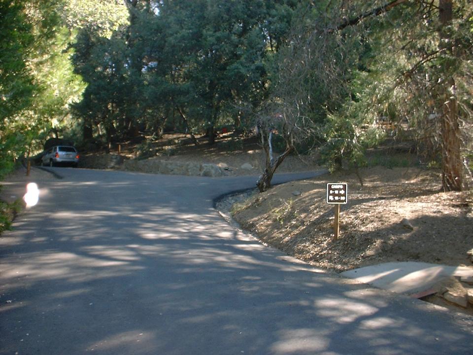
 opens up into north Doane Valley. You will
quickly roll into the Doane Campground. Make a right at the sign for campsites 9-12. This will take up to the northeast part of the campground where you will find a gate to a fire road. The nearby campsites have water so fill up if you need to as this is your last chance for the rest of ride..
This part of the trek was in exploration mode as I had only researched this on
my TOPO map software and a Cleveland NF map.
opens up into north Doane Valley. You will
quickly roll into the Doane Campground. Make a right at the sign for campsites 9-12. This will take up to the northeast part of the campground where you will find a gate to a fire road. The nearby campsites have water so fill up if you need to as this is your last chance for the rest of ride..
This part of the trek was in exploration mode as I had only researched this on
my TOPO map software and a Cleveland NF map.
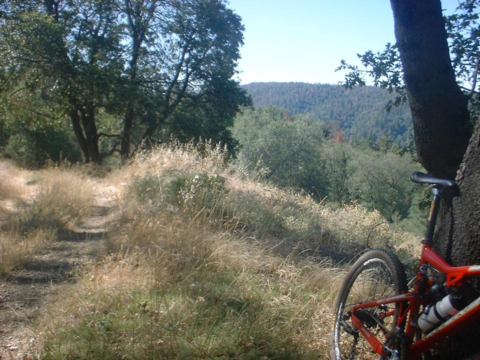
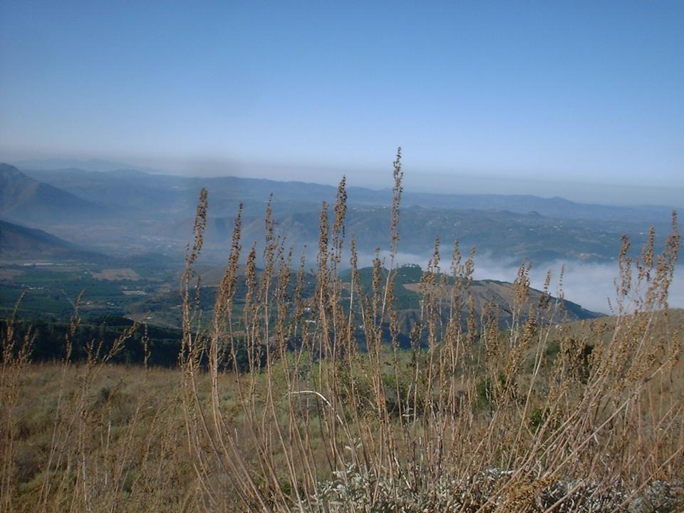
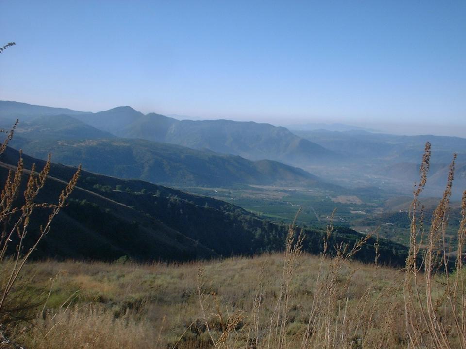
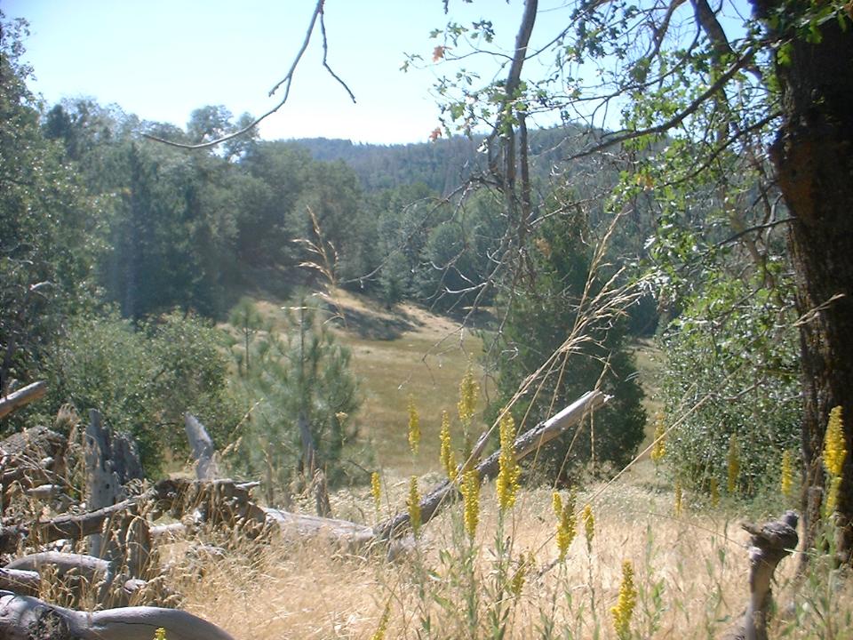
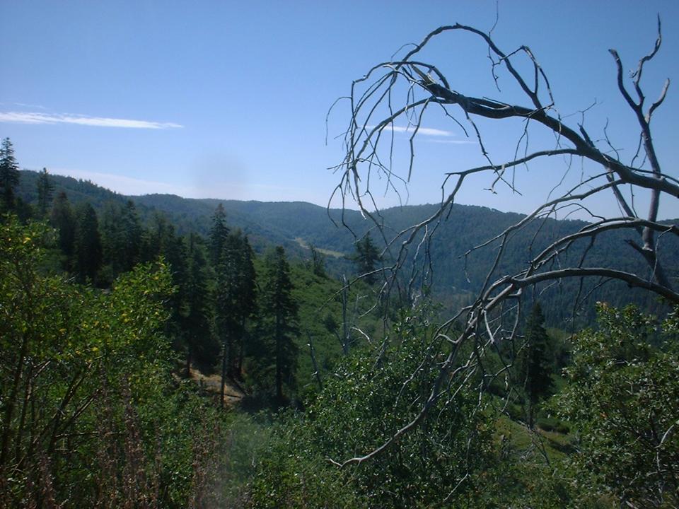
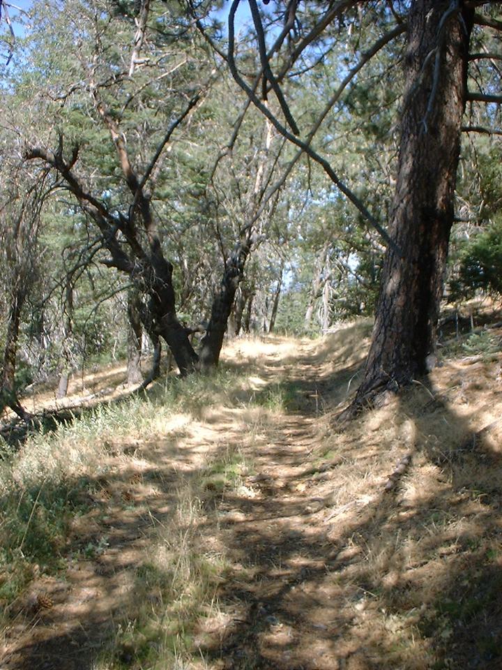
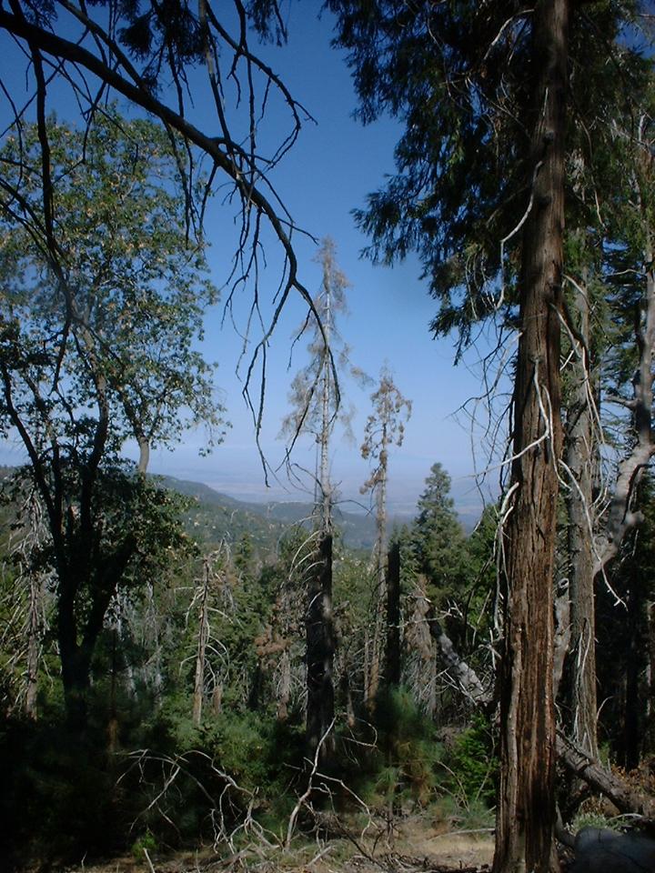
Views from the Climb Described in the next paragraph
 You will do some mild climbing with awesome views of the Lower French Valley
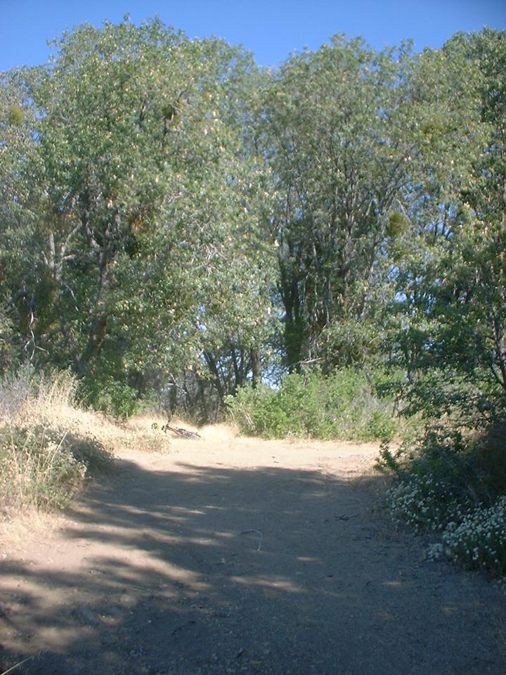
below you and to your left. After about 1 mile you come to a switchback in the main road. Look closely right at the apex of the switchback.
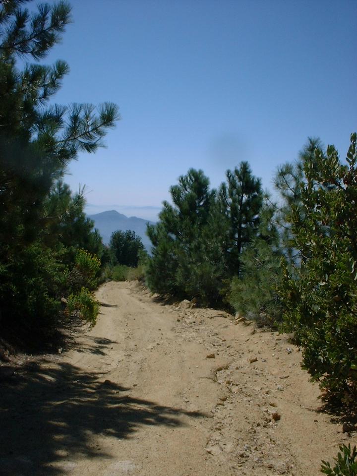
(Picture of it to the left) You will see and old and apparently no longer used fire road heading downhill. It is readily seen by looking for the absence of trees. The beginning of this old fireroad looks like a faint singletrack for the first 30 yards and the
definition of the road become more apparent. You will get to enjoy some downhill fun under a canopy of trees as you navigate
this leaf covered fireroad that is on the fast track to being a reclaimed
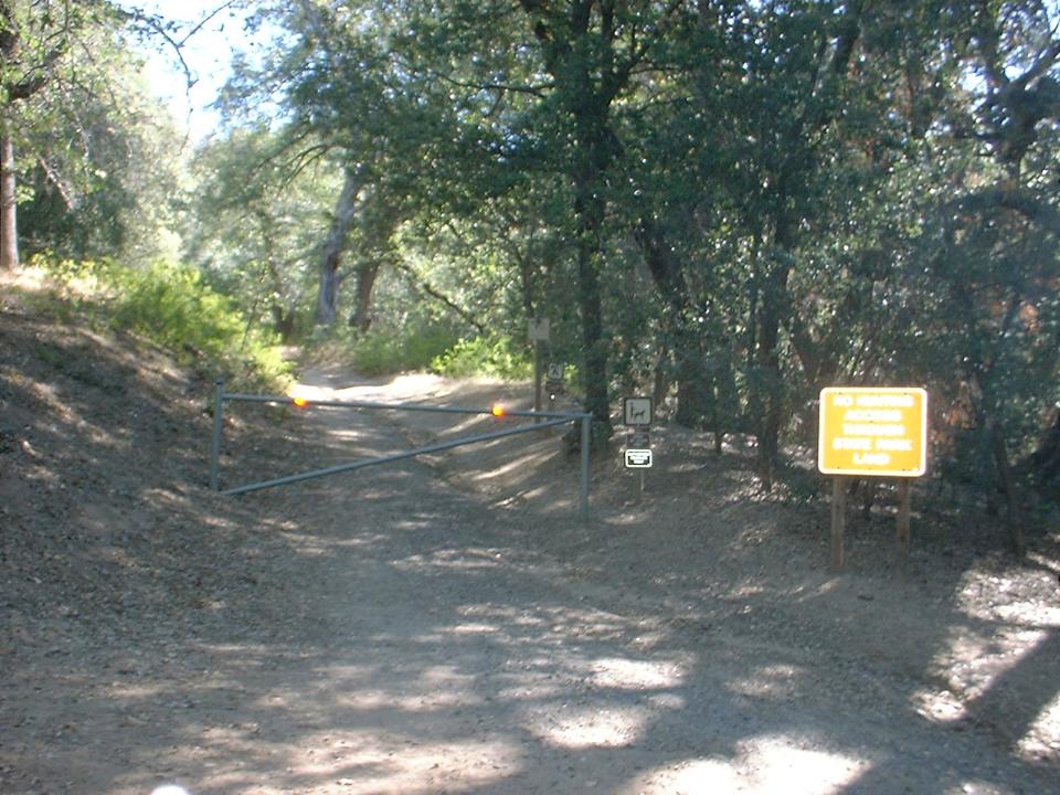
sinqletrack. You will soon come to a locked green gate that marks the boundary of Palomar State Park
You will do some mild climbing with awesome views of the Lower French Valley
below you and to your left. After about 1 mile you come to a switchback in the main road. Look closely right at the apex of the switchback.
(Picture of it to the left) You will see and old and apparently no longer used fire road heading downhill. It is readily seen by looking for the absence of trees. The beginning of this old fireroad looks like a faint singletrack for the first 30 yards and the
definition of the road become more apparent. You will get to enjoy some downhill fun under a canopy of trees as you navigate
this leaf covered fireroad that is on the fast track to being a reclaimed
sinqletrack. You will soon come to a locked green gate that marks the boundary of Palomar State Park
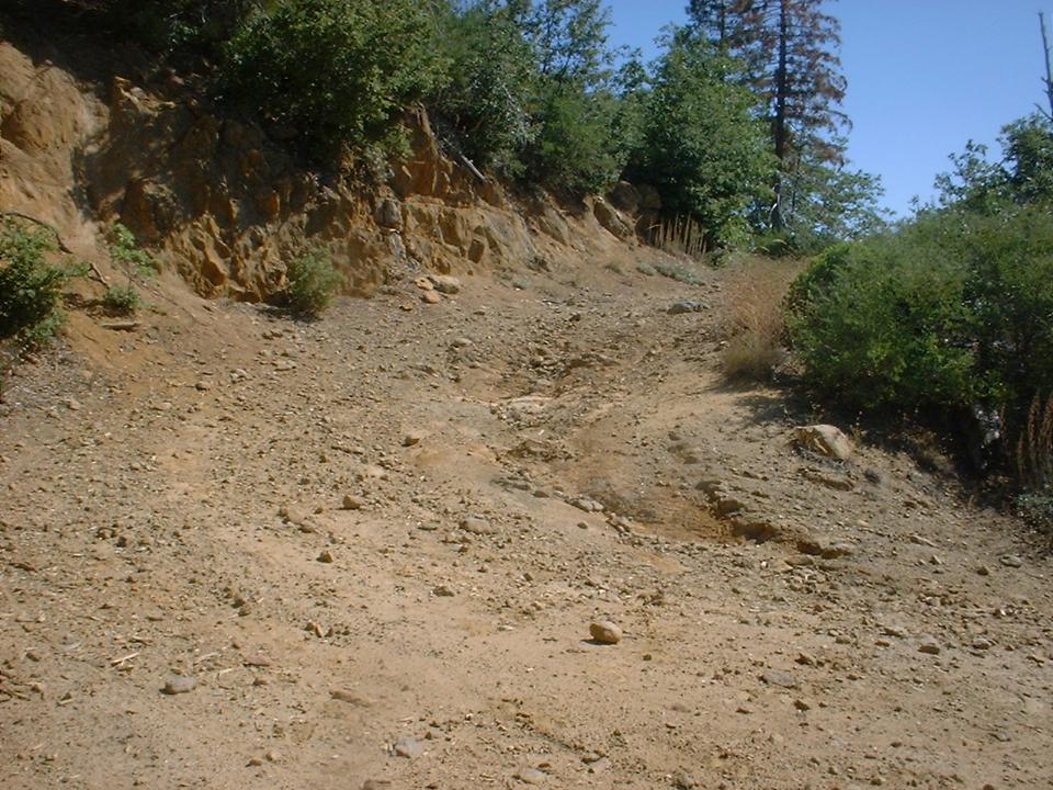
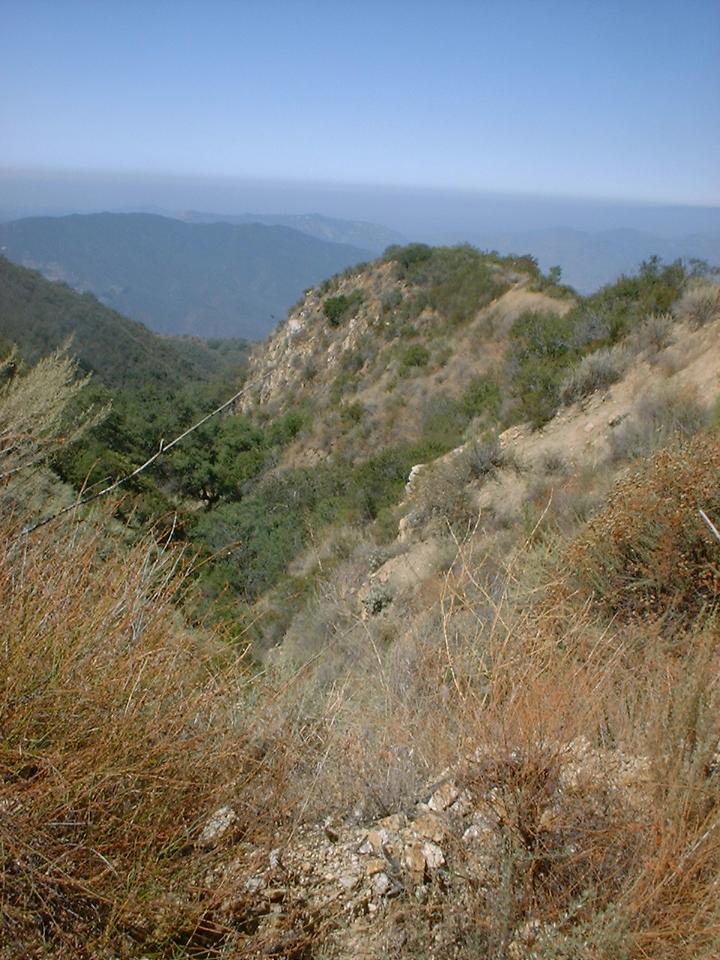
 After you get over the gate continue own down until you are at a fireroad intersection. Your option are: a hard left and uphill; a shallow right and uphill; and straight and downhill.
(Picture to the left) Continue straight where you will almost immediately cross a stream. Within a hundred yards you join up with the Palomar Divide truck trail. This section does see some use, but it is still “small” for the most part. You will spend the next mile skirting along and trough the northern edge of the
Lower French Valley.
After you get over the gate continue own down until you are at a fireroad intersection. Your option are: a hard left and uphill; a shallow right and uphill; and straight and downhill.
(Picture to the left) Continue straight where you will almost immediately cross a stream. Within a hundred yards you join up with the Palomar Divide truck trail. This section does see some use, but it is still “small” for the most part. You will spend the next mile skirting along and trough the northern edge of the
Lower French Valley.
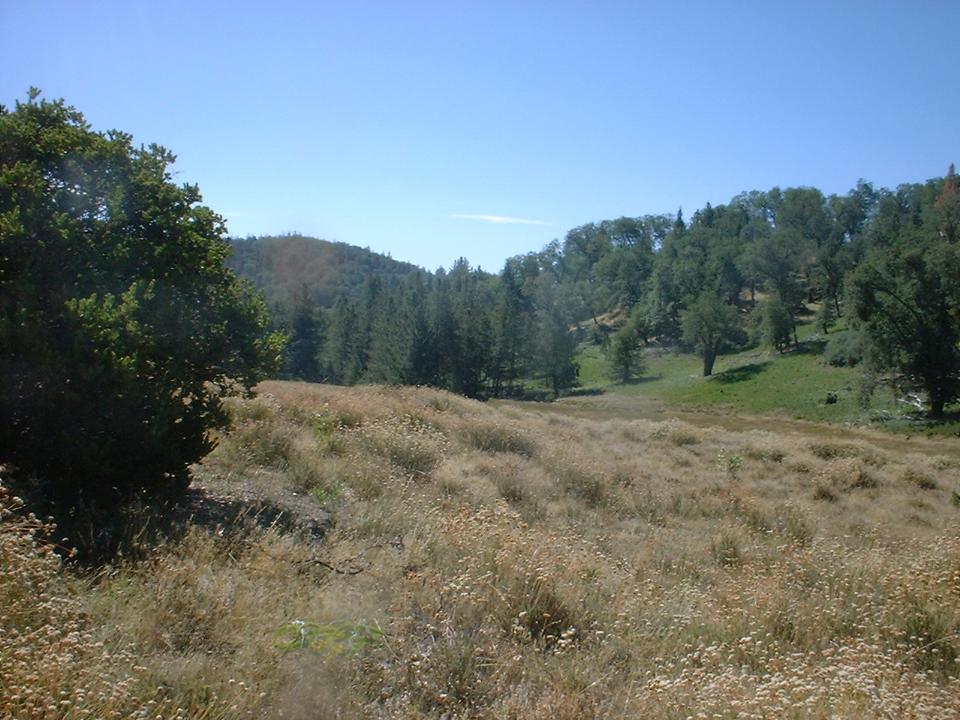
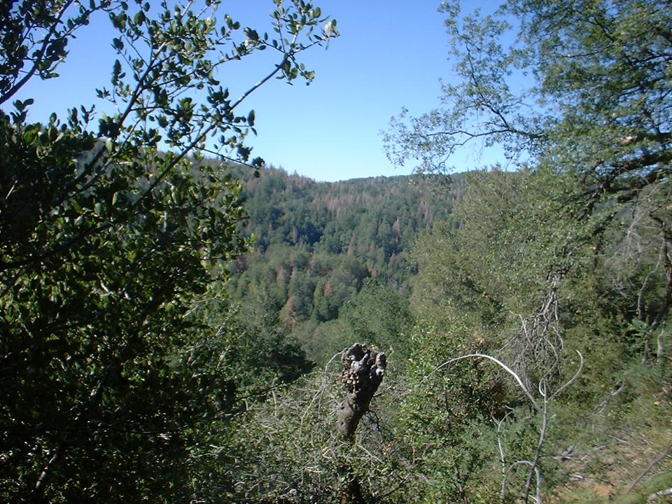
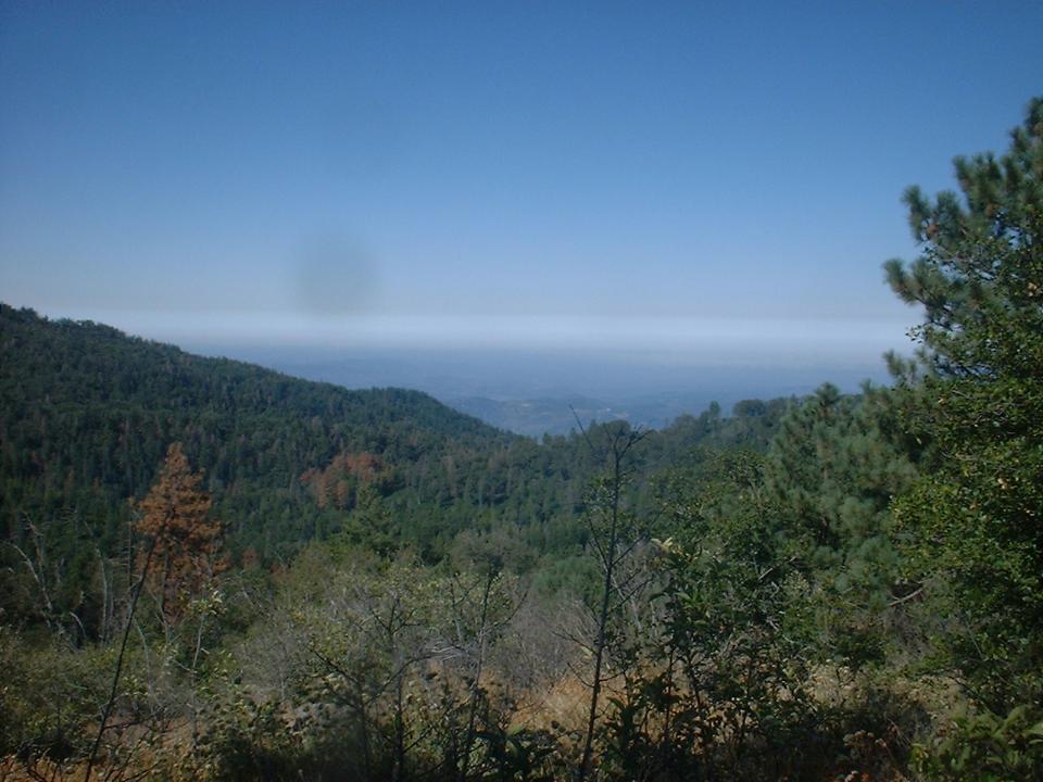
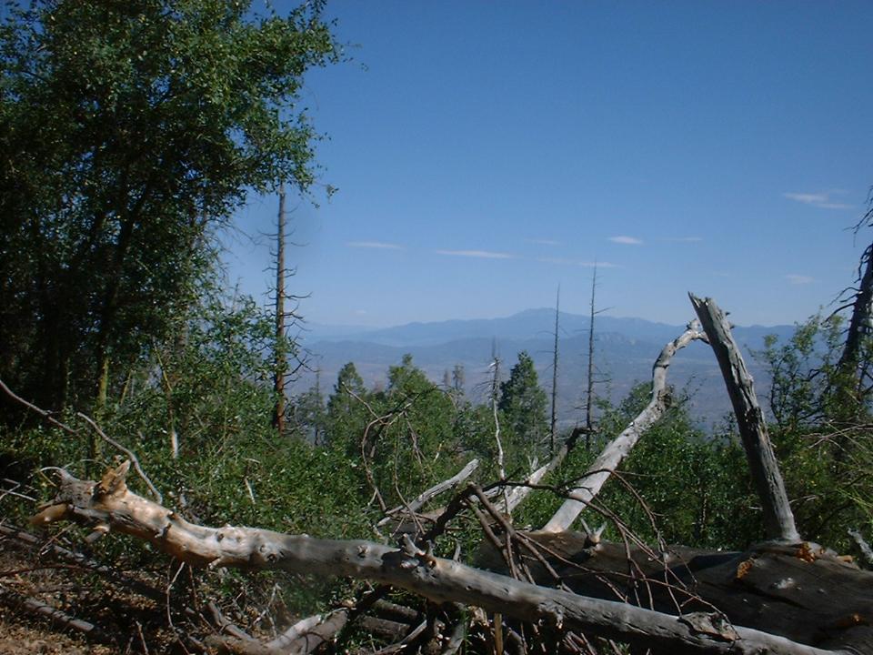
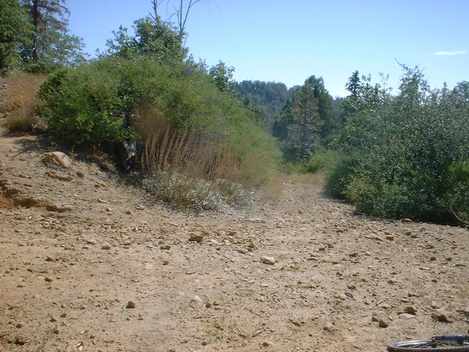
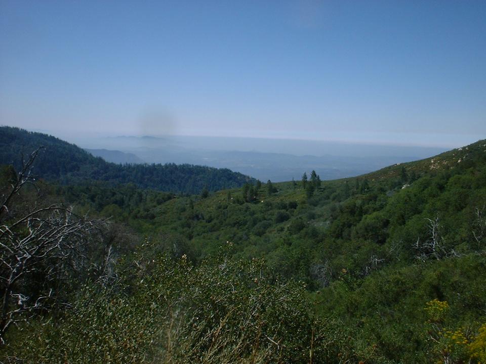
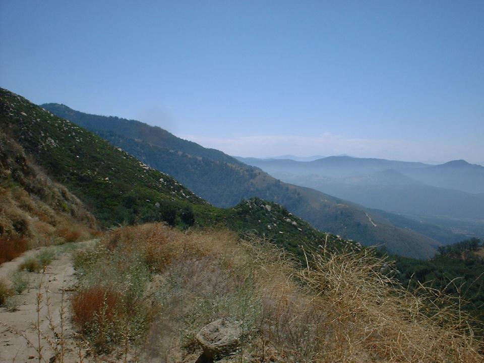
Pictures from along the northern edge of the Lower French Valley
 You will soon come to gate across the truck trail. Make sure to close the gate behind you. The main fireroad bends to the right
just after the gate. Look to your left and you should is an fireroad heading into the wooded hillside. This
is the Palomar Divide truck trail and the way you will go. Once out of the meadow the truck trail is a little more defined but it see very little use. I only saw two bike tracks and a few horse tracks. The climbing get tough as
grade is a little steep and the terrain is either small rocks or cushy bed of decomposing leaves, all of which is
energy sapping. There are a couple of deadfalls across the trail on the climb. I did not mind stopping to get over them at all. By one particular deadfall you have a
beautiful view of the San Jacinto and San Bernardo Mountains to the north.
You will soon come to gate across the truck trail. Make sure to close the gate behind you. The main fireroad bends to the right
just after the gate. Look to your left and you should is an fireroad heading into the wooded hillside. This
is the Palomar Divide truck trail and the way you will go. Once out of the meadow the truck trail is a little more defined but it see very little use. I only saw two bike tracks and a few horse tracks. The climbing get tough as
grade is a little steep and the terrain is either small rocks or cushy bed of decomposing leaves, all of which is
energy sapping. There are a couple of deadfalls across the trail on the climb. I did not mind stopping to get over them at all. By one particular deadfall you have a
beautiful view of the San Jacinto and San Bernardo Mountains to the north.
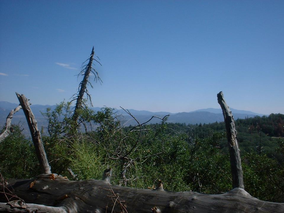
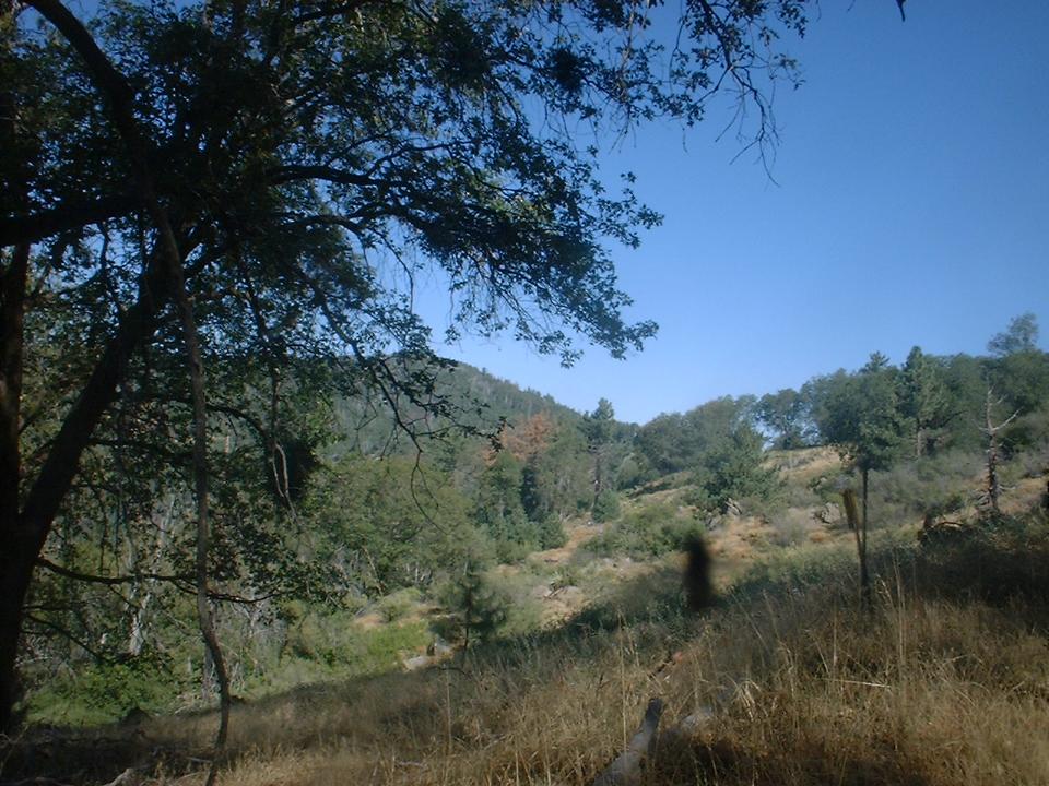
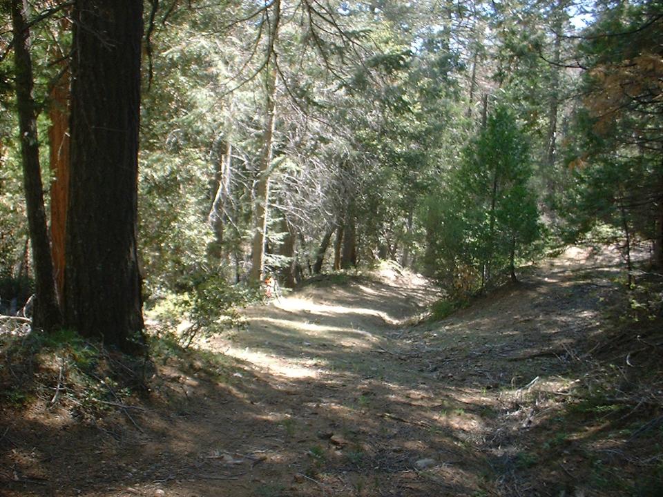
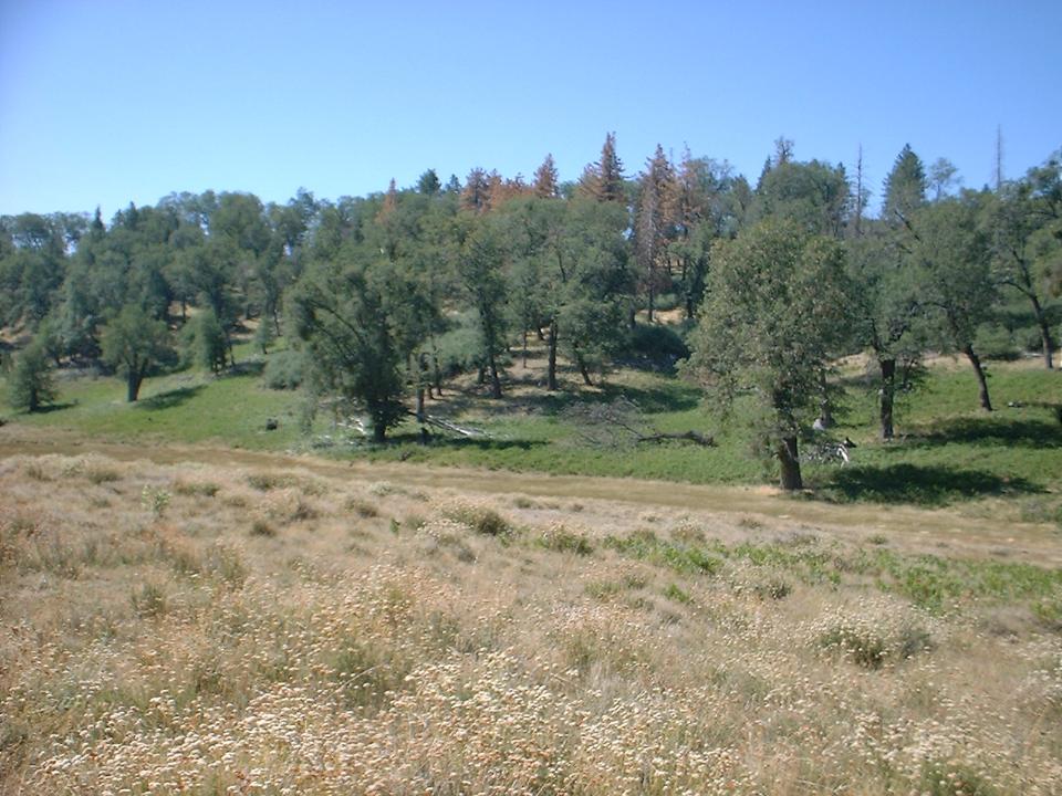
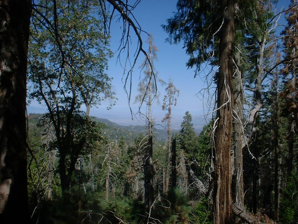
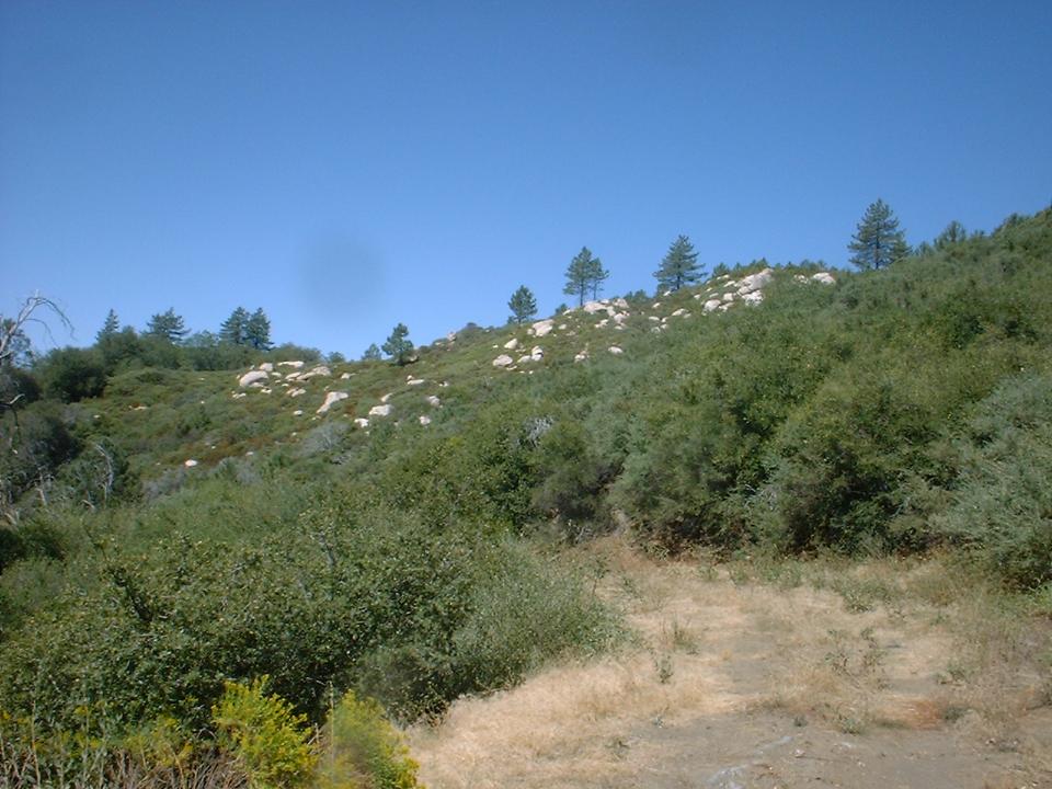
Views from the Palomar Divide Truck Trail on the way up to Morgans Hill
 Soon you
peaked out near Morqan Hill at 5,600 feet. From here the truck trail turns to the left and south. More importantly it turns down.
(The picture to the left is where the fireroad turns down) This section of also sees next to no use which was wonderful as I zipped along under a canopy of pines and oaks. After about
3/4ths of a mile of this, the truck trail switchbacks to the left. About 50 yards after the switchback there is single wire cable gate across the truck trail making the northern boundary of the Pauma Indian Reservation.
Soon you
peaked out near Morqan Hill at 5,600 feet. From here the truck trail turns to the left and south. More importantly it turns down.
(The picture to the left is where the fireroad turns down) This section of also sees next to no use which was wonderful as I zipped along under a canopy of pines and oaks. After about
3/4ths of a mile of this, the truck trail switchbacks to the left. About 50 yards after the switchback there is single wire cable gate across the truck trail making the northern boundary of the Pauma Indian Reservation.
After stepping over wire cable, continue on for a couple of hundred yards where you come to a opening in the forest as well as a T-junction. To the right and uphill the Palomar Divide Truck Trail continues on. To the left and downhill is Reservation road
#2 which is also known as the Gomez Trail.
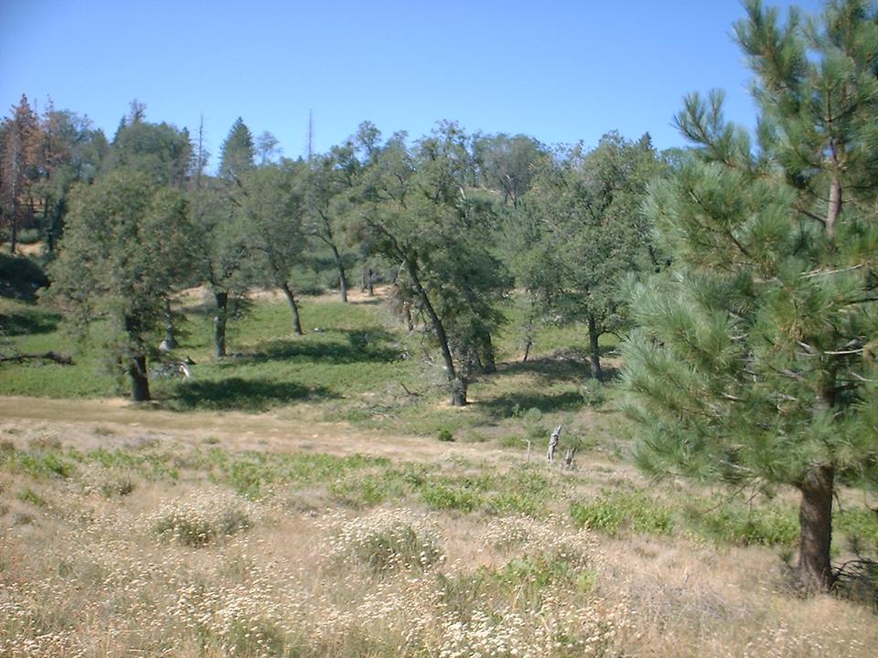
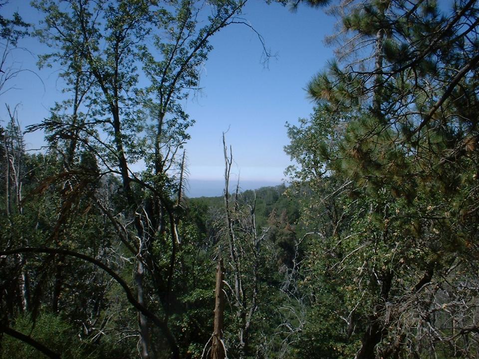
Views from the section just after Morgans Hill
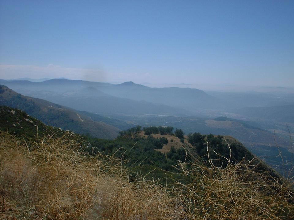 The fireroad was wide like a fireroad but it does not get maintained much.
There was a little climbing here and there which hurt at this point in
the trip, but after a few miles of ridge riding climbing the fireroad down
and got pretty steep for a fireroad. One 1/2 mile section had an
average grade of 20 percent. The fireroad was very challenging and downright
treacherous in spots. It pretty much had a wide spread of challenges. with rocky
ruts, angled washboards, loose sandy spots, big rocks, etc...and some of
that stuff
The fireroad was wide like a fireroad but it does not get maintained much.
There was a little climbing here and there which hurt at this point in
the trip, but after a few miles of ridge riding climbing the fireroad down
and got pretty steep for a fireroad. One 1/2 mile section had an
average grade of 20 percent. The fireroad was very challenging and downright
treacherous in spots. It pretty much had a wide spread of challenges. with rocky
ruts, angled washboards, loose sandy spots, big rocks, etc...and some of
that stuff 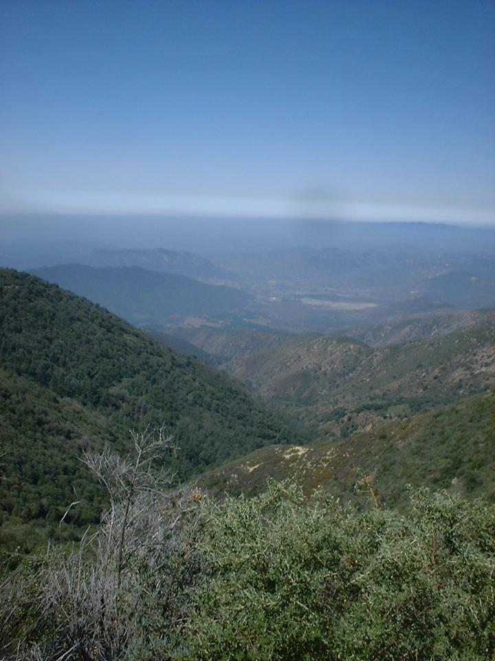
 in
combination. It was mucho fun in a sometimes scary sort of way.
Of course all you had to do in most spots is lay off the brakes for a
microsecond and your flying. This 8-mile fireroad (with average grade of
17 percent) dumped me out on Adams Grant road close to the 76. It was an
easy 2.5 mile mostly flat/downhill return back to the truck from there.
in
combination. It was mucho fun in a sometimes scary sort of way.
Of course all you had to do in most spots is lay off the brakes for a
microsecond and your flying. This 8-mile fireroad (with average grade of
17 percent) dumped me out on Adams Grant road close to the 76. It was an
easy 2.5 mile mostly flat/downhill return back to the truck from there.
 The route was 29.2 miles long and 6,800 feet of climbing. Access onto the Pauma Indian Reservation
subject to change at any given time so you may want to check with the tribal
office (760-742-1289) before you head out on this epic. Even if the tribe
has issues with access that day turning around at the top of Morgan's hill and
going back through the Lower French Valley and Nate Harrision Grade is still a
great ride. This is definitely a leg burner and lung buster, but the views and nearly
undisturbed trails are worth the price of admission.
The route was 29.2 miles long and 6,800 feet of climbing. Access onto the Pauma Indian Reservation
subject to change at any given time so you may want to check with the tribal
office (760-742-1289) before you head out on this epic. Even if the tribe
has issues with access that day turning around at the top of Morgan's hill and
going back through the Lower French Valley and Nate Harrision Grade is still a
great ride. This is definitely a leg burner and lung buster, but the views and nearly
undisturbed trails are worth the price of admission.