
Chilao Flat - Silver Moccasin
I need to give a special thanks to my long time riding bud, Bill O'Neil (Better known as “MrMountainHop” online) who put this route together and collaborated heavily with the creation of this page, particularly the options provided at the end. Bill has a real knack for putting together some awesome routes that often include trails off the beaten path. When arranging this ride with Bill my main theme was “I'm driving a long way, lets use all of the day.” Boy did Bill and the San Gabriel Mountains deliver on that. |
||
Directions:
|
||
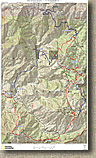 |
Maps: Here is the map and elevation profile for this ride that also shows some of the options available for the ride. Electronic Data Files: National Geographic TPO - Google Earth KML - Garmin GDB - Raw GPX |
 |
| Ride Notes: | ||
 |
The ride starts from the Chilao Flats Visitor Center. We did this ride in December so the campground was closed. My mileage described here starts from the entrance to the campground off highway 2. Normally I derive my mileage from paper notes using my bike computer. These where derived using my GPS track data. I find that over the course of long and twisty ride the GPS track data method tends to come up short on the actual mileage. This total ride could be as much as a mile longer than described, however the smaller individual segment mileages are pretty close. | 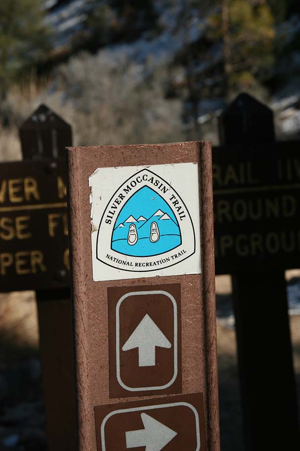 |
 |
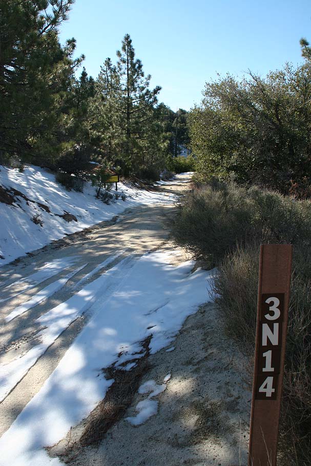
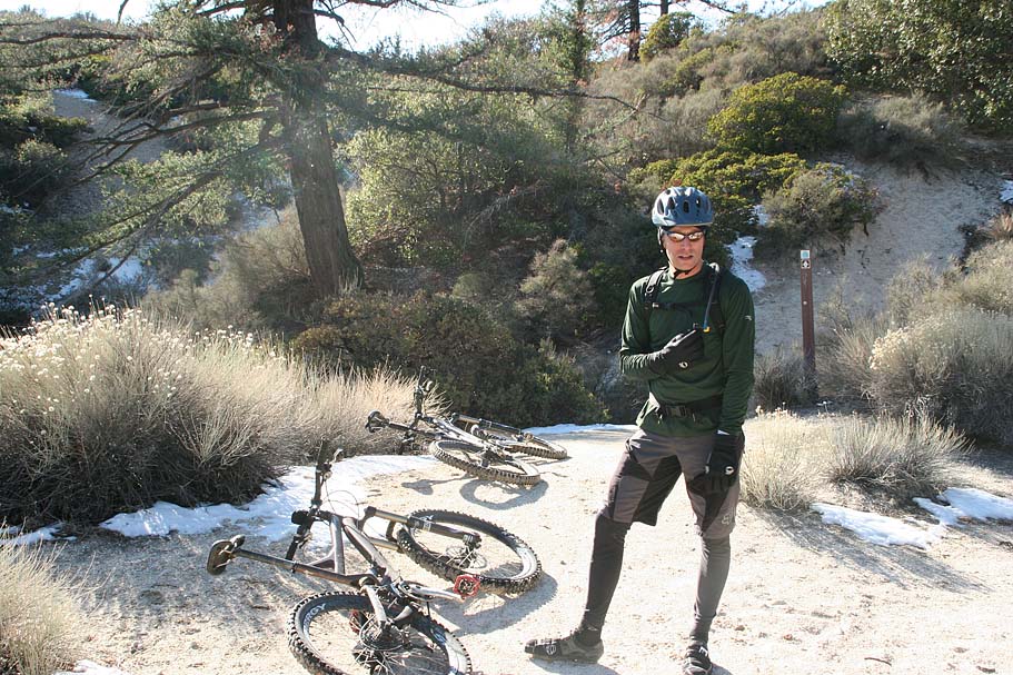
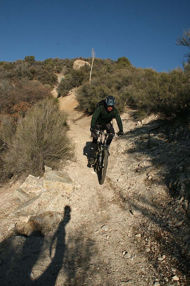
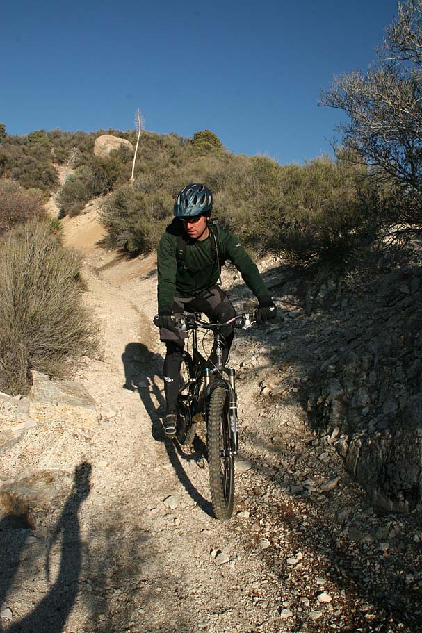
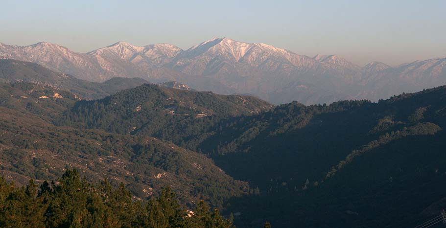
From the entrance to the Chilao Visitor Center and highway 2 (Point A on the map) proceed westward and gradually downhill past the visitor center. At 0.7 miles (Point B) take note of that the Silver Moccasin trail crosses the road here. You will be coming down the hill from your right later in the ride. Continuing on, you will turn right at 1.0 miles (Point C) (Following signs for the ranger station). You will cross over Chilao Creek and start gradually climbing. At 1.5 miles (Point D) veer right at the ranger station onto 3N14 which turns to dirt shortly after this point. The grade on this climb is mild all the way to Point F. The early morning temperatures here in December were pretty cold making me quite content to try and stay warm by pedaling. |  |
 |
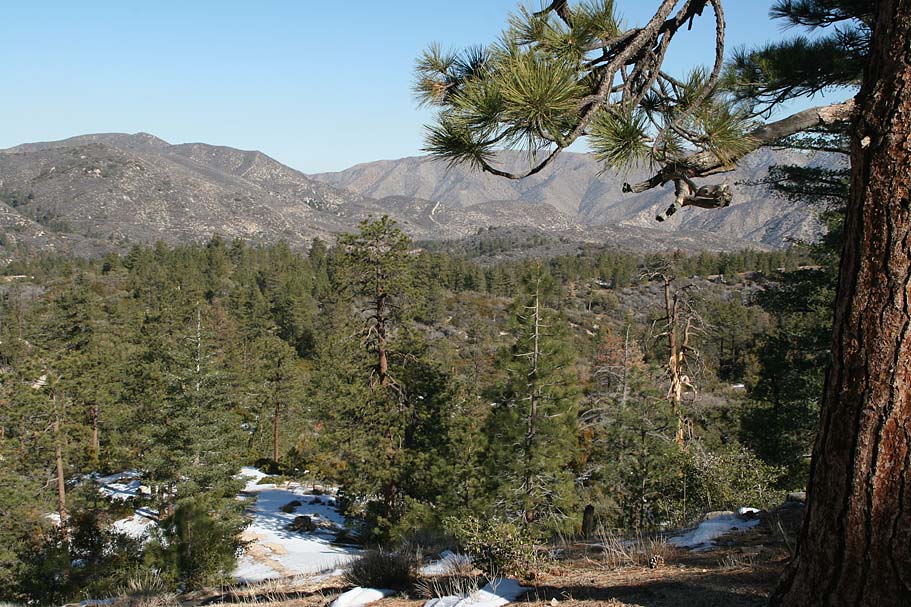
 At 2.4 miles (Point E) you pass the junction with 3N18 coming up from Loomis Ranch. (If you do the mega-loop option described below you will be coming up from this fireroad). Continuing on with the consistent grade climbing you will start getting some good views of Pacifico Mountain on your left. At 4.2 miles (Point F) you come to the junction with 3N17. A pretty cool trail option from here would be to go left at go down to Alder Saddle and then take the old fireroad up to the top of Pacifico Mountain for a fantastic look see around. This however would be substantial climb. For this route, turn right and a quarter mile later look for a trail off to the right behind a series of concrete filled metal post to deter four-wheeler types (Point G). This is the trail up to Mount Hillyer. At 2.4 miles (Point E) you pass the junction with 3N18 coming up from Loomis Ranch. (If you do the mega-loop option described below you will be coming up from this fireroad). Continuing on with the consistent grade climbing you will start getting some good views of Pacifico Mountain on your left. At 4.2 miles (Point F) you come to the junction with 3N17. A pretty cool trail option from here would be to go left at go down to Alder Saddle and then take the old fireroad up to the top of Pacifico Mountain for a fantastic look see around. This however would be substantial climb. For this route, turn right and a quarter mile later look for a trail off to the right behind a series of concrete filled metal post to deter four-wheeler types (Point G). This is the trail up to Mount Hillyer. |
|
|
||
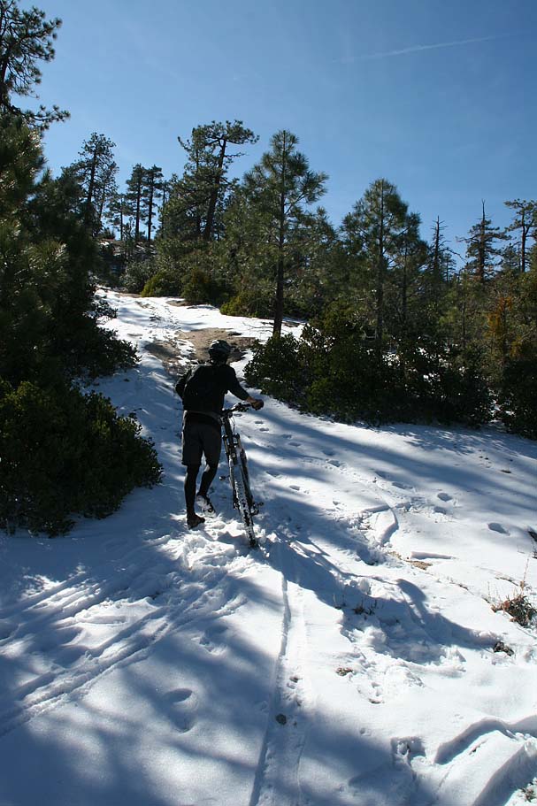 |
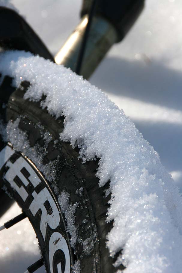
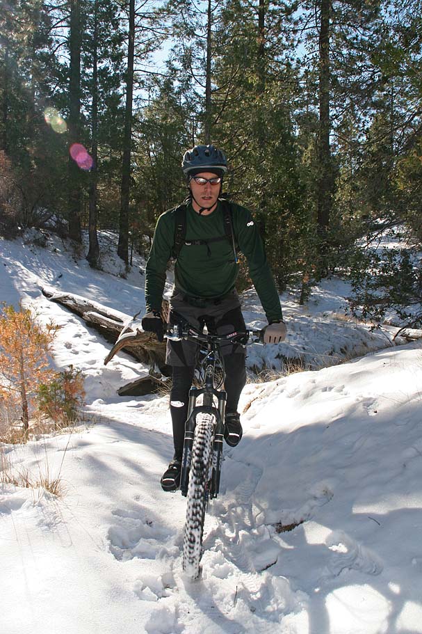
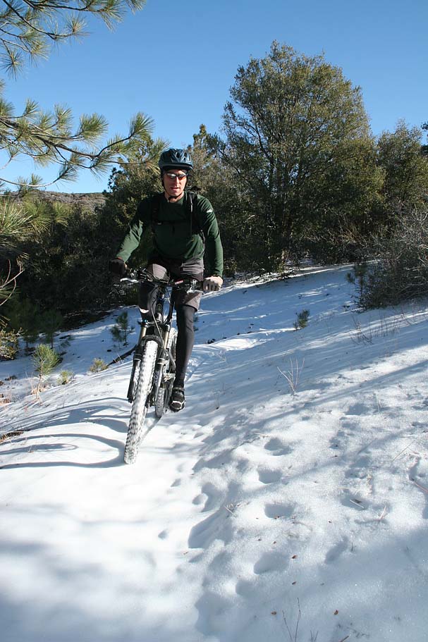
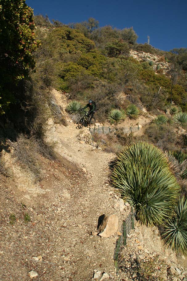
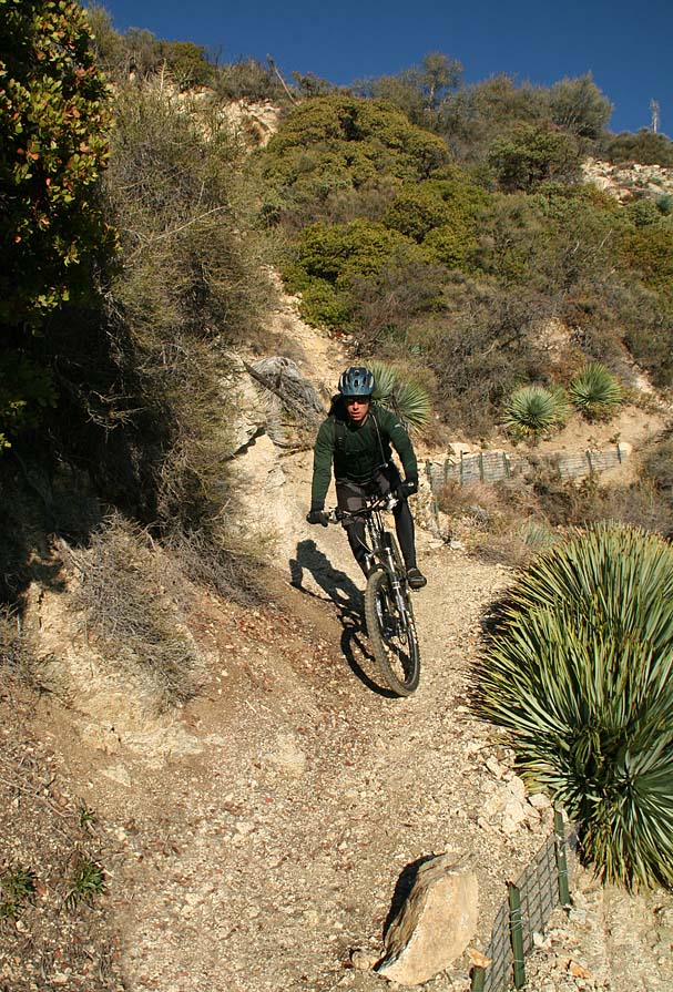
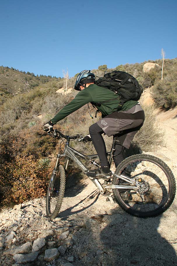
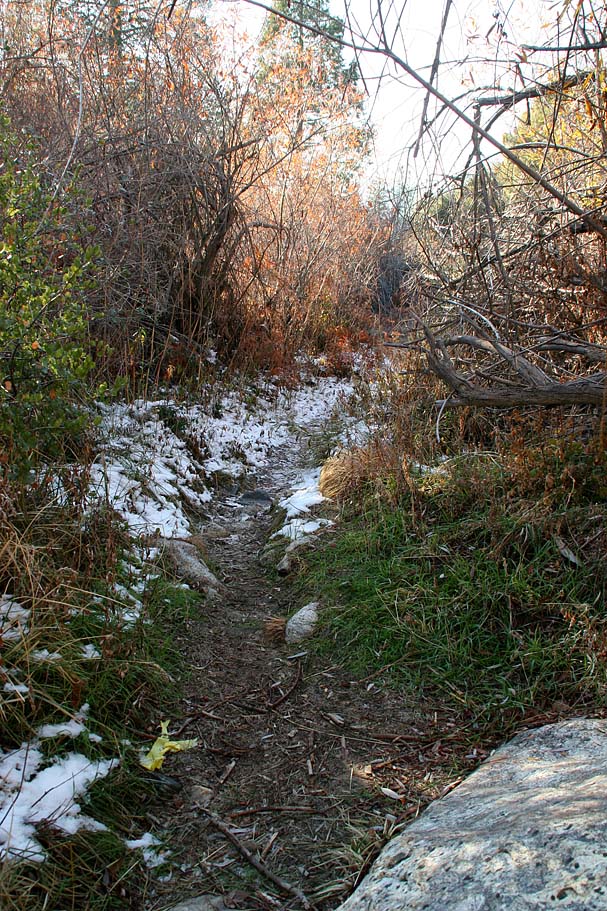
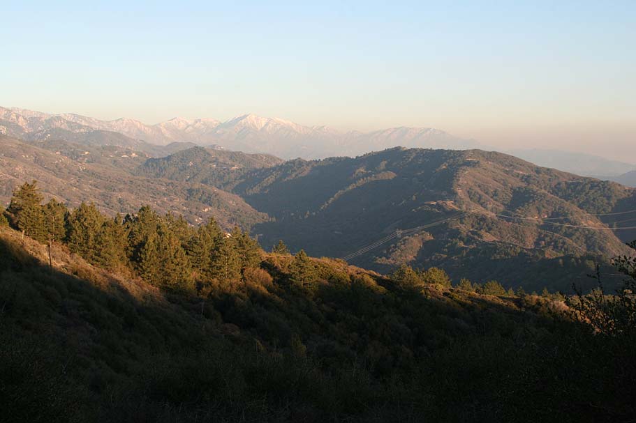
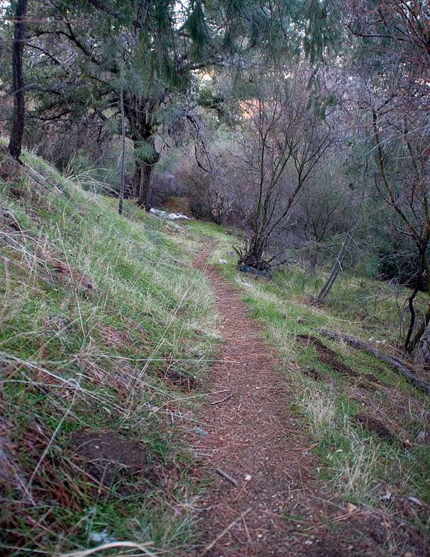
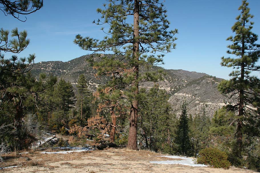
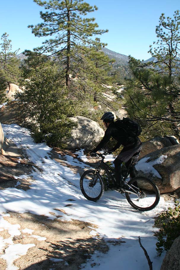
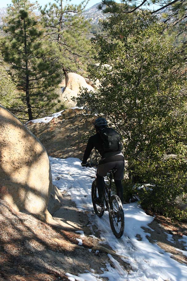
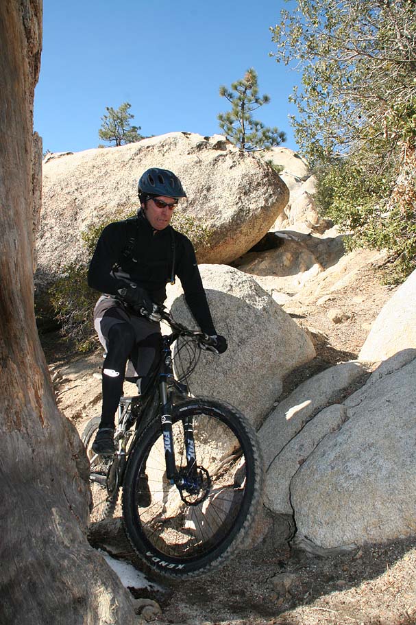
The trail to the summit of Mount Hillyer can be quite sandy during the dry season. This was not the case on this ride. Snow and ice did a fine job of hampering the climb today. The grade was fairly mild at the start but just about one half mile into the trail, it got stupidly steep for a short bit. Luckily it was short lived and mellowed a bunch until reaching the summit of Mount Hillyer at 5.3 miles (Point H). | 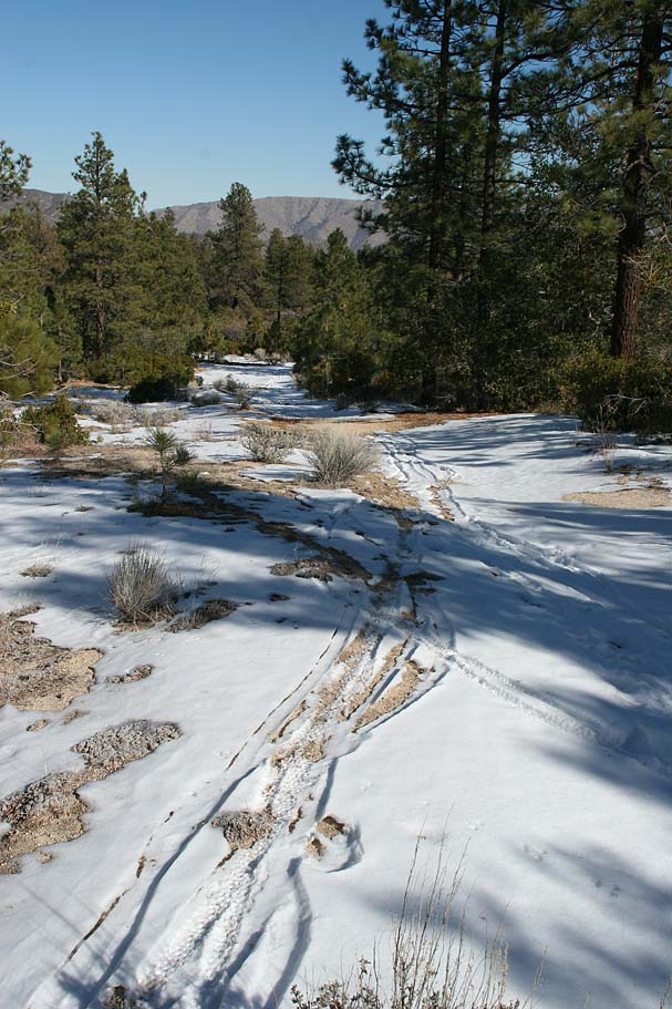 |
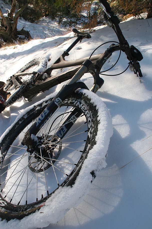
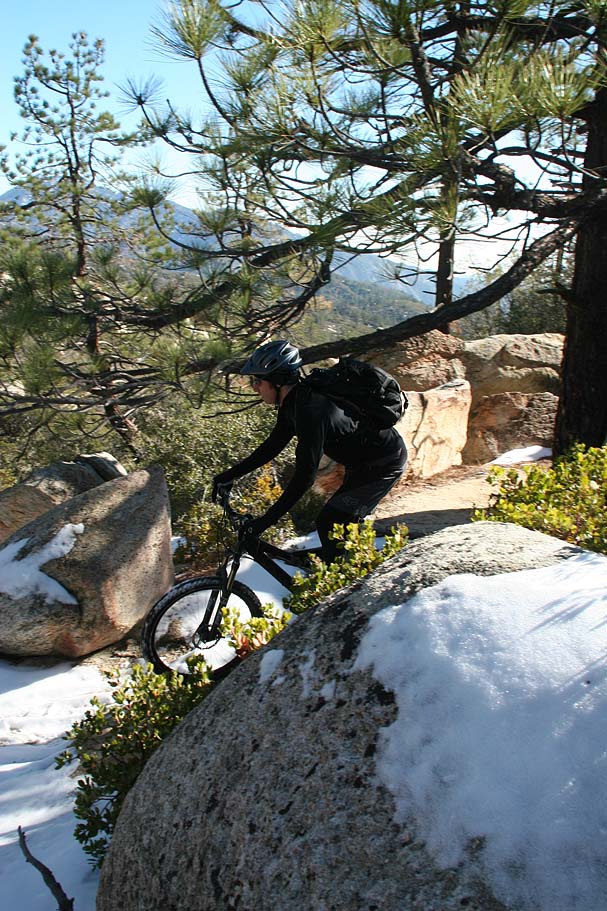
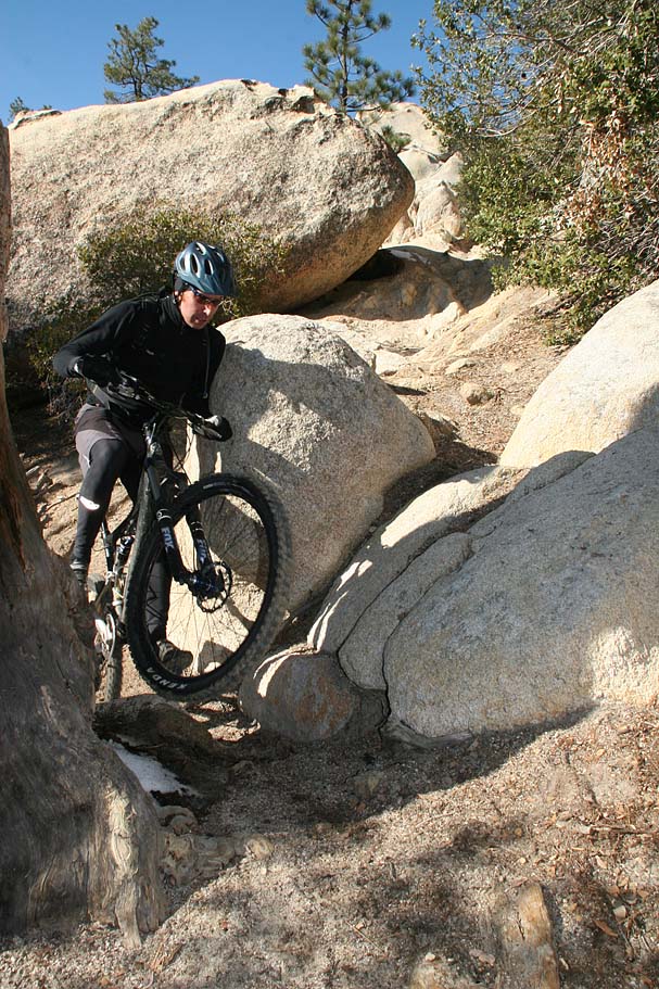
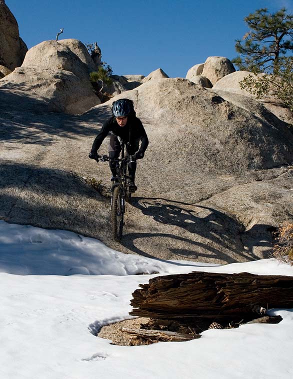 The summit was a great place to grab a snack as there were nice views of Pacifico and many other peaks to be seen. The Mount Hillyer trail beyond this point soon turned downhill. It was and extremely pretty stretch of trail with large boulder outcropping near the trail as it weaved its way back and forth down the mountain. There were no shortage of technical rocks features on the trail itself. The technical aspect of this trail was kicked up a notch with the addition of the some snow and ice. Even a small rock roll is MUCH more interesting with a 1/4" of ice on top. It was not all snow and ice as a good chunk of the trail was on a south facing slope. The summit was a great place to grab a snack as there were nice views of Pacifico and many other peaks to be seen. The Mount Hillyer trail beyond this point soon turned downhill. It was and extremely pretty stretch of trail with large boulder outcropping near the trail as it weaved its way back and forth down the mountain. There were no shortage of technical rocks features on the trail itself. The technical aspect of this trail was kicked up a notch with the addition of the some snow and ice. Even a small rock roll is MUCH more interesting with a 1/4" of ice on top. It was not all snow and ice as a good chunk of the trail was on a south facing slope. |
 |
|
|
||
 |
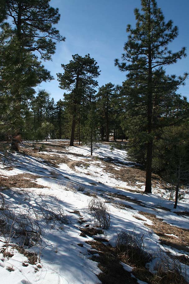
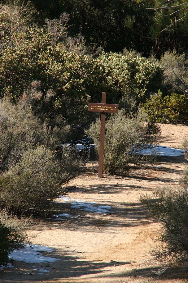
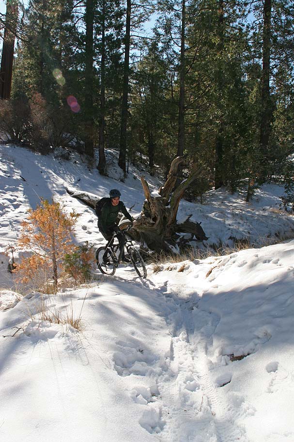
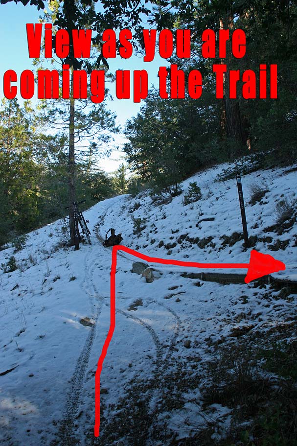
The Mount Hillyer trail flattened out after about 1.3 miles from the summit near Horse Flats campground (Point I). From there you will hang a right on a trail that is well marked pointing to the Silver Moccasin trail. In .2 miles (Point J) you will come to a T-intersections with the Silver Moccasin trail. | 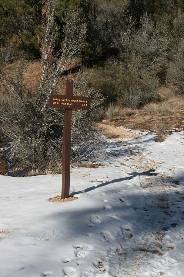 |
 |
Hang a right on the Silver Moccasin trail as it turns to the south and heads downhill. The next mile is a bunch of rock waterbar hopping fun as the trail weaves and switchbacks its way down the mountain. Looking through the photos I realized I must have really enjoyed this section as I did not stop to take a single picture. Around 8.0 miles (Point B) the trail comes out onto the road you started the ride on. Bear to the left and then a quick right to stay on the Silver Moccasin trail. | 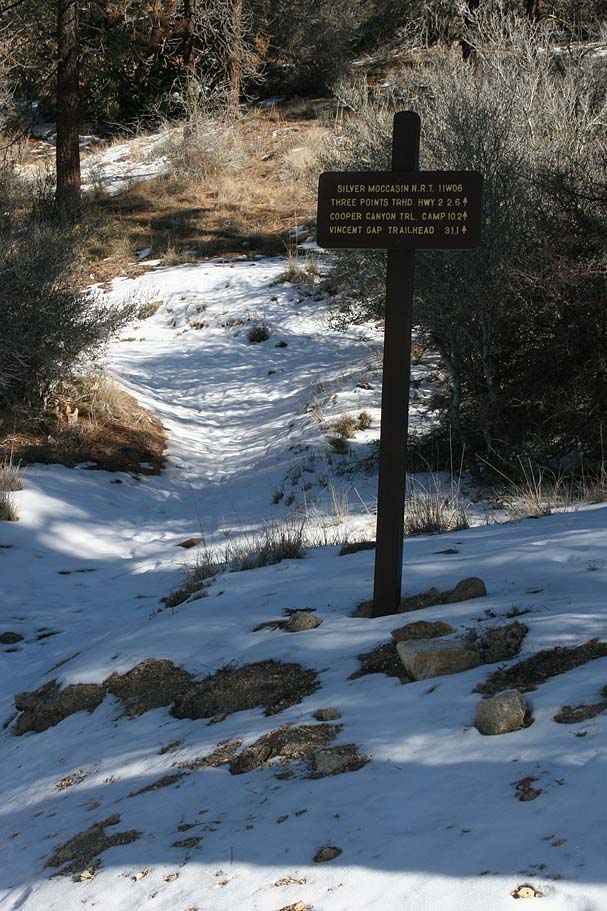 |
 |
 The next section of trail is particularly buff and gradually climbs to the southwest for about .4 miles before turning to the south and getting much steeper. I found it to be a painful 1/4 mile section up to a small saddle. I had opted to bring along my 35+ pound bigger "play" bike vice my spry XC rig on this ride and I was seriously contemplating my thought process on that decision during the climb. After that climb, it was quite zip down the hill where we came out on the "lower" Chilao Flats access road at Point K (8.9mi). The next section of trail is particularly buff and gradually climbs to the southwest for about .4 miles before turning to the south and getting much steeper. I found it to be a painful 1/4 mile section up to a small saddle. I had opted to bring along my 35+ pound bigger "play" bike vice my spry XC rig on this ride and I was seriously contemplating my thought process on that decision during the climb. After that climb, it was quite zip down the hill where we came out on the "lower" Chilao Flats access road at Point K (8.9mi). |
|
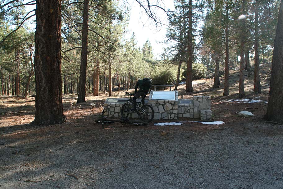 We hung a left and went about 1/10th of a mile and took the marked Silver Moccasin trail off to the right (Point L). There is a stone kiosk that talks about the area right near where the trail continues. The trail goes uphill for a really short bit then it appears to split. If you seem perplexed take your best guess. Because of the campsites close by a handful of little feeder and shortcut trails have developed. If you go relatively southwest they will merge together onto the Silver Moccasin trail. We hung a left and went about 1/10th of a mile and took the marked Silver Moccasin trail off to the right (Point L). There is a stone kiosk that talks about the area right near where the trail continues. The trail goes uphill for a really short bit then it appears to split. If you seem perplexed take your best guess. Because of the campsites close by a handful of little feeder and shortcut trails have developed. If you go relatively southwest they will merge together onto the Silver Moccasin trail. |
 |
|
 |
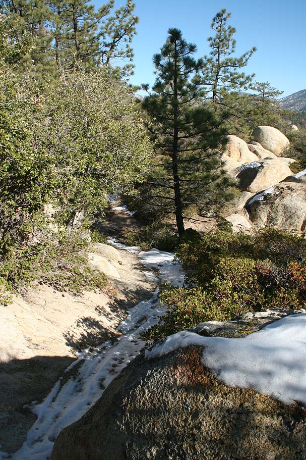
For the next 3/4ths of a mile the trail has little in the way on the technical features and the sight lines are great as it sheds off about 400 feet. Those are some good ingredients for a downhill ripfest and we whipped up a good batch of the stuff. An added bonus was that the trail was out in the sun and south facing so there was no snow to put us in check. It was over all too quickly when the trail rolled out onto forest service road 3N86A (It is not on my map). Continue down the fireroad in the direction you were going when you came out onto the road. (south-southeast) | 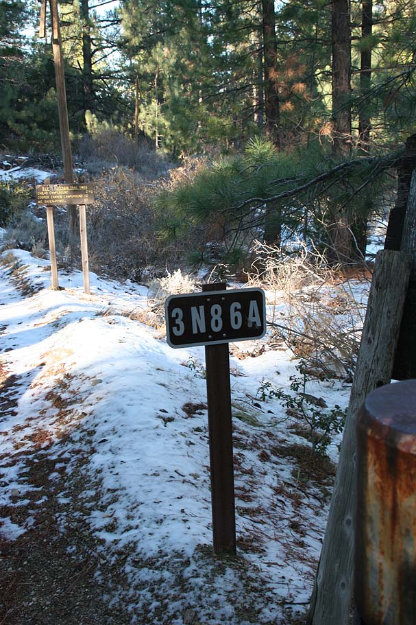 |
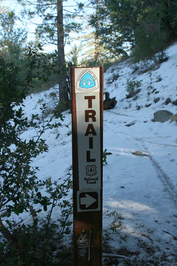
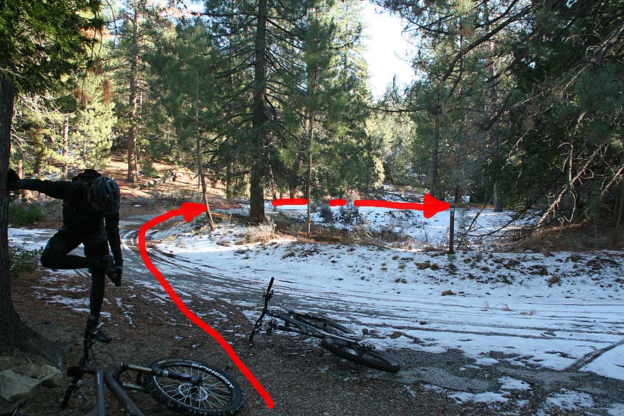 The next mile on this dirt road does some substantial climbing in spots. There is one section shortly before you reach Point M where it has been paved due to grade. On this day we did not see much of that pavement as it was covered in snow and ice. It was quite an entertaining hike-a-bike/tap dancing section. At around 11 miles the fireroad comes out at the junction of the paved forest service road 3N16 which circumvents the Charton Flats area. You will bear to your left and follow the road for about .2 miles where you will once again pick up the well marked Silver Moccasin trail on your right at Point N. (See note below on the Figure Eight option). Turn off the road and follow the trail uphill. The next mile on this dirt road does some substantial climbing in spots. There is one section shortly before you reach Point M where it has been paved due to grade. On this day we did not see much of that pavement as it was covered in snow and ice. It was quite an entertaining hike-a-bike/tap dancing section. At around 11 miles the fireroad comes out at the junction of the paved forest service road 3N16 which circumvents the Charton Flats area. You will bear to your left and follow the road for about .2 miles where you will once again pick up the well marked Silver Moccasin trail on your right at Point N. (See note below on the Figure Eight option). Turn off the road and follow the trail uphill. |
||
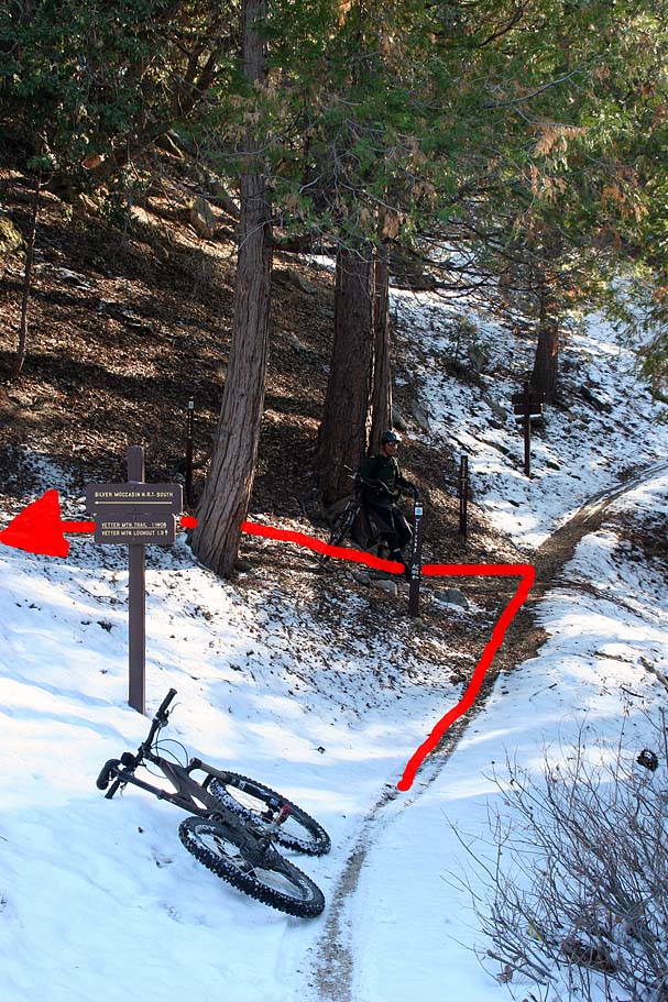 |
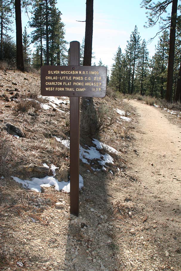
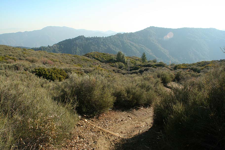
At around 11.25 miles (Point O), You will come to a 3-way junction. The Silver Moccasin trail switchbacks sharply to the left and uphill. If you continue straight on the trail you are currently on it heads out to Vetter Mountain. On the day we did this ride we made the first set of tracks in the snow once we made the left. | 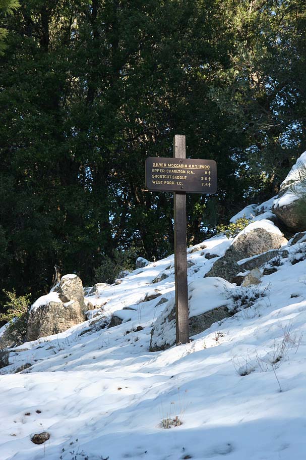 |
   |
||
 |
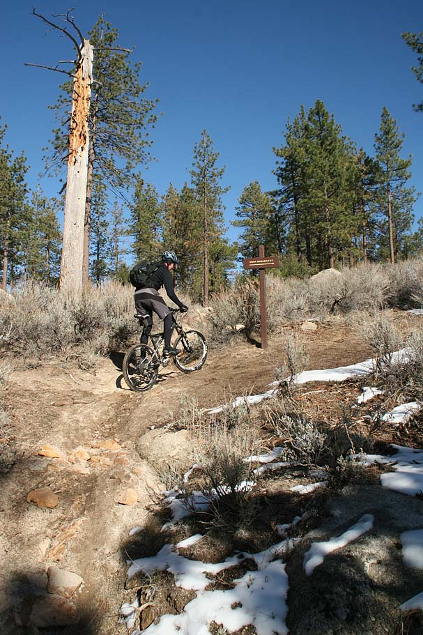
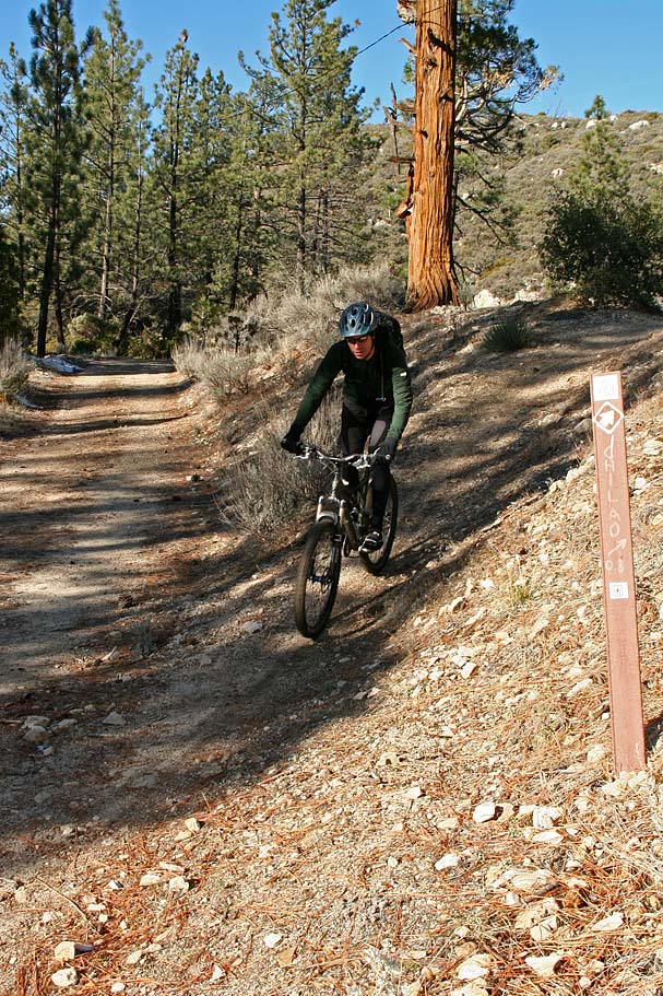
Over the course of the next mile we rode ride through a nice pine forest while mostly climbing along a hillside. There are a couple of spur trails that head off to the east and back to highway 2. The Silver Moccasin trail is well marked so it is hard to miss a turn. Around Point P, the trail switchbacks to the right as one of those spurs continues straight. I have a couple of pictures of this turn below as it is the easiest one to miss. From Points P to R you will be going through the Charlton Flats campground and crossing the campground roads twice. The second road you cross is 3N15 which goes out to Vetter Mountain. | 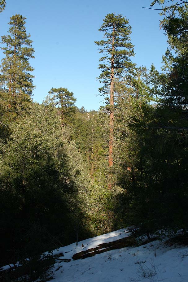 |
 |
NOTE: If you are going doing what is considered the "Classic Figure 8" loop out here you will want to hang a left on one of the spurs or roads that head to the east at Points N, P, Q and certainly at Point R. Once you go beyond Point R on the Silver Moccasin trail you have committed to a significant chunk of additional mileage and climbing. I'll describe the rest of the Classic Figure 8 loop in the options section below. | 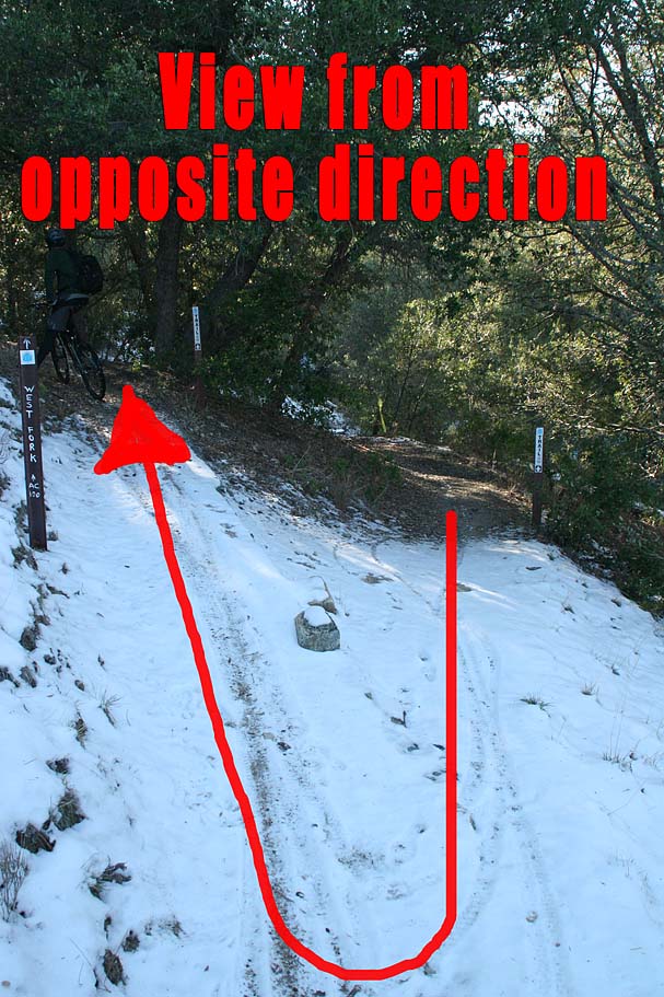 |
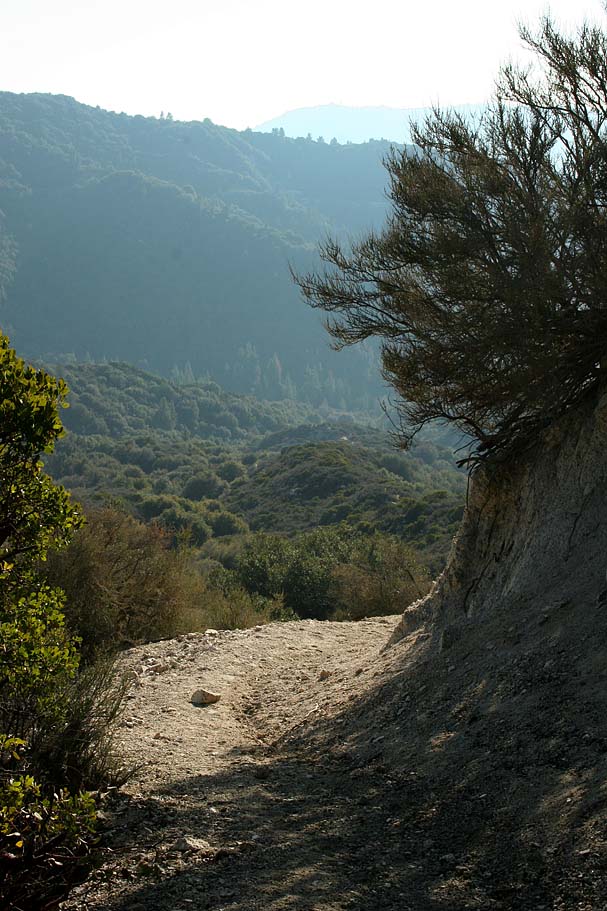
 From Point R the Silver Moccasin trail parallels the road for just at short bit then turns south and starts shedding off some elevation in a hurry. Over the next 1.8 miles you will drop about 1,200 feet as the trail swoops and turns its way down into the upper end of Big Tujunga Canyon. There are only a few switchbacks along the descent and at the speeds you can reach they can sneak up on you. As you get down into the bottom of the canyon the trail follows along Big Tujunga Creek before crossing it at Point S. From Point R the Silver Moccasin trail parallels the road for just at short bit then turns south and starts shedding off some elevation in a hurry. Over the next 1.8 miles you will drop about 1,200 feet as the trail swoops and turns its way down into the upper end of Big Tujunga Canyon. There are only a few switchbacks along the descent and at the speeds you can reach they can sneak up on you. As you get down into the bottom of the canyon the trail follows along Big Tujunga Creek before crossing it at Point S. |
 |
|
       |
||
 |
You should be pretty jazzed about that awesome descent at this point, I know I had a big stinking smile on my face. Time to whip it off. The trail turns quite freaking steep at this point as you will climb about 500 feet over the next 3/4ths of a mile. It is a rather pretty climb in the trees and the trail itself is quite buff. This section screwed with my head a bit as the trees and the buffness of the trail seemed to hide the steepness from my eyes, but the legs and lungs will telling the truth. The trail also is along a steep hillside so if you blow your line to the low side you could be in long roll down the hill until you hit one of the many trees. |  |
 |
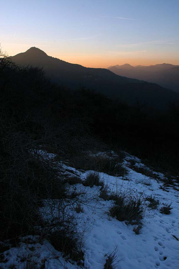
At around 14.9 miles (Point T) the trail thankfully flattens as it comes out into a pull-out on highway 2 at Shortcut Saddle. The Silver Moccasin trail crosses the road here and drops down into Shortcut Canyon. That section of trail will we ride on some other day. Considering that this was a December ride, we had to take stock on the amount of daylight we had left. Considering the amount of trail left ahead we assessed that we had a 30 to 45 minute buffer of daylight left. |  |
 We proceeded down and west on highway 2 for just a little over half a mile where we passed by Big Tujunja Canyon Road (3N92) on our right. (We would have taken that road down if we had been short on daylight) About 1/10th of a mile beyond that road, we took a fireroad on your right (2N46) that immediately turned uphill. (Point U) We proceeded down and west on highway 2 for just a little over half a mile where we passed by Big Tujunja Canyon Road (3N92) on our right. (We would have taken that road down if we had been short on daylight) About 1/10th of a mile beyond that road, we took a fireroad on your right (2N46) that immediately turned uphill. (Point U) |
||
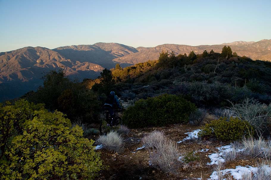
 The climb on 2N46 (Which I think is called Barley Flats Road) is not bad at all. It is an old but still intact paved road that gains around 950 feet over 2.5 miles. The evening light was getting really nice while on this climb but the temperature was also dropping. In the shady portions of the climb there were still patches of ice and snow that added some spice to the pavement climb. The climb on 2N46 (Which I think is called Barley Flats Road) is not bad at all. It is an old but still intact paved road that gains around 950 feet over 2.5 miles. The evening light was getting really nice while on this climb but the temperature was also dropping. In the shady portions of the climb there were still patches of ice and snow that added some spice to the pavement climb. |
||
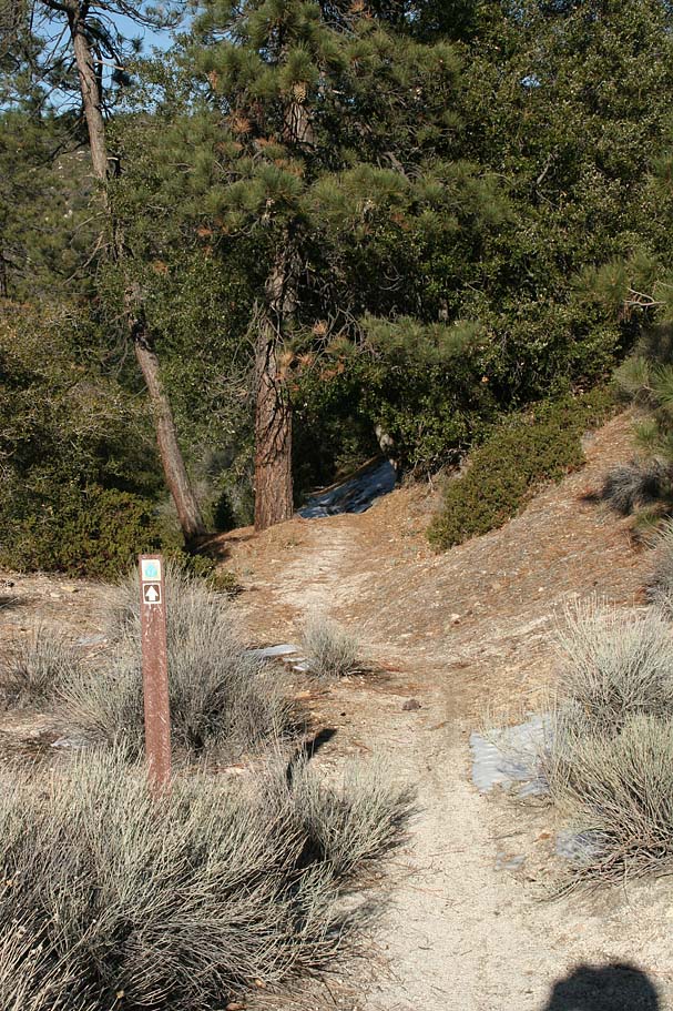
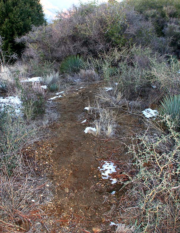
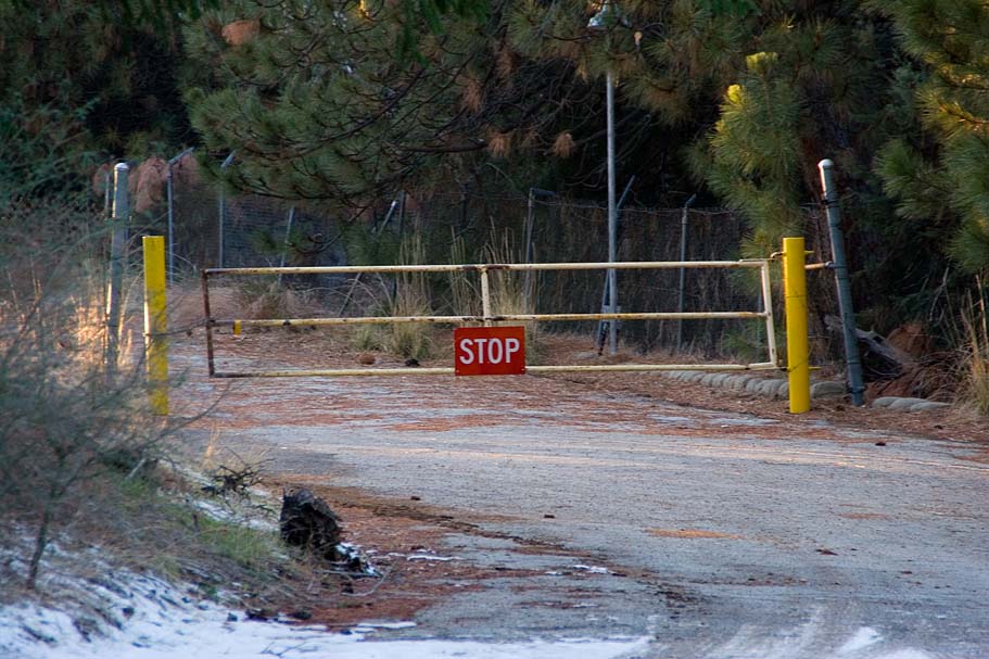 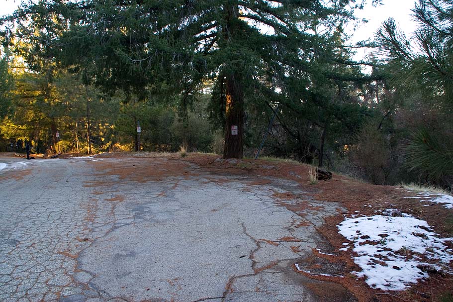 At around 18.3 miles the road flattened out and we could see a locked gate ahead. As soon as you see the gate, look to your right just as a pavement pullout area opens up on your right. The unmarked Barley Flats trail is off to your right. (Right over the patch of snow in the picture to the right) At around 18.3 miles the road flattened out and we could see a locked gate ahead. As soon as you see the gate, look to your right just as a pavement pullout area opens up on your right. The unmarked Barley Flats trail is off to your right. (Right over the patch of snow in the picture to the right) |
||
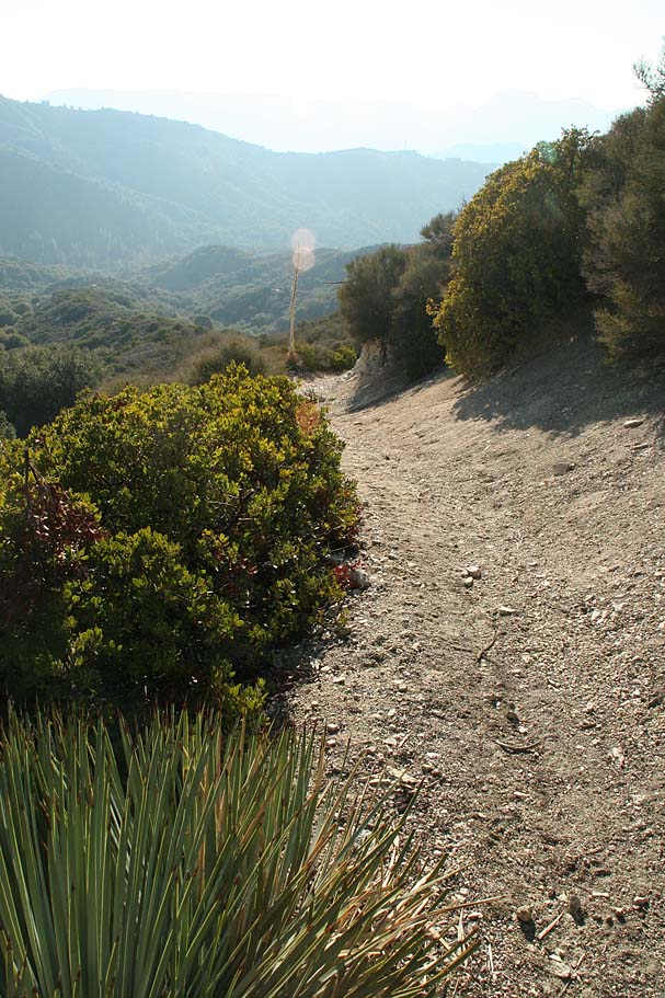
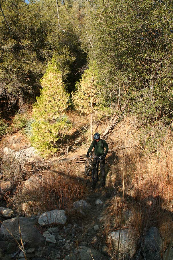
  Oh My, what a trail. This is a raw untrammeled bit of goodness that requires your full attention as it is narrow, steep and often quite brushy. It is not a fast ripper trail per se, but it does have its moments. Over the course of the next 2.5 miles you will dump 2,000 feet of elevation. There is only one spot during this descent where you could get a little confused which is near Point W. The trail pops out of the thick vegetation and comes to a rather faint T intersection. The original but fainter and bushier trail goes to the right where it goes around the hill in front of you. A newer, but more used route goes to the left and slightly uphill about 20 yards to a nice view Josephine and Strawberry Peaks to the west. The trail then turns to the right and climbs over a small hill and drops down the other side where it rejoins the original route. Oh My, what a trail. This is a raw untrammeled bit of goodness that requires your full attention as it is narrow, steep and often quite brushy. It is not a fast ripper trail per se, but it does have its moments. Over the course of the next 2.5 miles you will dump 2,000 feet of elevation. There is only one spot during this descent where you could get a little confused which is near Point W. The trail pops out of the thick vegetation and comes to a rather faint T intersection. The original but fainter and bushier trail goes to the right where it goes around the hill in front of you. A newer, but more used route goes to the left and slightly uphill about 20 yards to a nice view Josephine and Strawberry Peaks to the west. The trail then turns to the right and climbs over a small hill and drops down the other side where it rejoins the original route. |
||
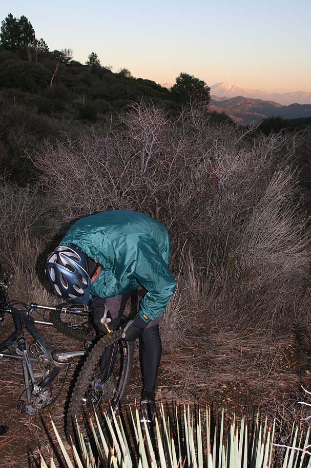
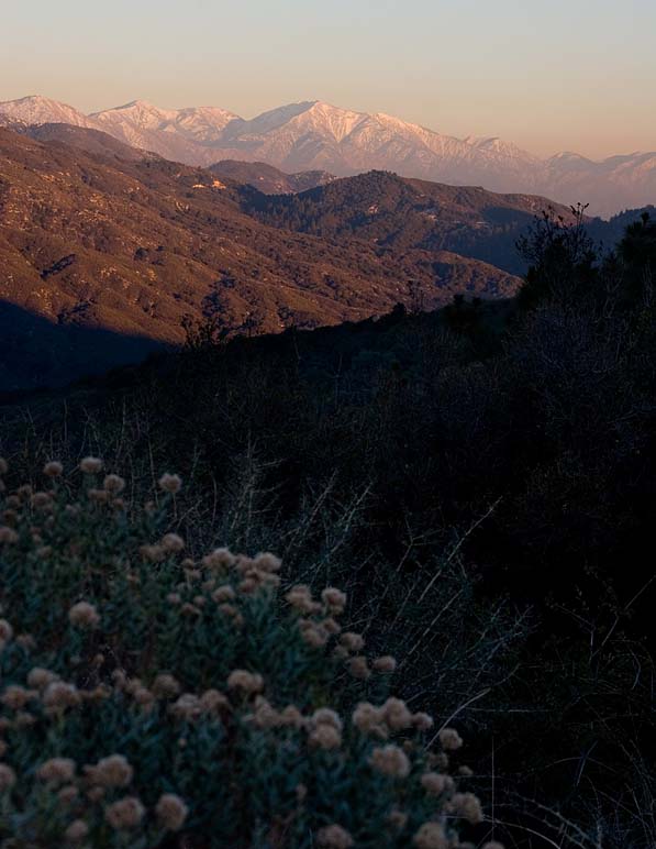 I had forgotten to pack my yellow lens for my glasses and I could have really used them at this point wehen the sun dipped down behind the mountains. Because of the brushyness of the trail I was not about to leave my eyes unprotected so I had a slower descent down the trail than I would have otherwise. There are some yucca plants that have encroached into the trail in numerous spots. One of those yuccas nabbed Bill's tire resulting in a flat. It was not the best time to get a flat and while it was fixed it quick order our "light buffer" was pretty much gone. We also got quite cold during the break. The scenery however was incredible as we were in the tailend of the "magic hour" of sunset. I had forgotten to pack my yellow lens for my glasses and I could have really used them at this point wehen the sun dipped down behind the mountains. Because of the brushyness of the trail I was not about to leave my eyes unprotected so I had a slower descent down the trail than I would have otherwise. There are some yucca plants that have encroached into the trail in numerous spots. One of those yuccas nabbed Bill's tire resulting in a flat. It was not the best time to get a flat and while it was fixed it quick order our "light buffer" was pretty much gone. We also got quite cold during the break. The scenery however was incredible as we were in the tailend of the "magic hour" of sunset. |
 |
|
 The rest of the descent went off without at hitch. The trail drops down into the Tujunga creekbed at Point X. The trail gets really hard to follow through here and there seems to be several small trail options vice one single option. You will cross the creek and keep heading north. You should see two large pipes that comprise the Alder Creek creek crossing of Big Tujunga Road. We followed a trail that brought us out onto the road just to the right of creek crossing at Point Y. From here we turned left and went west on Big Tujunga Road for .8 miles to our awaiting truck just off Lynx Gulch fireroad (Point Z). The rest of the descent went off without at hitch. The trail drops down into the Tujunga creekbed at Point X. The trail gets really hard to follow through here and there seems to be several small trail options vice one single option. You will cross the creek and keep heading north. You should see two large pipes that comprise the Alder Creek creek crossing of Big Tujunga Road. We followed a trail that brought us out onto the road just to the right of creek crossing at Point Y. From here we turned left and went west on Big Tujunga Road for .8 miles to our awaiting truck just off Lynx Gulch fireroad (Point Z). |
 |
|
|
||
 Back at the truck, we had a bomber of Stone Brewing Company's, 11th Aniversary Ale to celebrate the ride with. For those of you not in the know, this is pretty much necter from the Beer Gods. What was almost as nice as the beer was a change of warm clothes. This was an incredibly awesome ride that covered a good chunk of diverse ground. Riding in snow is not something we get to do a lot of here in Southern California and I find it a real treat in small doses. Back at the truck, we had a bomber of Stone Brewing Company's, 11th Aniversary Ale to celebrate the ride with. For those of you not in the know, this is pretty much necter from the Beer Gods. What was almost as nice as the beer was a change of warm clothes. This was an incredibly awesome ride that covered a good chunk of diverse ground. Riding in snow is not something we get to do a lot of here in Southern California and I find it a real treat in small doses. |
||
After Ride GrubYour options for after-ride grub are limited unless you want to drive 27+ miles back into town. Luckily the only close option is also a great one. Newcomb's Ranch about a 1/4 mile past the Chilao Visitor Center turnoff has some good beers, burgers and other goodies. The Ortega Burger did not stand a chance after our ride up here. At least one of the bartenders is a fellow mountain biker who is in tune with all the MTB happenings of the area. |
||
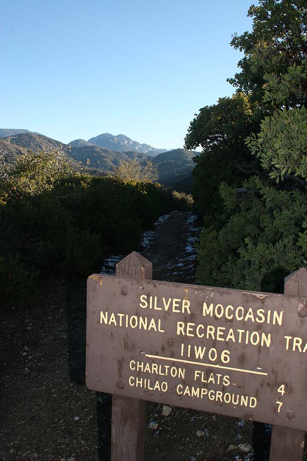
 Located almost in the middle of Angles National forest just west of the San Gabriel Wilderness the Chilao Flats Area and the Silver Moccasin National Recreation Trail are sure to get you excited about being in the great outdoors. The route described here covers a bunch of ground as a point to point tour that includes Mount Hillyer, a good chunk of the Silver Moccasin trail as well the Barley Flats trail. You will climb around 3,000 feet and descend over 5,000 feet over the course of 22 miles.
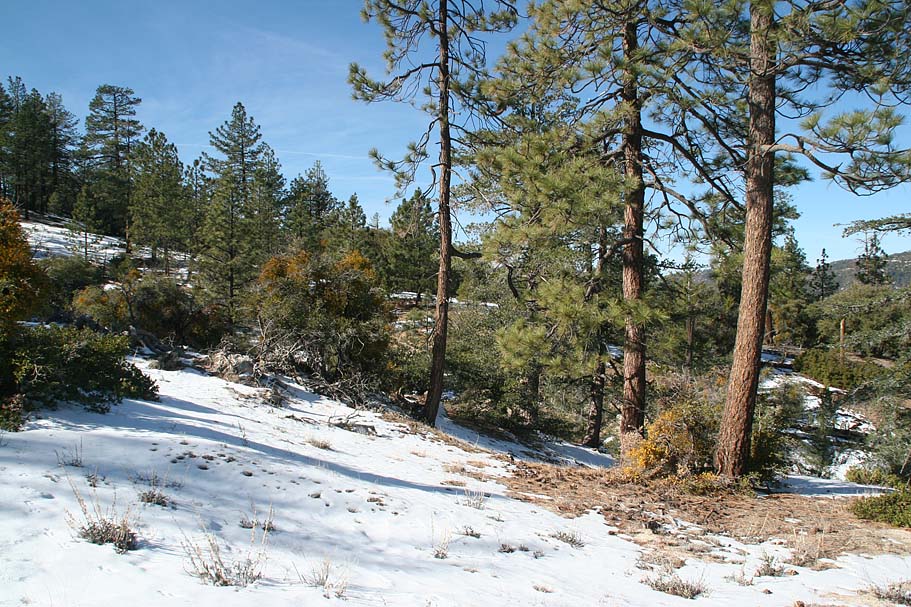
Other Options
The Classic Figure Eight Loop
This route is published in several books and online sources. Since I live near San Diego, I wanted something bigger if I going to drive such a long way. If you are not up for such a big ride you could do a smaller loop.
Do the ride as described above, but when when you get to Points N, P, Q and certainly at Point R, take either a spur trail or the road east back out to Highway 2. From the entrance to the Charlton Flats campground and highway 2, turn left and then a quick right onto 2N15. This paved road soon turns back to dirt. You will climb for about .7 miles where you will then descend for about 1.4 miles back out to highway 2. Turn right and mostly climb 1.4 miles back to the Chilao Visitor Center turnoff where you started.
Alder Creek Epic Loop
If the main route described above is not enough or maybe you are against doing point-to-point rides, then this is for you.
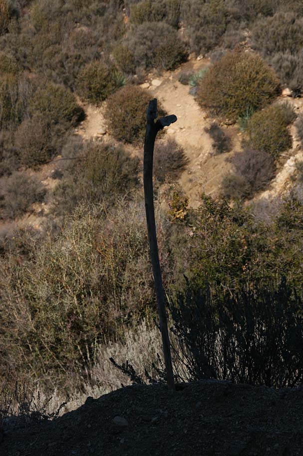 Park off of Lynx Gulch Road (Lower trail head in parking directions). Ride east along Big Tujunga Canyon road back to the Alder Creek crossing. Just to the east the crossing is the skinny Alder Creek singletrack heading off north along the creek bed. The day we were there the trail was marked with a simple stick wedged in the ground. After about .2 miles of following along the creek bed the trail crosses Alder Creek. The crossing at Alder Creek is primitive. A bit of beginner-level route finding is required to pick up the trail, which leads up and to the right immediately following the crossing, over the crest of a little rock outcropping. Once you have picked up the trail it will soon join onto a fireroad for maybe 100 yards before splitting off to the right back onto singletrack. From that point on you will have 3.5 miles of some significant climbing and a couple of descents on a sometimes yucca infested trail up to Loomis Ranch. From Loomis Ranch you will keep going uphill on fireroad 3N18. The next section of fireroad up to the junction with 3N14 at Point E is make-you-want-to-cry steep. Don't say you were not warned. From this point you will continue on the rest of the route I described above. The Alder Creek add-on encompasses about six miles, roughly 2,400 feet of climbing and 450 feet of descent. The total mileage of this loop would be around 26 miles and 5,600 feet of elevation change.
Check out Bill O'Neil's account of this loop as he told it on the SpokeJunkies' Trail Graffiti Forum.
Alder Creek Part I, Part II and Part III.
Some other Pretty Cool Trail options
- If you were a glutton for punishment, when you get to the junction of 3N14 and 3N17 (Point F), you could go left vice right down to Alder Saddle and then climb for five miles up to the top of Pacifico Mountain at 7,124 feet. It is a rugged old road that will exact some extra juice out of your legs in addition to what the distance and grade take out of you. You will rewarded with some incredible views in all directions. The total out and back mileage would be 11 miles and a little under 1,500 feet of climbing.
- If you do not mind missing out on Mt Hillyer, you can catch the Silver Moccasin trail from the Three Points trail head 2.1 miles past the Chilao Visitor's Center. It is on the left side of highway 2 and is well-marked. I'm not sure of the exact route but it ties in at Point J on my map.