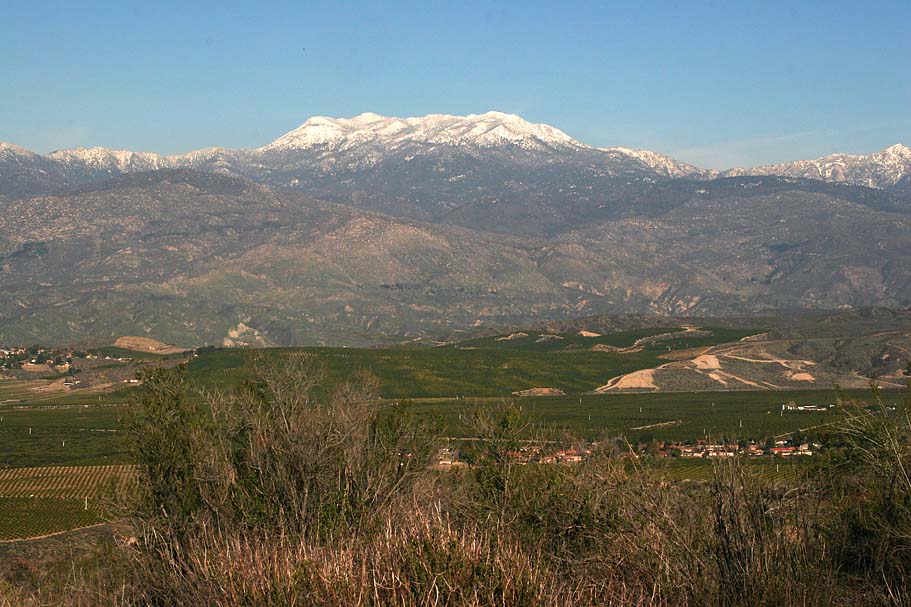
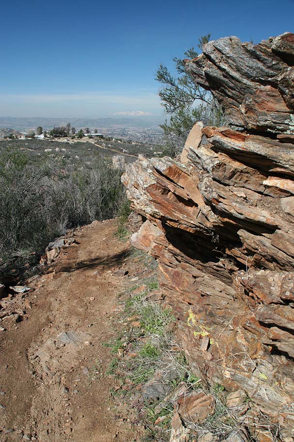
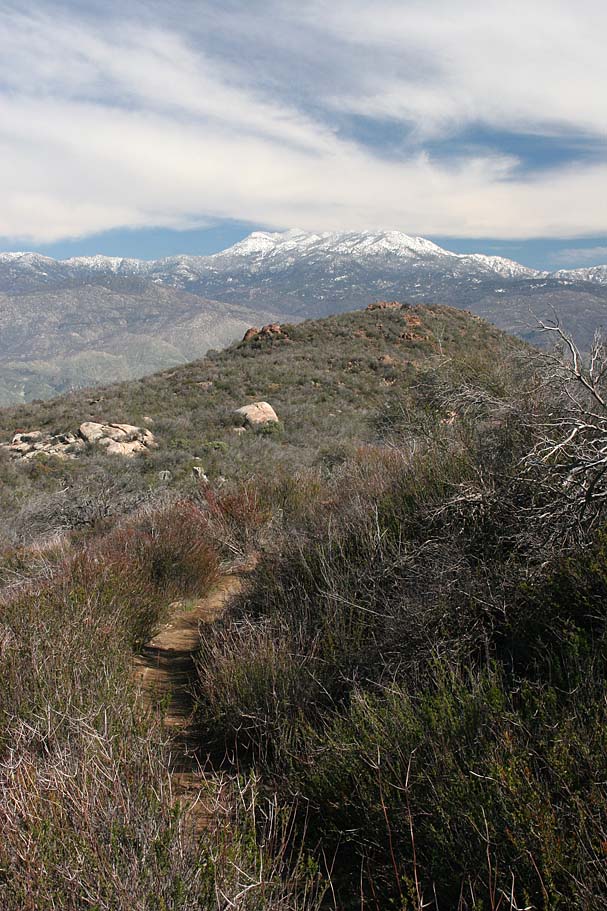
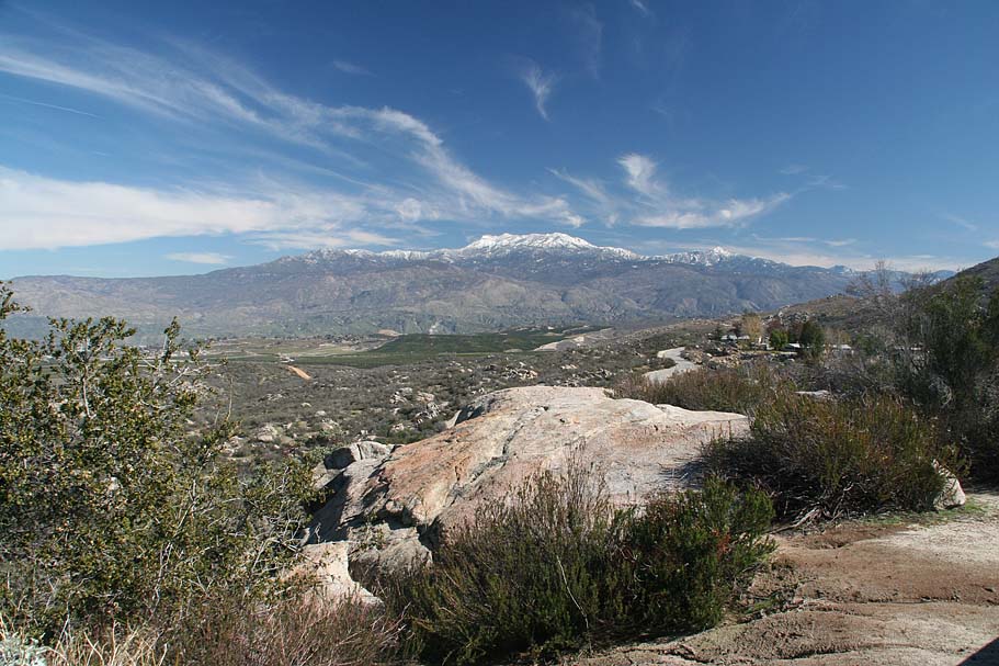
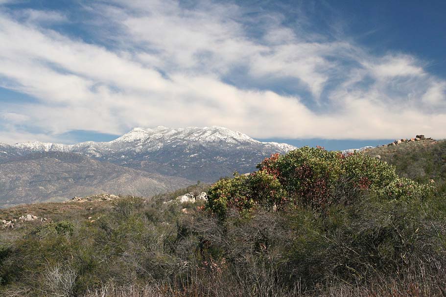
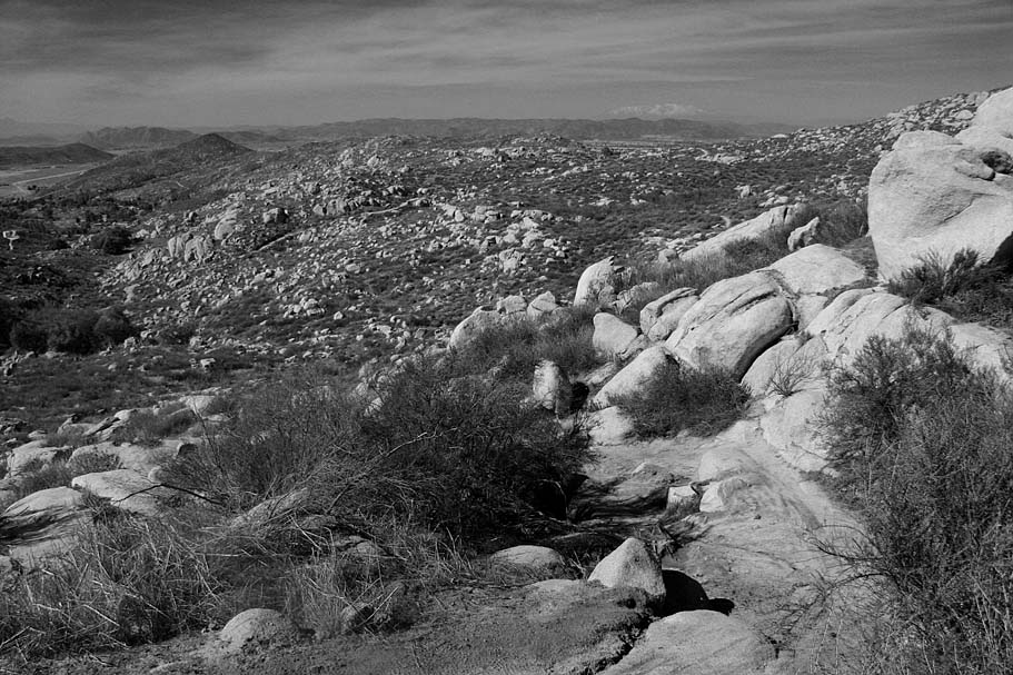
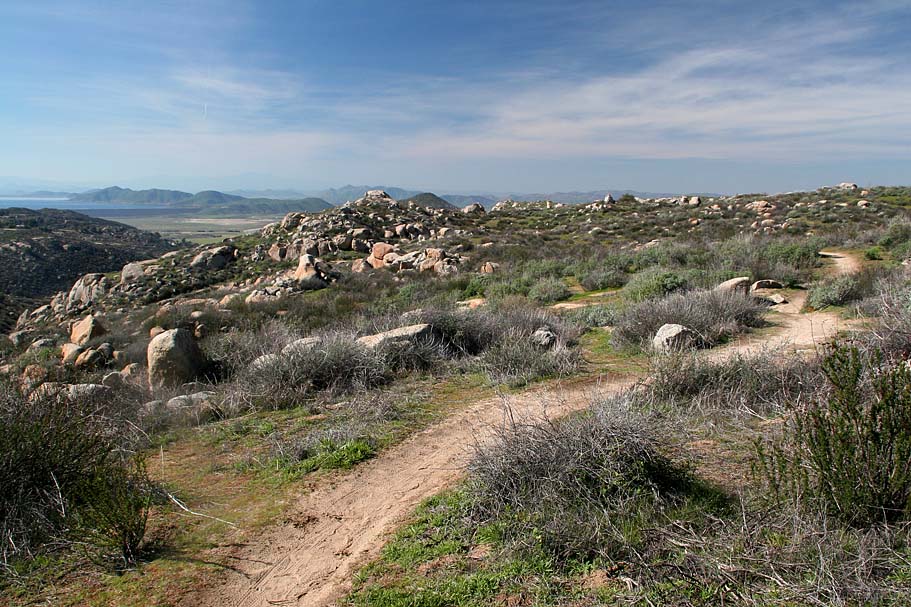
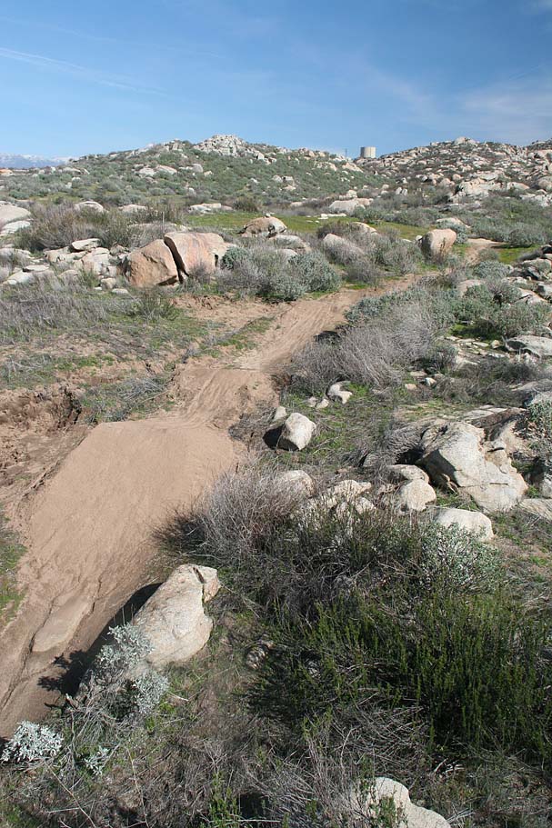
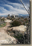
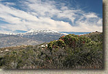
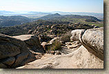
| "A descent network of singletracks as well as some technical features that would require your 'A' game"; That is what I had heard about Simpson Park located in the Santa Rosa Hills above Hemet. After taking in a winter ride there I would have to say that this place more than lives up to that reputation. There were more trails at the park than I expected and the quality of the singletracks were outstanding. They were often a mix of buffed tread with frequent undulations and rock features. I put in just under 14 miles riding here but I sure you could do more one you get to know the surrounding area. The great views of the snow-capped San Jacincto and San Bernardino Mountains coupled with the winter greening of the vegetation mad this a good place to spend an afternoon exploring. |
| |
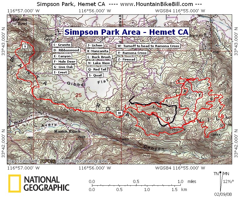
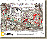 Map: This map does not include all of the trails. You may notice that the trail lettering code seems odd. The letters used to reference the trails on this map matches the lettering scheme on the trail map that you can pick up at the Visitor Center. Since I did not ride a few of the trails, those letters are skipped. Map: This map does not include all of the trails. You may notice that the trail lettering code seems odd. The letters used to reference the trails on this map matches the lettering scheme on the trail map that you can pick up at the Visitor Center. Since I did not ride a few of the trails, those letters are skipped.
Garmin Mapsource GDB - Raw GPX File - National Geographic TOPO! |
| |
| Directions: From Temecula, travel north in I-15 and take the I-215 for 9.7 miles. Take the Newport Rd exit and turn right. Travel 1.2 mile on Newport Road which turns into Domenigoni Parkway. Continue east for 11.1 more miles. Turn left onto State Street and travel 1.8 miles. Turn right onto Stetson Avenue and travel 2.0 miles. Turn right at Dartmouth Street and after 0.5 miles, turn left onto Crest Drive and travel 0.2 miles. Turn right at Vista Del Valle. After one mile it turns into Rawlings Road. After 0.7 miles bear to the right to stay on Rawlings Rd and enter the Simpson Park at the top of the hill. Also check out these Google Maps directions where you can change your starting location. |
| |
| Hazards: A few of the trails have some technical sections that can trip you up. This area can be blistering hot during the summer. |
| Ride Notes: Disclaimer - I did this ride in February following several weeks of frequent rains. The conditions when I rode here maybe the best possible. |
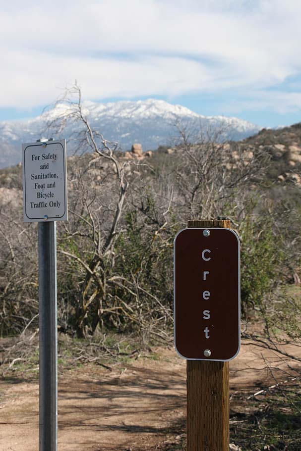
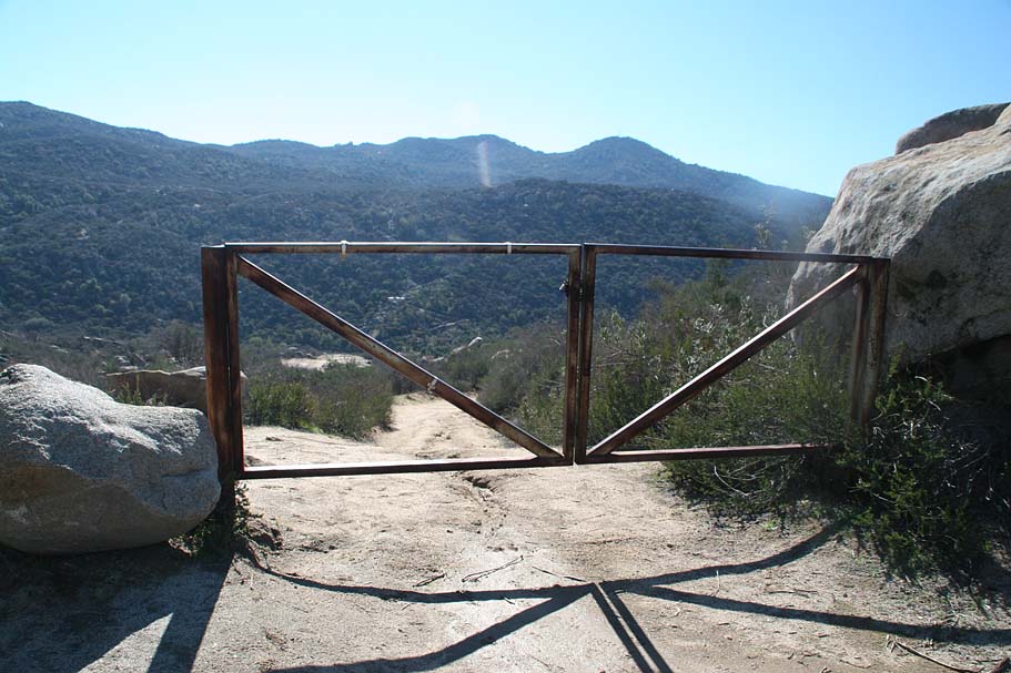
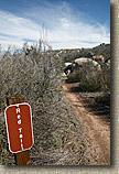
  Starting from the restrooms across from the covered picnic area, ride past the picnic area and pick up the fireroad just to the left of it. The fireroad will bend around to the left and you will soon see another fireroad heading down and to your right with a locked steel gate across it. Take note of this gate as you will be back here later. Continuing on the fireroad you started on, at around 0.3 miles you will see a singletrack heading off to your right. This is the Crest trail (I). Take this single track and you will start doing some undulations. There is is a short split in the trail not long after the start. They quickly rejoin one another so take either one.. Starting from the restrooms across from the covered picnic area, ride past the picnic area and pick up the fireroad just to the left of it. The fireroad will bend around to the left and you will soon see another fireroad heading down and to your right with a locked steel gate across it. Take note of this gate as you will be back here later. Continuing on the fireroad you started on, at around 0.3 miles you will see a singletrack heading off to your right. This is the Crest trail (I). Take this single track and you will start doing some undulations. There is is a short split in the trail not long after the start. They quickly rejoin one another so take either one..
|
| |
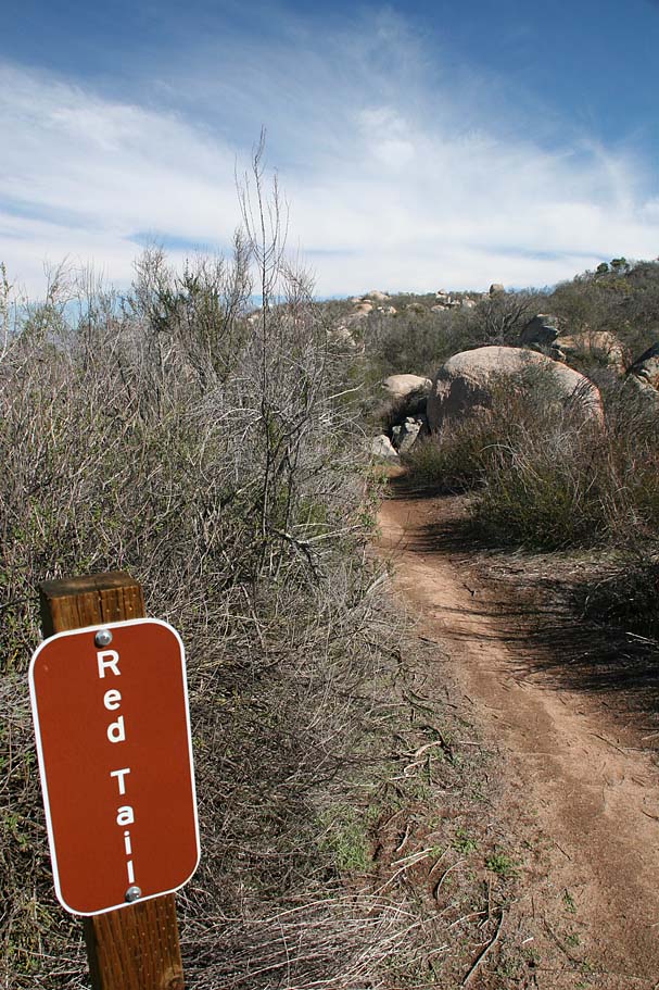
  At around 0.5 miles you will come to the junction of the Red Tail trail (Q) on your left. Continue on the Crest trail where the grunt factor gets up there as you climb about 300 feet or the next 1/2 mile. Once the trail flattens out a bit you will do a gradual and short bit of descending to a saddle where a fireroad turns downhill and to your left (west). There are some single tracks heading off to your right (eastwardly). I did not check out the singletrack off to the east. (Gonna go back!). From what I could tell by the offical map, I was out of Simpson Park at this point. I rolled down that fireroad for just a short bit and picked up the unmarked Canyon Trail (E) off to the right. At around 0.5 miles you will come to the junction of the Red Tail trail (Q) on your left. Continue on the Crest trail where the grunt factor gets up there as you climb about 300 feet or the next 1/2 mile. Once the trail flattens out a bit you will do a gradual and short bit of descending to a saddle where a fireroad turns downhill and to your left (west). There are some single tracks heading off to your right (eastwardly). I did not check out the singletrack off to the east. (Gonna go back!). From what I could tell by the offical map, I was out of Simpson Park at this point. I rolled down that fireroad for just a short bit and picked up the unmarked Canyon Trail (E) off to the right.
|
| |
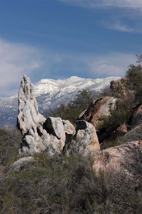
  What followed was some mighty fun single track that was twisty enough so that there was rarely a straight line to be seen but you where able to carry some good but not ripping speed. There were also some rock features and killer views of the San Jacinto Mountains. After 3/4th of a mile on this singletrack, you will come to the junction of the other end of the Red Tail trail (Q) that you saw near the beginning of the ride. The sign is not right on the trail as the Red Tail Trail joins in from on top of a large rock so the sign is set back from the trail some 40 feet or so. . Stay on the Canyon Trail and enjoy almost another 1/2 mile of goodness before you climb out onto a wide fireroad. Your total mileage at this point should be around 2.5 miles. Go uphill and to your left. You will quickly go by the lower junction of the Live Oak Trail (G). Keep climbing on the fireroad and after about .15 miles you will come to the Mule Deer Trail (F) on your left which you will take. This is an old fireroad which I found to have very little redeeming qualities. It is usually steep and will most likely be a sandy mess in the dry months. What followed was some mighty fun single track that was twisty enough so that there was rarely a straight line to be seen but you where able to carry some good but not ripping speed. There were also some rock features and killer views of the San Jacinto Mountains. After 3/4th of a mile on this singletrack, you will come to the junction of the other end of the Red Tail trail (Q) that you saw near the beginning of the ride. The sign is not right on the trail as the Red Tail Trail joins in from on top of a large rock so the sign is set back from the trail some 40 feet or so. . Stay on the Canyon Trail and enjoy almost another 1/2 mile of goodness before you climb out onto a wide fireroad. Your total mileage at this point should be around 2.5 miles. Go uphill and to your left. You will quickly go by the lower junction of the Live Oak Trail (G). Keep climbing on the fireroad and after about .15 miles you will come to the Mule Deer Trail (F) on your left which you will take. This is an old fireroad which I found to have very little redeeming qualities. It is usually steep and will most likely be a sandy mess in the dry months.
|
| |
  The good thing about the Mule Deer trail is that after 0.6 miles the Red Tail Trail (Q) crosses the trail. The trail is not marked here. Hang a left onto the Red Trail trail. The next .6 miles involves both some climbing and some fun downhill bits along with some nice rock features here and there. Once again the scenery is great and includes some really funky looking rock formations up on the hillsides. Once you get to the junction of Canyon Trail ( which you were on earlier) you can either decide to head back on the Red Tail trail or hang a left and redo the bottom bit of the Canyon Trail again. The good thing about the Mule Deer trail is that after 0.6 miles the Red Tail Trail (Q) crosses the trail. The trail is not marked here. Hang a left onto the Red Trail trail. The next .6 miles involves both some climbing and some fun downhill bits along with some nice rock features here and there. Once again the scenery is great and includes some really funky looking rock formations up on the hillsides. Once you get to the junction of Canyon Trail ( which you were on earlier) you can either decide to head back on the Red Tail trail or hang a left and redo the bottom bit of the Canyon Trail again.
|
| |
  Next time I may do the Canyon Trail option again, but on this day I turned around and retraced my way back towards the Mule Deer Trail where I then crossed over the fireroad and soon joined back up with the Crest Trail. From there I retraced my way back to the locked gate that I had taken note of earlier in the day. Next time I may do the Canyon Trail option again, but on this day I turned around and retraced my way back towards the Mule Deer Trail where I then crossed over the fireroad and soon joined back up with the Crest Trail. From there I retraced my way back to the locked gate that I had taken note of earlier in the day.
|
| |
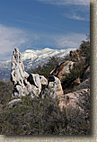
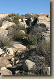
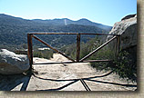 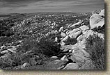 After going around the locked gate, you will cruise downhill for a little under a 1/4th of a mile before picking up the marked Quail Trail (S) singletrack coming off the right-hand side of the fireroad . The next 3/4ths of a mile is a real fun section of trail this is mostly downhill with some technical options here and there. The boulder and rock formations through this area are quite interesting and I bet there are some cool lines to ferret out on the rocks. After going around the locked gate, you will cruise downhill for a little under a 1/4th of a mile before picking up the marked Quail Trail (S) singletrack coming off the right-hand side of the fireroad . The next 3/4ths of a mile is a real fun section of trail this is mostly downhill with some technical options here and there. The boulder and rock formations through this area are quite interesting and I bet there are some cool lines to ferret out on the rocks.
|
| |
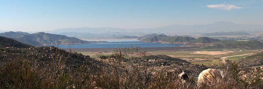
  The Ocotillo trail merges in with the Quail Trail somewhere along this run. I missed it while I was crusing along so I'm not sure if the entire run is the Quail Trail or wither the lower half is the Ocotillo trail. Either way the trail is a bunch of fun. It will come out onto a fireroad near the junction the Buck Brush trail (L) near Point W. You should have already noticed some nice views of Lake Perris off in the distance. The Ocotillo trail merges in with the Quail Trail somewhere along this run. I missed it while I was crusing along so I'm not sure if the entire run is the Quail Trail or wither the lower half is the Ocotillo trail. Either way the trail is a bunch of fun. It will come out onto a fireroad near the junction the Buck Brush trail (L) near Point W. You should have already noticed some nice views of Lake Perris off in the distance.
|
| |
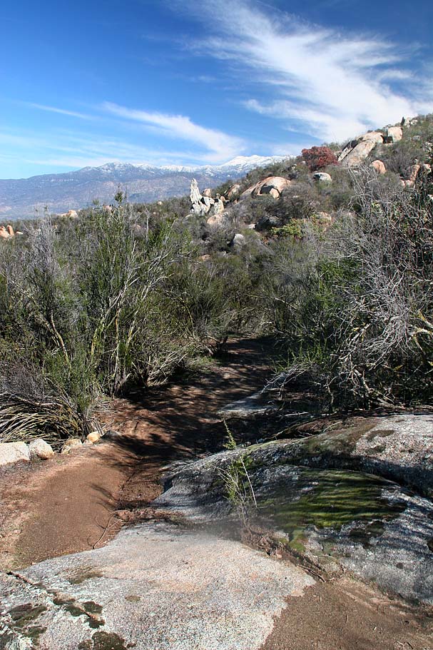
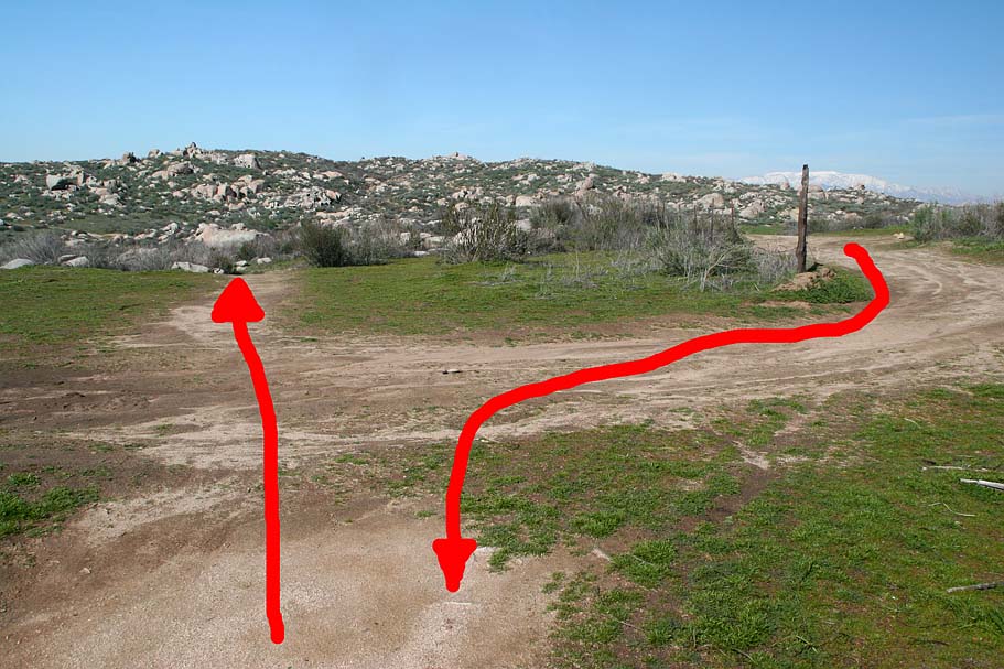
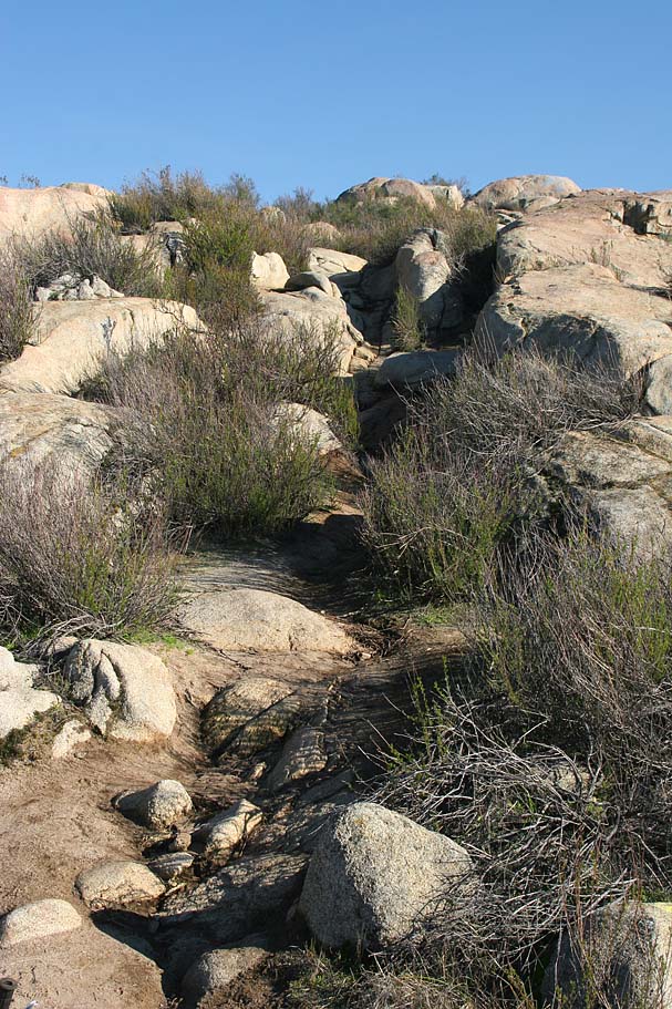
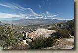
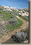
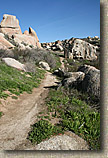
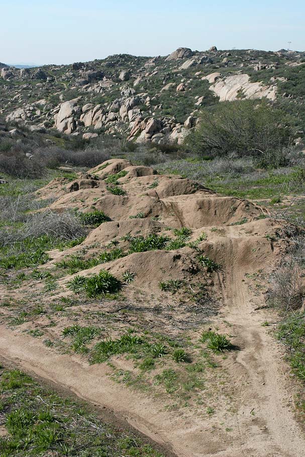
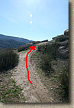  This area is the western edge of Simpson Park. From here look for a trail off to your left the heads up onto a small ridgeline. As you head up towards that ridgeline there is another trail heading off to the left and downhill, bear to right and continue uphill to get up onto the ridgeline. Refer to the picture to the left. The next 1.3 miles includes a singletrack that is a bunch of fun. The locals have shown this trail some tender loving care. There are some nice technical bits as well as some berms, doubles and gap jumps that should get you excited. About halfway through this section you will come to some gap jumps that must be for moto-types as they are pretty freaking big. While most of this run is downhill when heading west near the end you have to get back into some rolling and technical climbing. This area is the western edge of Simpson Park. From here look for a trail off to your left the heads up onto a small ridgeline. As you head up towards that ridgeline there is another trail heading off to the left and downhill, bear to right and continue uphill to get up onto the ridgeline. Refer to the picture to the left. The next 1.3 miles includes a singletrack that is a bunch of fun. The locals have shown this trail some tender loving care. There are some nice technical bits as well as some berms, doubles and gap jumps that should get you excited. About halfway through this section you will come to some gap jumps that must be for moto-types as they are pretty freaking big. While most of this run is downhill when heading west near the end you have to get back into some rolling and technical climbing.
|
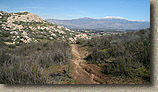
More Pictures from this area |
| |
 The single track will come out onto a Y-intersection of two fireroads. If you look further to the left you will see the top of a large light pole from the Ramona Bowl peaking over the ridge. I took the slightly to the left option and worked my way up to the ridge in a generally northwest direction (Often in the general direction of the ridgeline where the light pole was at). You will pass by another set of monster moto jumps before turning more towards the north. When I went through here there were some bike tracks to follow. If you are not so lucky, just take the splits that turn more northward. The single track will come out onto a Y-intersection of two fireroads. If you look further to the left you will see the top of a large light pole from the Ramona Bowl peaking over the ridge. I took the slightly to the left option and worked my way up to the ridge in a generally northwest direction (Often in the general direction of the ridgeline where the light pole was at). You will pass by another set of monster moto jumps before turning more towards the north. When I went through here there were some bike tracks to follow. If you are not so lucky, just take the splits that turn more northward.
|
| |
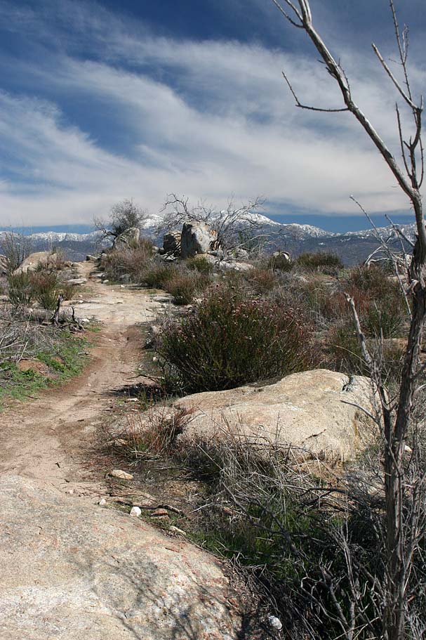
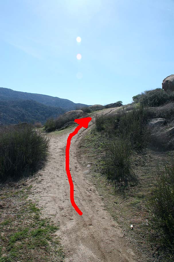
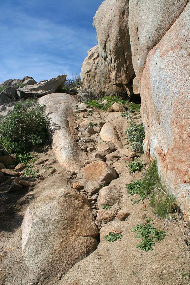
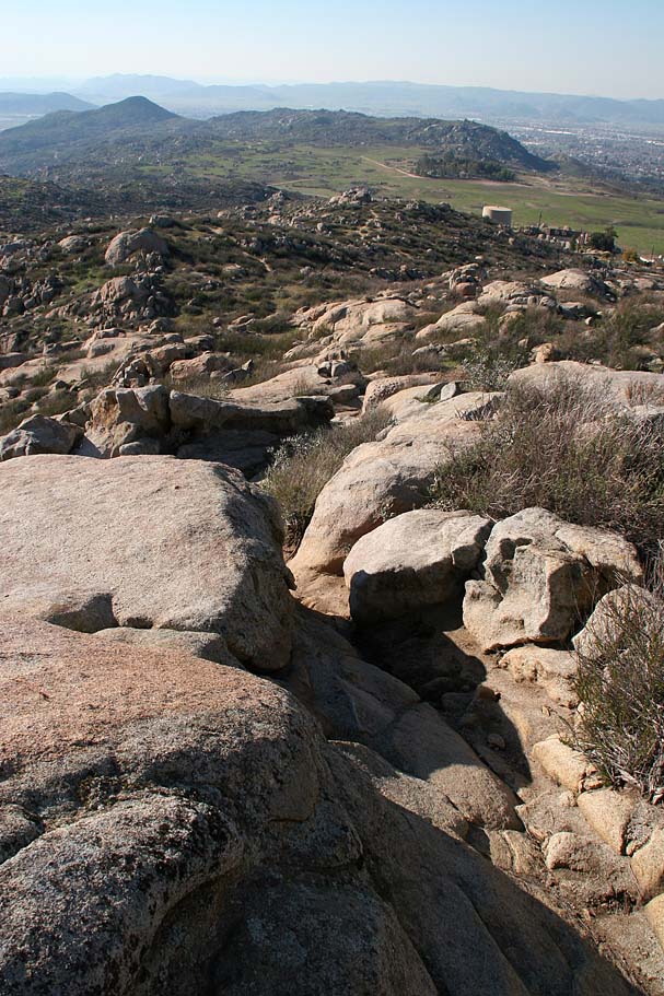
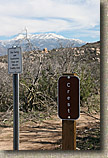
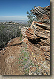
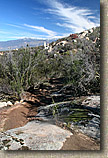
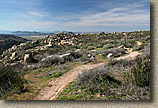
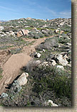
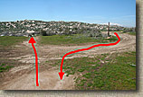
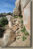
 During the course of working your way up the ridge you should come to a T-intersection of fireroads with a singletrack coming up from a valley to make a fourway intersection. Refer to the picture on the left. Take note of the rocky end of the ridge on the left-hand side of the picture. The single track you can see there is the way you will be coming back to this intersection later in the ride. Turn left (north) at this intersection and climb. At any splits (there is at least one) bear to the right and you will soon peak out and roll down to the Ramona Cross at Point Y. If you have been following my route you should have around 7.3 total miles at this point. During the course of working your way up the ridge you should come to a T-intersection of fireroads with a singletrack coming up from a valley to make a fourway intersection. Refer to the picture on the left. Take note of the rocky end of the ridge on the left-hand side of the picture. The single track you can see there is the way you will be coming back to this intersection later in the ride. Turn left (north) at this intersection and climb. At any splits (there is at least one) bear to the right and you will soon peak out and roll down to the Ramona Cross at Point Y. If you have been following my route you should have around 7.3 total miles at this point. |
| |
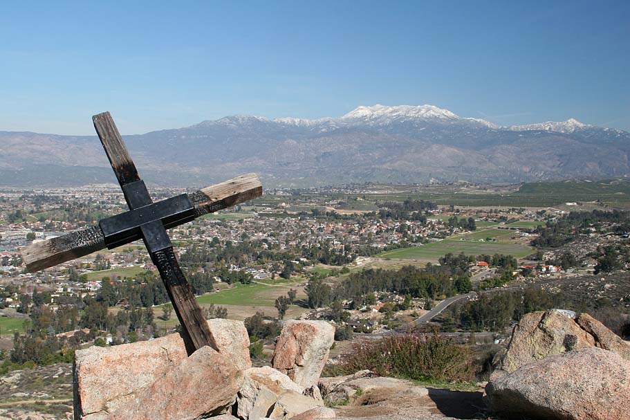
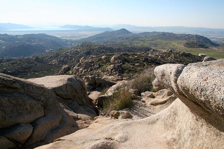
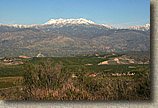
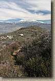
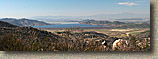
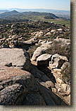
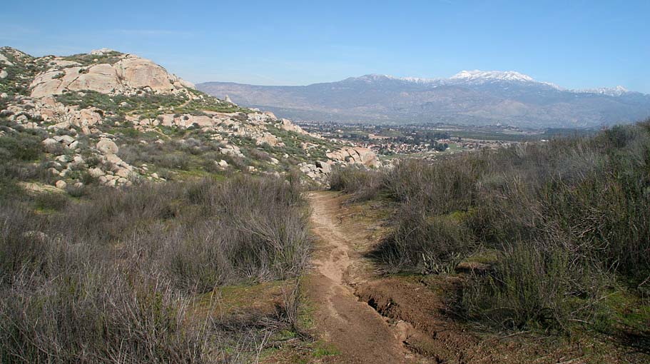
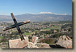 The view from the Ramona Cross is pretty cool and it is a nice place to take a break. On the Feburary day that I was here it was really nice with mild tempurates, green fields below and snow capped mountains in the distance. When ready to get going again look for the wide singletrack heading off to the east (It is really the only option beside the way you came in) and take it. You will roll slightly downhill and work around that rocky ridge you were looking at from the 4-way intersection earlier. There is one 30 foot or so hike-a-bike section just before you get to the end of the ridge and after that you should come around the ridge enough to see that intersection. The trail gets steep in a couple of spots on the way down off the ridge before you climb back up to the intersection. The view from the Ramona Cross is pretty cool and it is a nice place to take a break. On the Feburary day that I was here it was really nice with mild tempurates, green fields below and snow capped mountains in the distance. When ready to get going again look for the wide singletrack heading off to the east (It is really the only option beside the way you came in) and take it. You will roll slightly downhill and work around that rocky ridge you were looking at from the 4-way intersection earlier. There is one 30 foot or so hike-a-bike section just before you get to the end of the ridge and after that you should come around the ridge enough to see that intersection. The trail gets steep in a couple of spots on the way down off the ridge before you climb back up to the intersection.
|
| |
From this point you could retrace your steps back to Point W, but I opted to hang a left at this intersection and headed south where I came out onto Gibbel Flat. You should have seen enough of the lay off the land on your way out to the Ramona cross to be able to pickup one of the fireroads heading to your right to get back to that Y-intersection you were at earlier in the ride. |
| |
  From here you will pick up that east-west single track again and head back the east. It is mostly a climb in this direction. The layout of the jumps were certainly optimized for travel in the other direction. The rock formations along this trail were interesting enough that the trail did not feel much like an out-and-back. Once back at Point W (My mileage was 9.8 at this point), I followed the fireroad slightly uphill and north for just a sort bit until I realized that it went out the road that I drove in on. I retraced my way back to the Point W and picked up the Buck Brush trail (L). From here you will pick up that east-west single track again and head back the east. It is mostly a climb in this direction. The layout of the jumps were certainly optimized for travel in the other direction. The rock formations along this trail were interesting enough that the trail did not feel much like an out-and-back. Once back at Point W (My mileage was 9.8 at this point), I followed the fireroad slightly uphill and north for just a sort bit until I realized that it went out the road that I drove in on. I retraced my way back to the Point W and picked up the Buck Brush trail (L).
|
| |
  After just under .2 miles of climbing I came to the intersection of the Lake View Trail (M). Looking up the ridge that this trail came down from it looked plenty rocky and ripe with technical goodness potential. I opted to go up the Lake View Trail, where I soon found myself have to get off and push in quite a few spots. I was getting stoked. The grade of this trail averages 14% with some steep rollers, drops and tight manuever lines. It was a good push to get up to the top but I was happy to have prescouted some lines for the way back down. After just under .2 miles of climbing I came to the intersection of the Lake View Trail (M). Looking up the ridge that this trail came down from it looked plenty rocky and ripe with technical goodness potential. I opted to go up the Lake View Trail, where I soon found myself have to get off and push in quite a few spots. I was getting stoked. The grade of this trail averages 14% with some steep rollers, drops and tight manuever lines. It was a good push to get up to the top but I was happy to have prescouted some lines for the way back down.
|
| |
 The top of the Lakeview Trail (M) is located by the highest elevation picnic tables at the far west end parking area . I had forgotten my electrolyte drink in the truck so I made a quick roll over the truck to pick it up Taking the Lake View trail down was a heck of a lot of technical fun. I sessioned a couple of different lines but left a couple of the more adventurous lines for another day considering I was solo out here. The top of the Lakeview Trail (M) is located by the highest elevation picnic tables at the far west end parking area . I had forgotten my electrolyte drink in the truck so I made a quick roll over the truck to pick it up Taking the Lake View trail down was a heck of a lot of technical fun. I sessioned a couple of different lines but left a couple of the more adventurous lines for another day considering I was solo out here.
|
| |
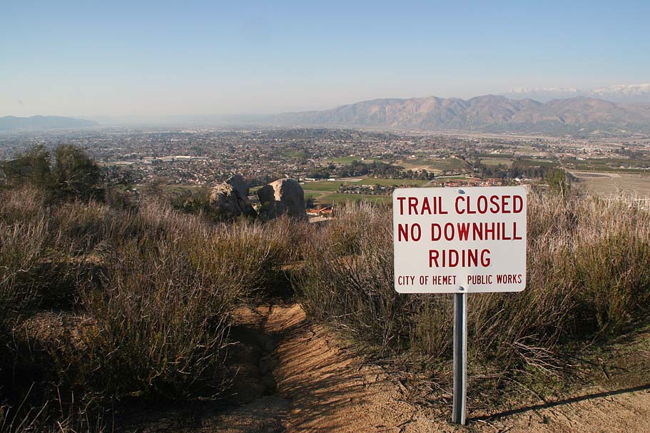
 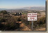 When I got down to the bottom of the Lake View trail, I hung a right and followed the trail down to the east of a water tank and picked up the Lichen Trail (J). This trail does some nice contouring for about 1/2 mile, where it joins the Manzanita trail. At this junction hang a left and roll down to the road you came in on. Pickup the Black Sage Trail (C) on the other side of the road and enjoy more singletrack goodness for .35 miles where you will come out onto a fireroad. Directly across the fireroad is the Ribbonwood Trail (D) take it and for another .3 miles before it loops back out onto the the same fireroad you crossed earlier but further down the hill. Directly across from this trail its the Live Oak Trail (G) so go across the fireroad and hit up this singletrack which is mostly downhill. About .2 mile into the trail, the Granite Trail goes off to the left. This trail is currently closed for downhill riding. Continuing on Live Oak it will soon come out on the fireroad once again. You should recognize where you are at since you were here earlier in the ride when you came off of the Canyon Trail. Turn right and climb up the fireroad. You will pass by the Mule Deer trail as well all the trails you most recently rode when cutting back and forth across the this fireroad. After .43 miles of climbing you will see the visitor center and paved road you came in on. Hang a left onto the Bobcat Trail (Fireroad) which will take you back past the Crest Trail and the fireroad you started your day on. Soon you will be back by the covered picnic area and your car. When I got down to the bottom of the Lake View trail, I hung a right and followed the trail down to the east of a water tank and picked up the Lichen Trail (J). This trail does some nice contouring for about 1/2 mile, where it joins the Manzanita trail. At this junction hang a left and roll down to the road you came in on. Pickup the Black Sage Trail (C) on the other side of the road and enjoy more singletrack goodness for .35 miles where you will come out onto a fireroad. Directly across the fireroad is the Ribbonwood Trail (D) take it and for another .3 miles before it loops back out onto the the same fireroad you crossed earlier but further down the hill. Directly across from this trail its the Live Oak Trail (G) so go across the fireroad and hit up this singletrack which is mostly downhill. About .2 mile into the trail, the Granite Trail goes off to the left. This trail is currently closed for downhill riding. Continuing on Live Oak it will soon come out on the fireroad once again. You should recognize where you are at since you were here earlier in the ride when you came off of the Canyon Trail. Turn right and climb up the fireroad. You will pass by the Mule Deer trail as well all the trails you most recently rode when cutting back and forth across the this fireroad. After .43 miles of climbing you will see the visitor center and paved road you came in on. Hang a left onto the Bobcat Trail (Fireroad) which will take you back past the Crest Trail and the fireroad you started your day on. Soon you will be back by the covered picnic area and your car.
|
| |

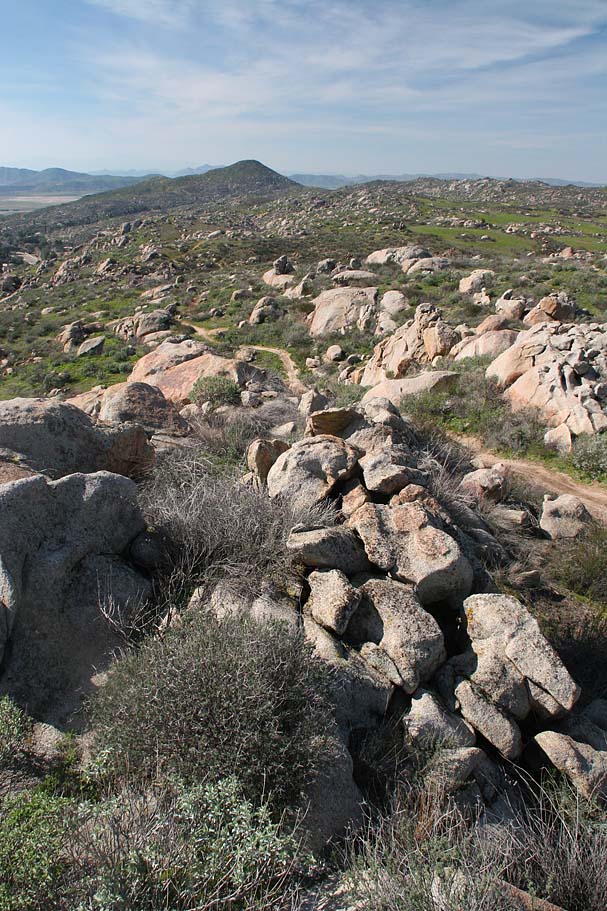
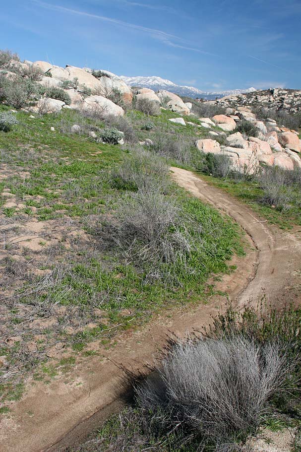
 During the course of working your way up the ridge you should come to a T-intersection of fireroads with a singletrack coming up from a valley to make a fourway intersection. Refer to the picture on the left. Take note of the rocky end of the ridge on the left-hand side of the picture. The single track you can see there is the way you will be coming back to this intersection later in the ride. Turn left (north) at this intersection and climb. At any splits (there is at least one) bear to the right and you will soon peak out and roll down to the Ramona Cross at Point Y. If you have been following my route you should have around 7.3 total miles at this point.