Galbraith Mountain in Bellingham WA
WOW! This place is awesome! This mountain is some of the most fun I have ever had on a mountain bike. Located on the east end of the very cool town of Bellingham, the trails of Galbraith Mountain are sure to rev up your stoke meter. There are miles and miles of cool singletrack but the stuff that really sticks in my mind are the gravity and freeride oriented stuff.
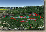 Map: When you get into Bellingham swing by the Fantik Bike Shop and pick yourself of the Galbraith Mountain Trails Map put together by the Whatcom Independent Pedalers (WHIMPS) Mountain Bike Coalition. This non-profit organization in addition to actively promoting open and multi-use trail access in Whatcom County also are responsible for the trail maintenance and construction on Galbraith Mountain. So in addition to picking yourself up a really good waterproof map you'll be throwing a few bones towards a good cause. The map and data files provided by me here are pretty crude and just shows what I played on. Buy the map it town, you'll be glad you did. GDB, GPX, KML
Directions: Putting in the address for the Fanatik Bike Co (2025 James Street, Bellingham WA) will get you to a really cool shop in town where you can pick up a map. Galbriath Mountain is a rather large area and their are two primary areas to park. If you plan hitting mostly just the gravity and stunt oriented trails then park at the bottom of Galbrith Lane.
- To Access Galbraith Lane Side from town: Get on I-5 and take exit on 252 (if you are near Lincoln St just head south on it), Take Samish Way for XX miles, after passing Lake Padden Estates on your left look for the dirt parking lot on your right. (Note you can also catch Samish Way further south of Bellingham via exit 246 and back track about a mile to the parking lot which may be quicker)
If you are interested in seeing the entire area or the XC oriented trails then park at the Birch Street trailhead
- Take exit 253 Lakeway and merge onto King Street. After .1 miles take the left onto Lakeway dr. Follow Lakeway for 1.8 miles and turn right onto Birch St. Go .3 miles to the trailhead where Birch St ends.
- If the birch street trailhead is full then go back to Lakeway drive and continue straight through the intersection which merges onto Electric Aves, and look for Whatcom, Falls Park on your left about 100 yards past the intersection on your left.
Ride Report: I rode out here twice in two successive weekends.
First off here is the quick route summary that will make no sense unless you have picked up a map.
The first weekend I started from the Birch Street Trailhead.
- Ridgeline-Cedar Dust-RD1200-RD2400-Kung Fu-RD2000-RD3000-Whoopsie Woodle-RD3000-Summit-Scorpion-Summit-Evolution-RD4000-Mullet-RD2000-RD3000-Summit-12 Monkeys - Wonderland-RD4000-Mullet-Cheech and Chongs-Not Shawns-Meth Lab. At his point I had dropped my map somewhere and was pretty pooped so I took RD1000 all the way back to Ridgeline and back to the car.
Second Weekend I started from Galbraith Lane:
- Galbraith Lane - RD2000-RD3000-Summit-Scorpion-RD3000-Summit-Evolution-RD3000-RD4000-Mullet-Cheech and Chongs - Not Shawns - Meth Lab - RD1000- RD2000 - Turn back up the mountain and repeat the Evolution-Mullet-Cheech-Not Shawns-Meth Lab run two more times.
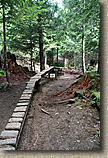
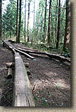
The first weekend had more XC trails than the second weekend. When you get a map you will see that there is a ton of other trails that I did not hit. Most of those are the XC oriented stuff. A notiable exception was the SST trail which has a lot of jumping and other cool features that I just did not make over to. The Whoopsie Woodle is a really cool XC trail that is quite worth checking out if you are near the southern end of the mountain. Cedar Dust will certainly help improve your skinny skills and most of stuff has a low hazard factor as it is not high off the ground.
As far as the black diamond/free ride stuff. The Evolution/Mullet/Cheech run is just stupid amounts of fun as well as challenging. Scorpion is also pretty awesome but there is one short section that cashes out a lot of elevation without a lot of payoff. Other than that is is also primo trail.
I generally was well hooked up with some locals so I spent a lot more time riding than taking pictures. Here are some of the shots:
 |
 |
 |
 |
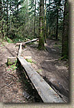 |
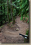
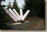
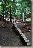
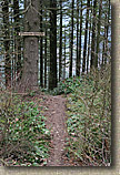
| Ridgeline Trail | Some of the outdoor art you will see on the mountain | Part of the Cedar Dust | Part of Cedar Dust | More Cedar Dust |
 |
 |
 |
 |
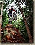 |
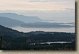
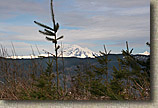
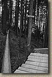
| Had enough of Cedar Dust? | Top of Whoopsie Woodle | Nice view from the Whoopsie Woodle trail | Mount Baker from Wonderland | Huckage |
 |
 |
 |
 |
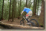 |
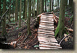
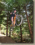
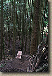
| Scorpion | More Scorpion | Jumpage on Mullet | Looking down at a section of Evolution | Skinny Action at the top of Evolution |
 |
 |
 |
 |
 |
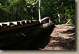
The rainbow skinny is one tough little log. The vertical arch make things really tricky. |
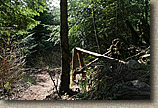
The start button for Chech and Chong's Wild Ride |
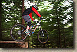
I believe this huck was on Scorpion |
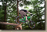
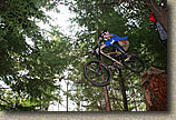
Mo Huckage |
I think this was some Evolution Stump Huckage |
| For post ride refreshments, you can not go wrong with a stop by the Boundary Bay Brewery and Bistro. Great atmosphere, good food, and of course awesome beer. It is hard to go wrong with their Inside Passage Ale. Thrown in one of their ymmy rueben sandwiches and life is good! | ||||
Video |
||||
 |
||||
| So while I did not take a lot pictures on Galbraith, I did let the helmet camera run. The opening scene is from Cedar Dust and the angled down shots are from Whoopsie Woodle. Outside of a couple other small clips, all of this video is from Scorpion, Evolution, Mullet, Cheech and Chongs, Not Shawns or Meth Lab. You may find the music a little aggro but both of these tunes popped into my head while riding these trails. | ||||
