Downieville 2007 - Day 3
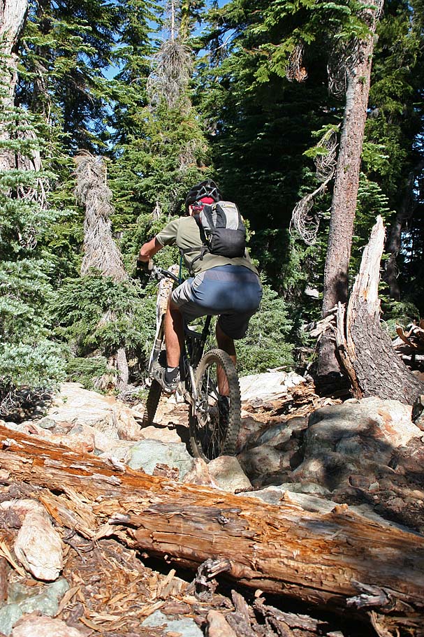
| Today's adventure was a Lake's Basin point-to-point ride with a sizable hike-a-bike trip up to Mt Elwell at 7,818 feet and then down into the town of Graeagle at 4,350 feet. After six days of riding not only did my legs feel a little cooked and my "cheeks" were feeling a little flush. Yeah this ride should cut down on both the saddle and pedaling time. This was a pretty awesome ride and I have never had a problem with hike-a-biking. While this ride was only about 14 miles long we busted out 1,600 feet of climbing and 3,900 feet of descent. Oh did I mention there were more jaw dropping views on this trail than you could shake a stick at? | ||||||
|
Directions:
|
||||||
 |
Map: Here is the map of the ride. It is
formatted for printing on 8.5" by 14" paper Here is the TOPO File. |
|||||
 |
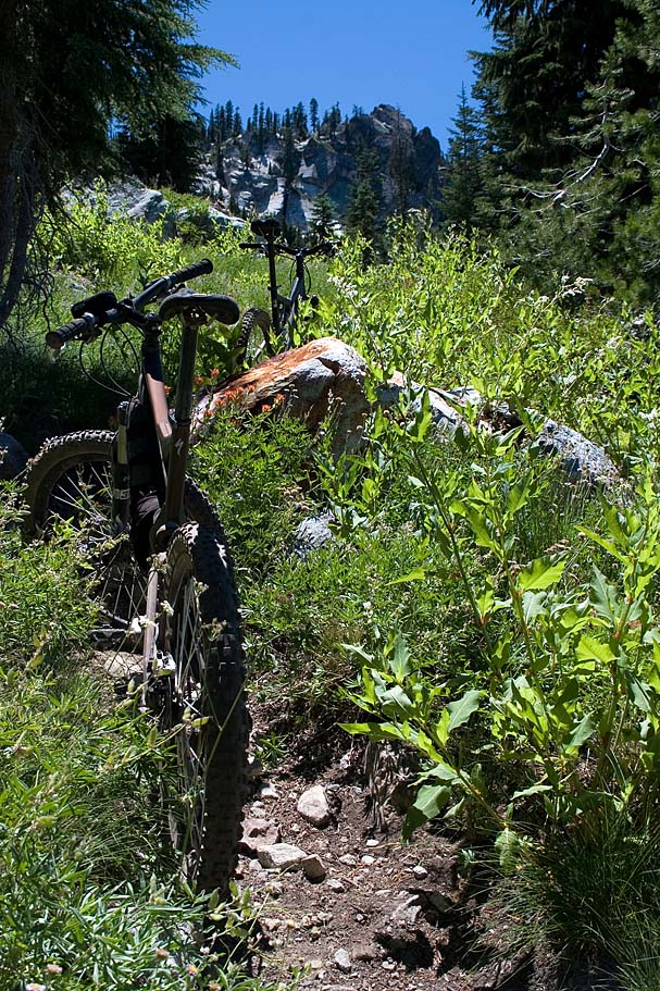
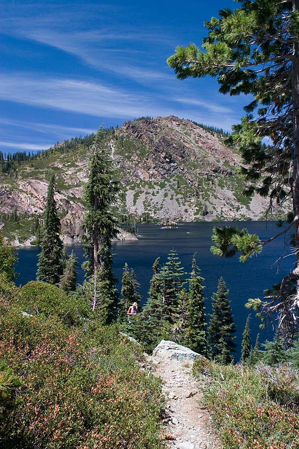
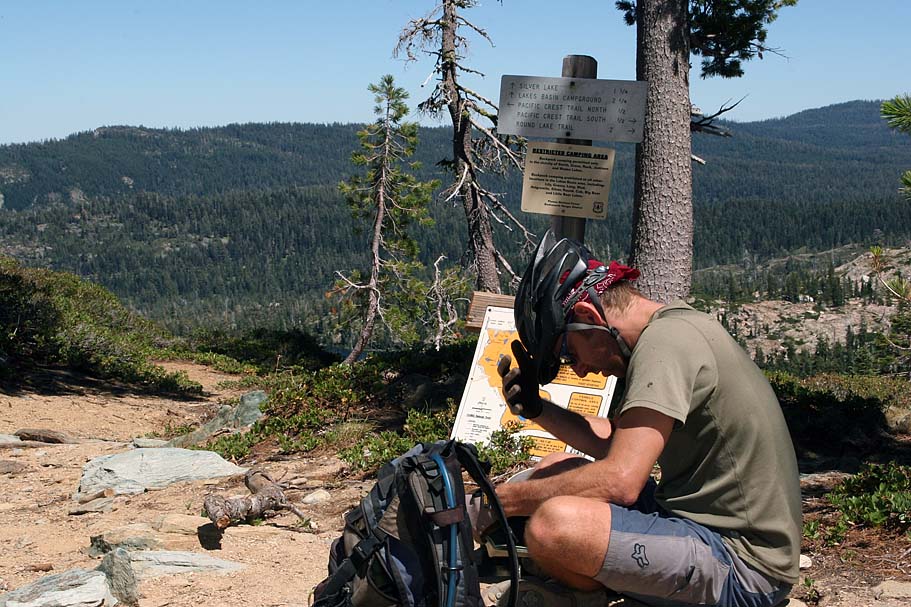
Starting from the Gold Lake Lodge parking area we picked up the trail that I believe said "to" the Bear Lakes Loop. At about 1 mile (EW-02) we came to the Bear Lakes Loop sign. We went to the left. Soon we passed by Bear Lake, Little Bear Lake, and finally Cub Lake. The trail was often rocky with some technical challenges here and there. At 1.6 miles (EW-03), we came to the junction of the Silver Lakes Trail. | 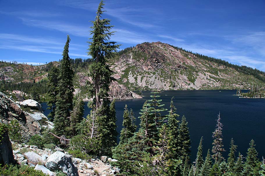 |
||||
 |
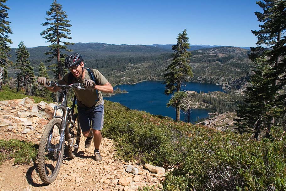
We went to the left and the climbing got more substantial for a ways. At the same time nice views of Long Lake came into view so | 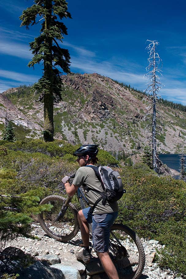 |
||||
 |
At 1.8 miles (EW-04) we went by the Round Lake connector trail, We kept going. At 2 miles (EW-05) we came to the junction of the Mud Lake Trail. It had some signage for Mount Elwell but this was not our route. The route we were taking would get us up onto the ridge as fast as possible. |  |
||||
|
|
||||||
|
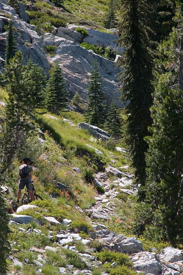
The next 1.2 miles involved quite a bit of pushing on my part as we worked our way up to the ridge to the west. The trail was was often rocky but always pretty with blooming flowers being a common sight. |
||||||
 |
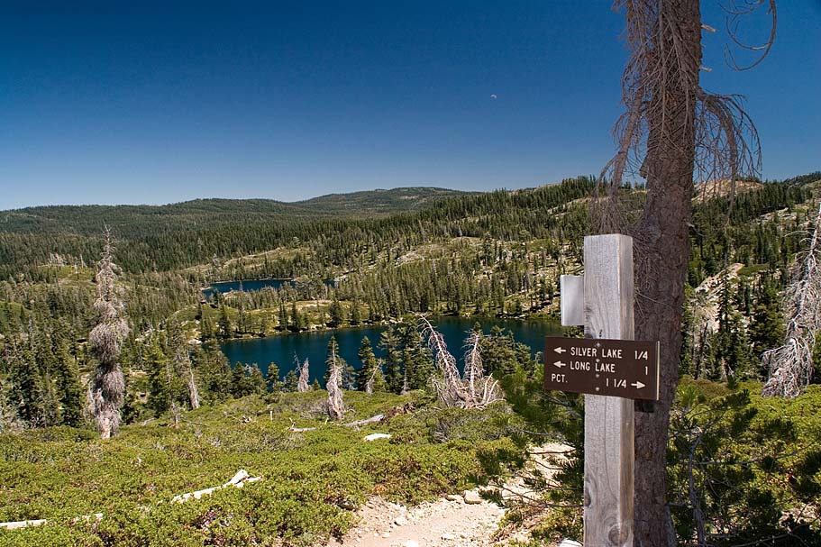
At 3.2 miles (EW-06). We came to the junction of the Mt Elwell Trail and two connectors to the Pacific Crest Trail. We took the Mt Elwell trail to the north. We were back to riding again and we actually lost a little bit of elevation as well. It was quickly over as at 3.8 miles (EW-07), we came to the junction of the Mud Lake and Long Lake trails. The Mt Elwell trail turned uphill at this point and after a short bit of climbing we were back to hike-a-biking. | |||||
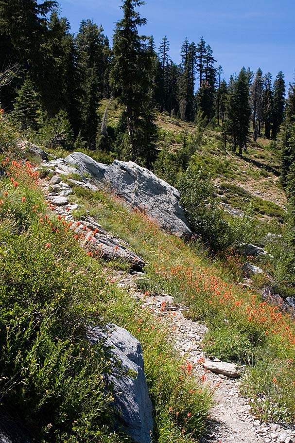
 |
The next 3/4ths of a mile were rough as we gained about 735 feet. The further up we went the rougher the trail got. | |||||
 |
There is one spot in this section where you can step off the trail just a little and get a good view of Jamison Lake to the northeast. (You will not be able to see this like from the top.) |  |
||||
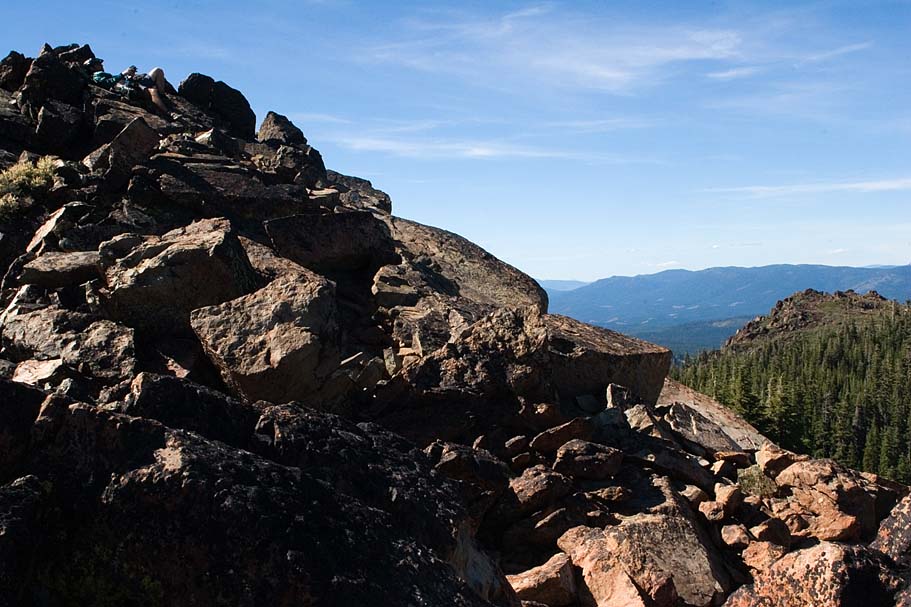 |
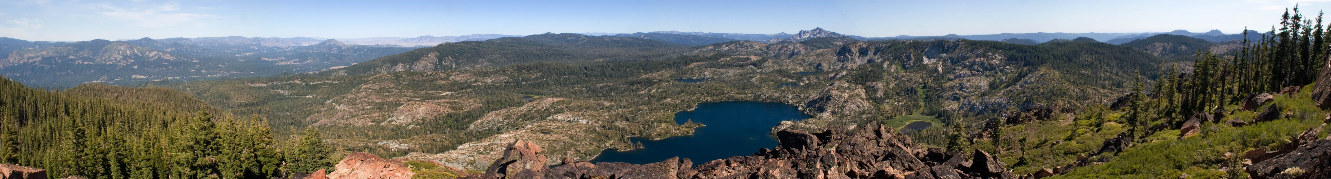
As you get near this summit the views start looking exceptional but upon reaching the high point it is a bit of a bummer as all the rocks are blocking a good chunk of your view. It is well worth it to scramble your way over the rocks to your right to get to some expansive views of the Lakes Basin area with the Sierra Buttes beyond. |
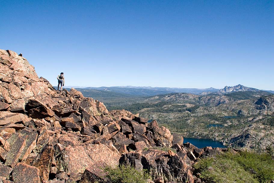 |
||||
|
|
||||||
 |
Get in the right spot and you can see Mount Lassen to the north. |
 |
||||
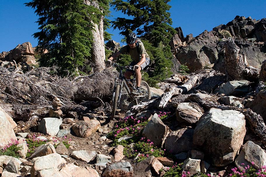 |
We hung out at the top for quite some time before heading down the other side. The first 1/4 mile down the other side has a bunch of technical chunk that would be rated somewhere between mighty nice to hairball by most intermediate to advanced riders. After this the trail turned into a ripper of singletrack down the through the pine trees. The sight lines where often quite far through here so you could really let it fly. After about a mile of this ripping through the trees, the trail turns noticeable to the east (EW-09) and flattens as you pass by a couple of small lakes. | 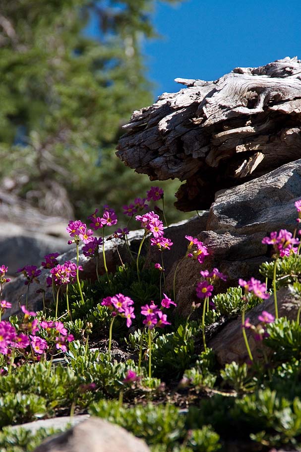 |
||||
 |
Shortly after the lake you are back onto the descending but it is rockier here than the earlier forest rip fest. The next trail junction was the Smith Lake trail coming in from the left (EW-10). We stayed straight and just a short distance down the trail we came to the junction of the Smith Creek Trail (EW-11). The is a sign for the Gray Eagle Lodge to your right. Take the right, cross the creek and then climb for just a short distance before you start descending again. This trail comes out into small trailhead parking lot. Just east of this parking lot (EW-12) is the Gray Eagle trail off to the left. The Gray Eagle trail is not as steep as the earlier trails and it tends to be naturally gravelly. It is plenty of fun but you will often have to work to get your speed up should you loose some momentum in the sporadic technical bits. | |||||
 |
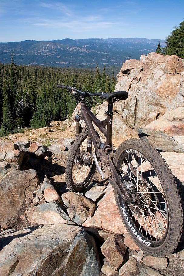
After about 2.3 miles the single track comes out onto to a doubletrack at a creek crossing. I'm pretty sure we went astray here as we just flowed right onto the doubletrack that descended another 2.2 miles into town in a hurry. I believe we were supposed to pick by up the singletrack somewhere near where we popped out on the doubletrack. From what I understand we cheated ourselves of out the last two mile of singletrack. Oh well, it was still a bunch of fun. That evening we had another great meal at the Grubstake and back at came we made sure that no good beer would have to make the horrid journey home tomorrow. | |||||
 The following
day was all about the long drive back home and
I had lots of time to reflect on the great week I had just had. I
find it awesome to be around people that are passionate about mountain
biking and have chosen it as a profession. Not because
they want to get rich, but because they love what they do. Cris
with his AZ Nomad
Adventures has my dream job and you can tell it is his as well.
Wayne, Eric, Flick and the rest of the folks at
Yuba
Expeditions really want you to have a good time in Downieville.
Sure it is good business, but you can tell it is not about the business.
It is about passionate Mountain Bikers sharing their love for the land
and our sport. It is this kind "extra spice" that transforms a
great trip into an amazing trip. As I pulled into my
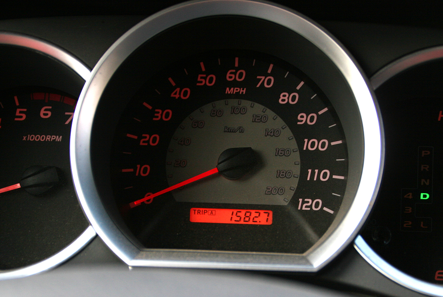
driveway with the trip odometer reading 1,528 miles I came to realize
this was an amazing trip. The following
day was all about the long drive back home and
I had lots of time to reflect on the great week I had just had. I
find it awesome to be around people that are passionate about mountain
biking and have chosen it as a profession. Not because
they want to get rich, but because they love what they do. Cris
with his AZ Nomad
Adventures has my dream job and you can tell it is his as well.
Wayne, Eric, Flick and the rest of the folks at
Yuba
Expeditions really want you to have a good time in Downieville.
Sure it is good business, but you can tell it is not about the business.
It is about passionate Mountain Bikers sharing their love for the land
and our sport. It is this kind "extra spice" that transforms a
great trip into an amazing trip. As I pulled into my
driveway with the trip odometer reading 1,528 miles I came to realize
this was an amazing trip. |
||||||