
Palm Canyon - Pinyon Flats Loop
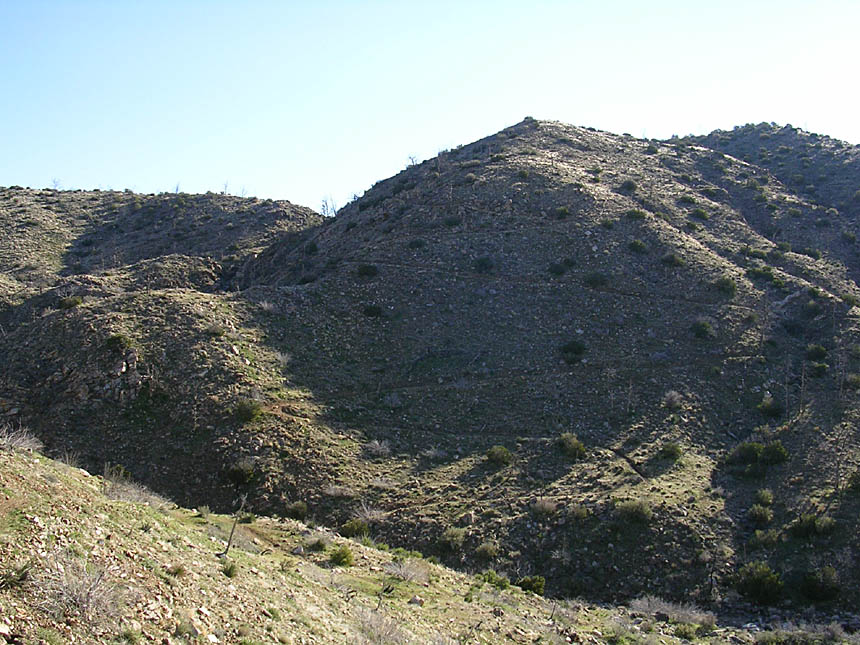
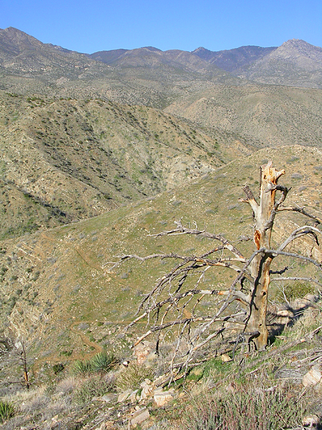
Located on the north slope of Santa Rosa Mountain near the little hamlets of Spring Crest and Pinyon Pines this 11.1 mile loop offers some narrow singletrack with impressive canyon and ridge top views. The terrain is mostly rocky with some of really narrow sections that have cactus just off the trail to punish those who can't keep on the line. The first part of the ride has you descending on a bit of 4WD roads and the narrow single track on the Palm Canyon trail. The trail eventually takes you down to a wash where you will hook up with the Pinyon Pines trail for a mostly gradual climb up through desert scrub terrain on singletrack. If you like grand views and singletrack and can stay online on narrow trails, you are going to really like this ride.
- Directions: This loop can be done from three different trailheads.
- Palm Canyon Trailhead

- Pinyon Flats Trailhead
- Cactus Spring/Sawmill Trailhead
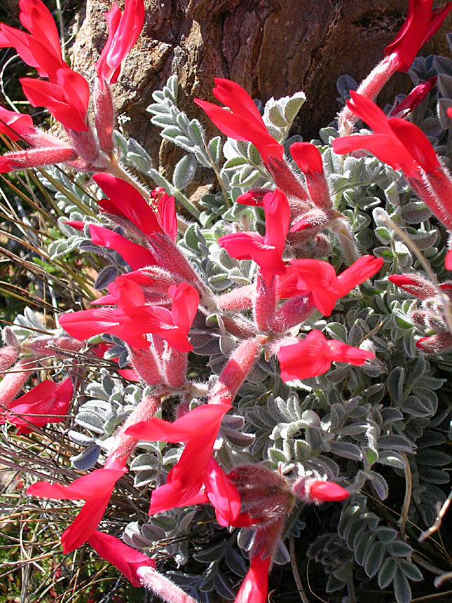
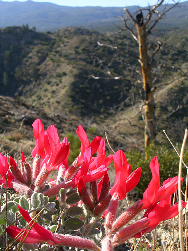
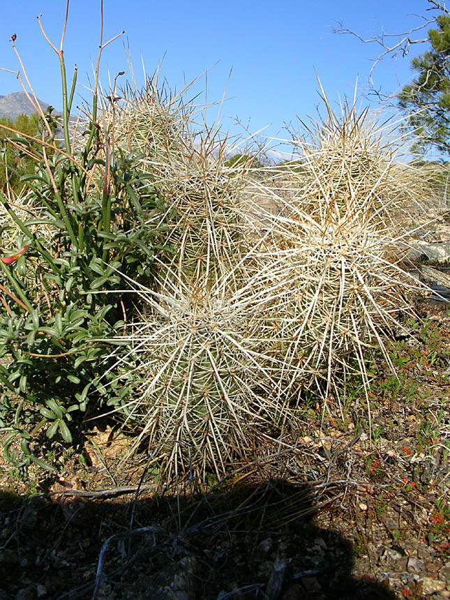
HAZARDS: Cacti - Many types that are just off the trail and often infringing into the trail's airspace. Exposure along canyon sides and some technical spots as well as a few steep descents.
Featured routes in this area (See Description Below):
Pinyon Flats to Palm Canyon Loop(Hwy 74): ![]()
Pinyon Flats and Palm Canyon Loop(No Hwy): ![]()
![]()
With Ribbonwood add-on Figure 8 ![]()
![]()

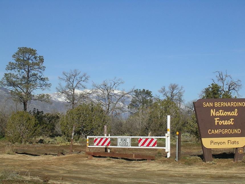
Ride Description: The points that I refer in this description are from my PDF map. Also place your mouse over the thumbnails as some of them have additional information. My orginal loop shown on the PDF map includes a 3 mile section of pavement that you can either do at the end or the beginning of the ride according to where you park. Since I first started riding in this area a dirt route option has developed that eliminates riding along highway 74 to get between the two trailheads. I prefer to knock out the pavement or dirt connector at the beginning so I park at the along Pinyon Drive just out side out of the campground. The rest of the description is based on taking the pavement and I discuss the dirt connector further below.
From Pinyon Drive just outside the campground entrance take the dirt road a couple of hundred yards back to highway 74 and hang a right onto the pavement. You road rolls up and down but is mostly uphill. You will notice off to the right that there are some dirt/4WD roads that parallel the highway here and there. After 2.8 miles you will come to Pine View Road on your right. Take the right and in 2/10ths of a mile the road dead ends. (This is where you park if you want to finish the ride off with the road return.)

 From the end of Pine View Road travel along the old 4WD road that is nearly
singletrack now .1 miles until you see a split in the trail where you will go to
the right and slightly downhill. The trail to the right is marked by an
old square sign that is so rusted you can not read what used to be on it.
This trail curves around this way at that while heading downhill and at 3.2 miles
it will make a large sweeping right turn at some stone cairns while another less
used trail heads off slightly to the left. (Point B on the map)
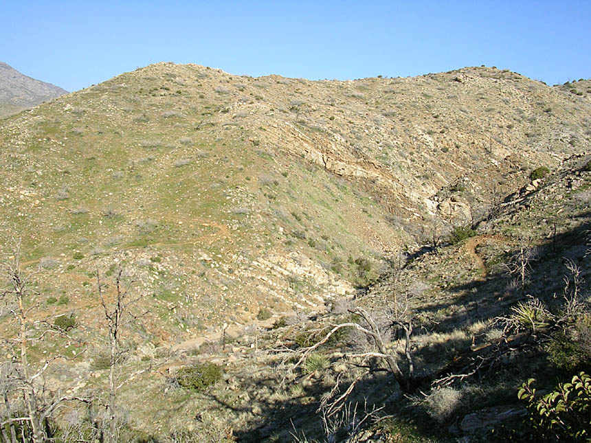
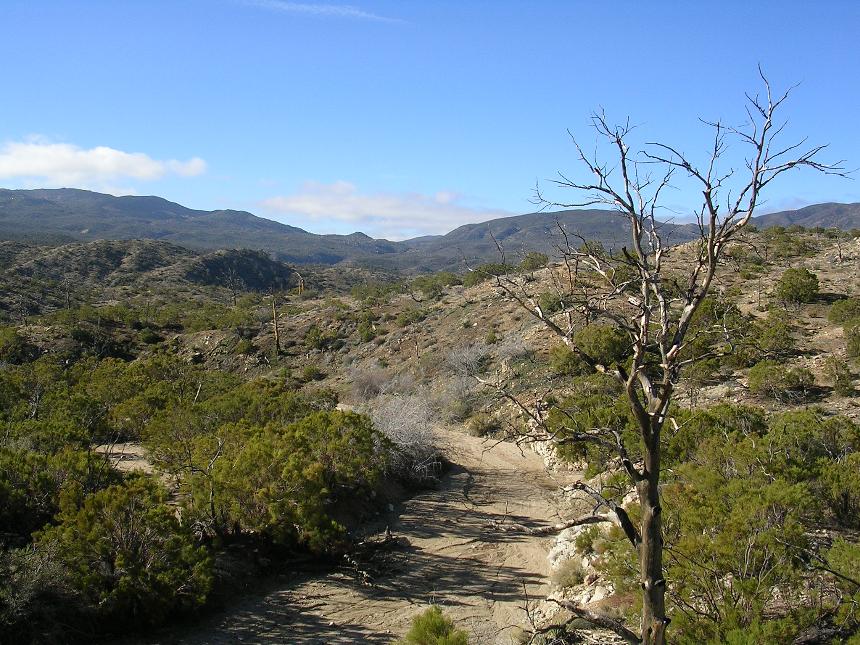
Continue to the right and downhill while the views of Palm Canyon start opening
up to you left. You will continue gently rolling down hill as the trail twists back and forth for a little over a mile.
From the end of Pine View Road travel along the old 4WD road that is nearly
singletrack now .1 miles until you see a split in the trail where you will go to
the right and slightly downhill. The trail to the right is marked by an
old square sign that is so rusted you can not read what used to be on it.
This trail curves around this way at that while heading downhill and at 3.2 miles
it will make a large sweeping right turn at some stone cairns while another less
used trail heads off slightly to the left. (Point B on the map)
Continue to the right and downhill while the views of Palm Canyon start opening
up to you left. You will continue gently rolling down hill as the trail twists back and forth for a little over a mile.


 As
you near point C at 4.3 miles the trail descends sharply to a four-way junction,
with a sign making that you are on the Palm Canyon trail, Forest Service Trail
4E01. You have the option of taking the canyon bottom route or a ridge top
route. Take the ridge top route and climb just a bit and then you
are back to the descending thing. You soon come out to flat section where
the trail is back to being a full-size double track. The view down
into Palm Canyon to your left is quite impressive. The double track
ends abruptly at the foot on a hill and the trail continues on as singlte off to
the right.
As
you near point C at 4.3 miles the trail descends sharply to a four-way junction,
with a sign making that you are on the Palm Canyon trail, Forest Service Trail
4E01. You have the option of taking the canyon bottom route or a ridge top
route. Take the ridge top route and climb just a bit and then you
are back to the descending thing. You soon come out to flat section where
the trail is back to being a full-size double track. The view down
into Palm Canyon to your left is quite impressive. The double track
ends abruptly at the foot on a hill and the trail continues on as singlte off to
the right.

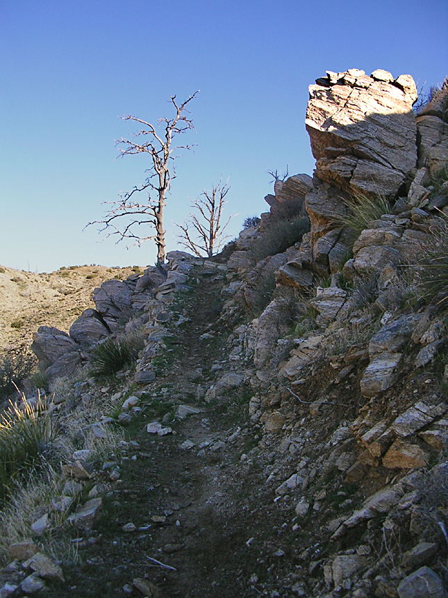
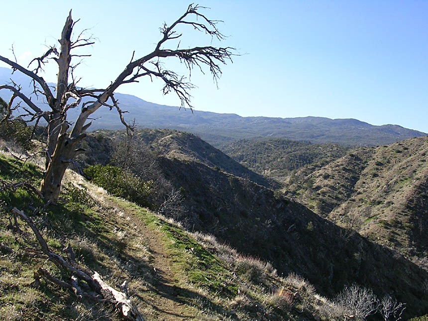
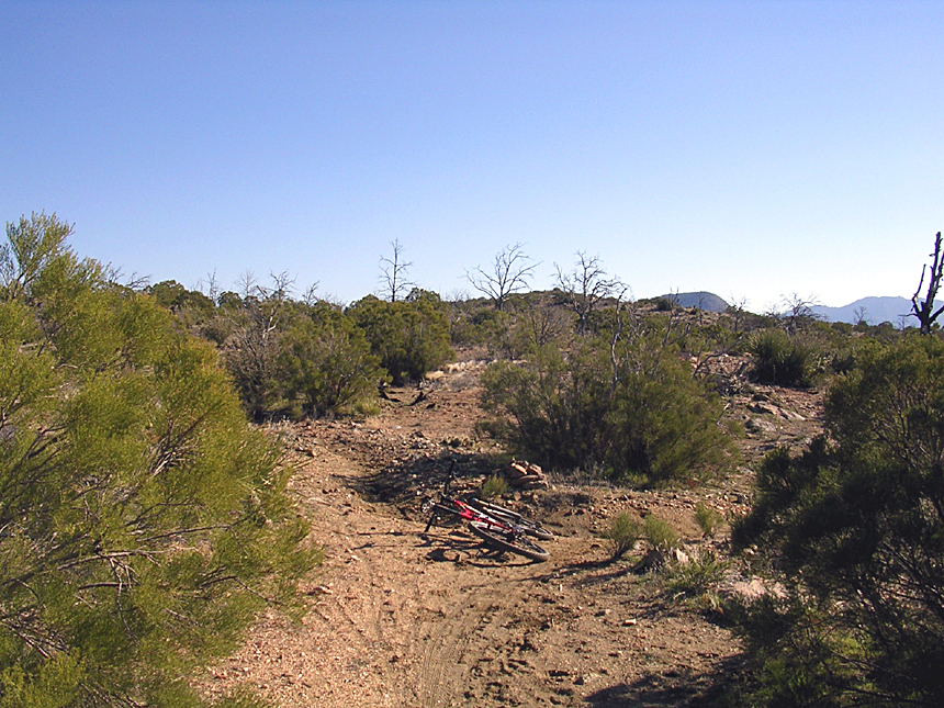
 The
single track in the next section is nothing short of great. The trail is
fairly narrow and travels either right along the top of the
ridge or clings to the side of the canyon. Between the occasional technical
spots and the ever present cacti nudging its way into the trail's airspace you
will find enough features to keep you on you toes. Of course with picturesque
views in every direction you may find it hard to keep your eyes on the
trail. Please do stop in a spot or two and take it all in as this is
singletrack of the "Top Flite" variety.
The
single track in the next section is nothing short of great. The trail is
fairly narrow and travels either right along the top of the
ridge or clings to the side of the canyon. Between the occasional technical
spots and the ever present cacti nudging its way into the trail's airspace you
will find enough features to keep you on you toes. Of course with picturesque
views in every direction you may find it hard to keep your eyes on the
trail. Please do stop in a spot or two and take it all in as this is
singletrack of the "Top Flite" variety.


 At around mile 5.5 the trail switching from riding along the ridge top or along the
west slope over to the east slope and starts descending toward Omscott
Wash. The trail has some exposure in spots as the start descending in
earnest. You will also have a few switchbacks to deal with as well.
At around mile 5.5 the trail switching from riding along the ridge top or along the
west slope over to the east slope and starts descending toward Omscott
Wash. The trail has some exposure in spots as the start descending in
earnest. You will also have a few switchbacks to deal with as well.
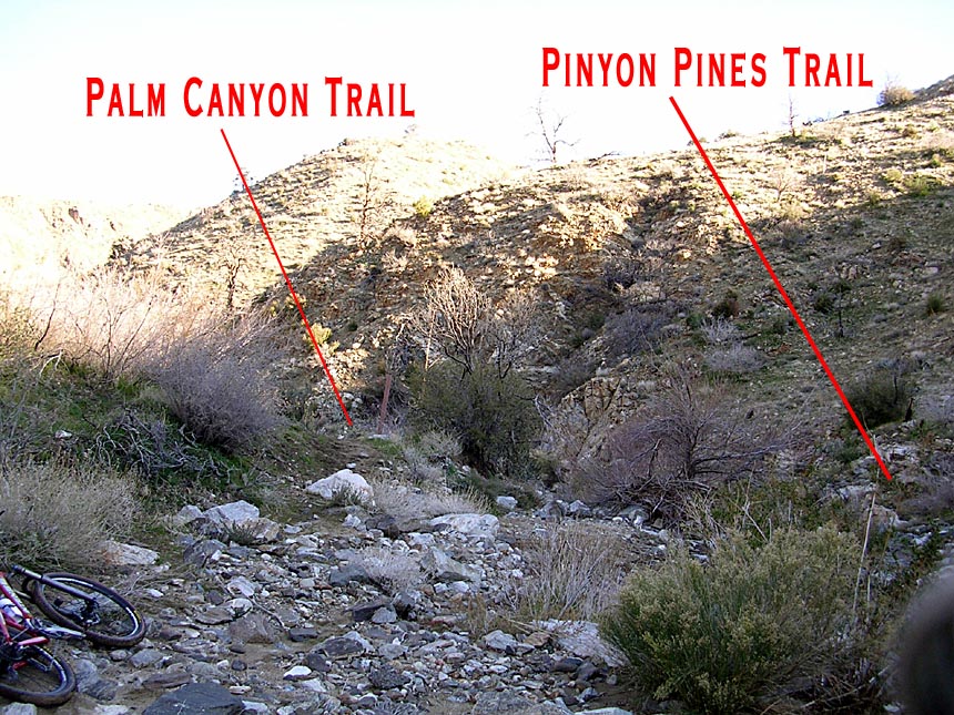
 The Palm Canyon trail will dump you out into Omscott Wash at 6.7 miles. As soon as
you go into the wash look to your left (downstream). You will see the back
of a trail sign and the trail heading off past it. The picture to the
right is view you should have. Almost directly across the wash from
this sign is the Pinyon Pines Trail heading out of the other side of the
wash. The picture to the right from the trail sign looking back up the
wash from where you came. This is Point D on the map.
The Palm Canyon trail will dump you out into Omscott Wash at 6.7 miles. As soon as
you go into the wash look to your left (downstream). You will see the back
of a trail sign and the trail heading off past it. The picture to the
right is view you should have. Almost directly across the wash from
this sign is the Pinyon Pines Trail heading out of the other side of the
wash. The picture to the right from the trail sign looking back up the
wash from where you came. This is Point D on the map.


 The picture to the left is the view from the trail sign looking directly across
the wash at the Pinyon Pines trail heading out of the wash. If you see any
of the two views to your right you have missed the Pinyon Pines trail and
traveled too far down the wash on the Palm Canyon
trail.
The picture to the left is the view from the trail sign looking directly across
the wash at the Pinyon Pines trail heading out of the wash. If you see any
of the two views to your right you have missed the Pinyon Pines trail and
traveled too far down the wash on the Palm Canyon
trail.
 Once you get on the Pinyon Pines trail you start doing some climbing as the
trail works its way up along the side of the canyon. There are
some great scenic turns where you round the corner and just go
WOW!
Once you get on the Pinyon Pines trail you start doing some climbing as the
trail works its way up along the side of the canyon. There are
some great scenic turns where you round the corner and just go
WOW!
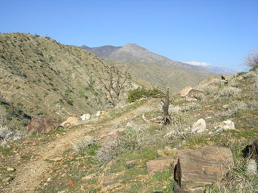
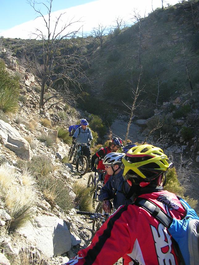
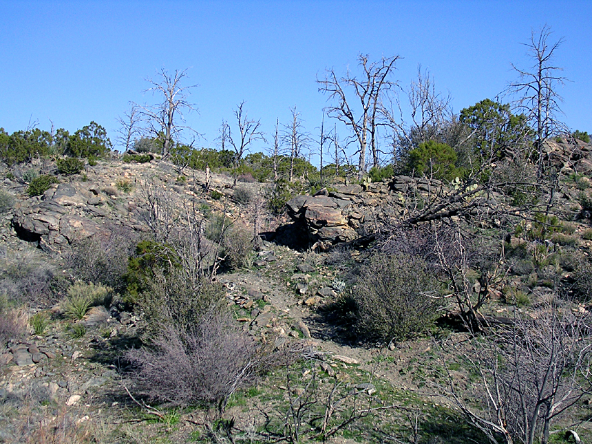
 At 7.1 miles, you will crest over a hill and see a rather steep hillside with a
bunch of switch backs on the far side of a small canyon. The trails
descends down into the canyon crosses a wash and goes up this
hillside. The top of this hillside is roughly were Point E is on the
map.he trail up the hillside has some very tight switchbacks
coupled with some exposure. The tightest switchbacks with the most exposure
are up near the top. Couple this with the fact that the grade up this hill
is pretty steep, clearing all of the switchbacks would feel pretty darn good for
even an advanced rider.
At 7.1 miles, you will crest over a hill and see a rather steep hillside with a
bunch of switch backs on the far side of a small canyon. The trails
descends down into the canyon crosses a wash and goes up this
hillside. The top of this hillside is roughly were Point E is on the
map.he trail up the hillside has some very tight switchbacks
coupled with some exposure. The tightest switchbacks with the most exposure
are up near the top. Couple this with the fact that the grade up this hill
is pretty steep, clearing all of the switchbacks would feel pretty darn good for
even an advanced rider.
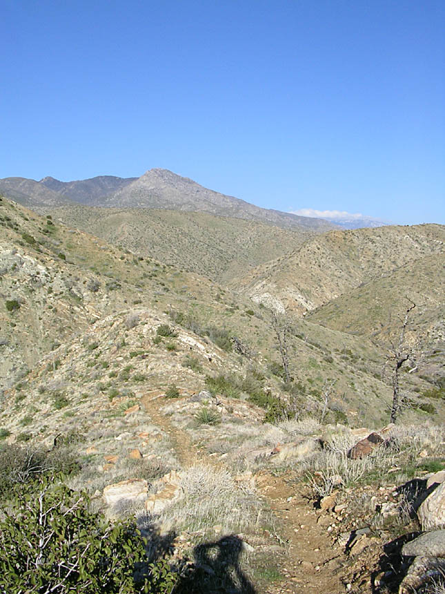
One of the steeper sections leading up to a switchback
From maybe halfway up the hillside looking back at the trail you took down into wash
Near the top of the hillside looking back down a the trail. It is Steeper Than It Looks. If you look close you can see the Palm Canyon Trail slope left to right about 1/3rd of the way down the far canyon side.
 Once you get up this hillside you do not really have any more extended pressing
climbs, they are mostly short little burst type climbs and rolling ups and downs
but you are mostly gaining elevation.
Once you get up this hillside you do not really have any more extended pressing
climbs, they are mostly short little burst type climbs and rolling ups and downs
but you are mostly gaining elevation.
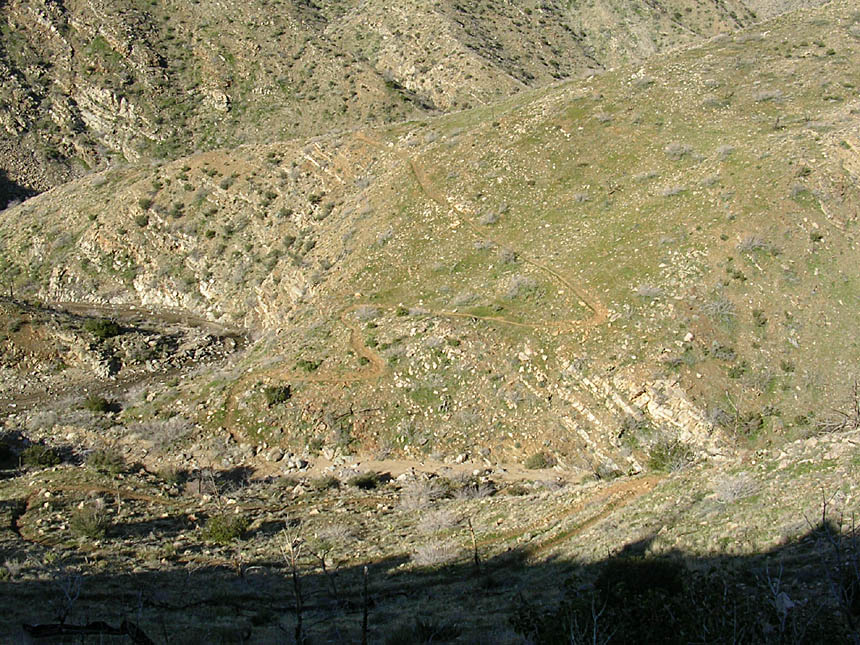
 Somewhere around the 8 mile mark the canyon side riding with expansive views
gives way to more narrow views where you cross a few washes here and
there. When you drop into these washes the trail normally is in
plain side coming out the other side and you should never have to travel more
than 20 yards up or down wash to hook back up with trail.
Somewhere around the 8 mile mark the canyon side riding with expansive views
gives way to more narrow views where you cross a few washes here and
there. When you drop into these washes the trail normally is in
plain side coming out the other side and you should never have to travel more
than 20 yards up or down wash to hook back up with trail.
 There is at least one spot where the trail splits somewhere between 9.5 and 10
miles. The Pinyon Pines trail is quite popular so just follow the
most used trail. The closer to the campground you get the more of
these little offshoots you will see.
There is at least one spot where the trail splits somewhere between 9.5 and 10
miles. The Pinyon Pines trail is quite popular so just follow the
most used trail. The closer to the campground you get the more of
these little offshoots you will see.
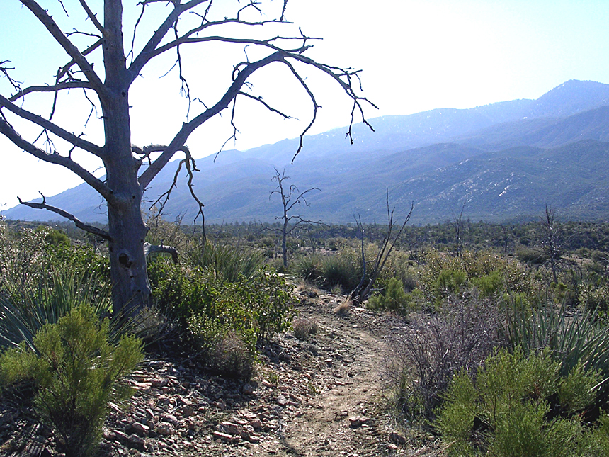
 At 10.3 miles the trail will come out and cross the Palm Canyon dirt road (This
is also known as Dunn Road further north). Pick up the trail on the other
side of the road and continue on it southeast. This section of the trail
allows ATVs so it is much wider now. There are many splits here and
there but it is virtually impossible to get too lost at this point. There is a fence to
north and east, highway 74 to the south and Palm Canyon road behind you to the
west. You can stay on the widest trail that works it way out to the
fence line and out to the entrance to the campground or you can take any split
in the trail you like and as long as you are heading east or southeast you will
get to the campground entrance at around 11.1 miles. If you parked here you are done, if not hang a right and
go out to highway 74, hang a right and take the pavement 2.8 miles up to Pine
View road.
At 10.3 miles the trail will come out and cross the Palm Canyon dirt road (This
is also known as Dunn Road further north). Pick up the trail on the other
side of the road and continue on it southeast. This section of the trail
allows ATVs so it is much wider now. There are many splits here and
there but it is virtually impossible to get too lost at this point. There is a fence to
north and east, highway 74 to the south and Palm Canyon road behind you to the
west. You can stay on the widest trail that works it way out to the
fence line and out to the entrance to the campground or you can take any split
in the trail you like and as long as you are heading east or southeast you will
get to the campground entrance at around 11.1 miles. If you parked here you are done, if not hang a right and
go out to highway 74, hang a right and take the pavement 2.8 miles up to Pine
View road.
Eliminating Highway 74
Highway 74 is the quickest and easiest way to connect between the Pinyon Flats and Palm Canyon trailheads, I would certainly not call it the safest or most interesting option. I personally do not care to be on that highway. The dirt option is more work and about half a mile longer than the base loop. You came out to ride your mountainbike and not do some roadie stuff right?
(I'm assuming you are using a bike computer/GPS and have the No HWY loop or the Ribbonwood Figure 8 Add-On linked above loaded) From the Pinyon Flats trailhead you will get on the Pinyon Flats trail just after the entrance to the camground. There will be several lessor splits off this trail but stay on the main trail. You will come out onto a large dirt road (Dunn Road) at 0.8 miles. Take a second and locate a trail coming in from the south just before you reach the road. This is the trail that is used if you do the Ribbonwood add-on.
You will diverge off of the Pinyon Flats trail at this point and turn left onto Dunn Road, then make a right onto St Pierre Road. After 3/4th of a mile of heading almost due west the road bends to the northwest and turns into Eden Dr (it was not signed the last time I did this route). In about a 1/10th of a mile the road ends and you will bear sharply to the left and take an old 4WD road downhill. You will crossover two other 4WD paths while heading downhill. After you cross a wash it will be time to get your climb on for about a mile. There are several 4WD path heading off primarily to your right as you climb. You may notice bike tracks heading off on some of them. There has been some renegade building off of the Palm Canyon Trail and in this area so you will see more tracks as you near Highway 74. The USFS is well aware of these shenigans and have actively destroyed about a mile's worth of these trails that were built right on/beside the Palm Canyon trail.
You will climb out to a pull out beside Hwy 74. Pickup a lightly used trail off to your right and follow it around to the Palm Canyon trailhead. Follow the route and description for the main route above.
Ribbonwood Figure 8 Add-On
This route adds on the trail coming off the Sawmill trail that goes by the the Ribbonwood equestrain campground and then connecting up with the Pinyon trail. I'm going to assuming you are using a GPS and have the Ribbonwood Figure 8 track loaded. From the Pinyon Flat Trailhead/campground, ride south back to highway 74 and cross the road the and continue south/southeast on the dirt. As you come to the Catcus Springs trailhead parking area on your left and a dirt road indicating the Ribbonwood Equestrian Campground on your right, you will see two options straight ahead. The dirt road goes to a trash transfer station, while a lesser dirt road splits off very slighty to the right. This is the Sawmill trail. Take this dirt road. You will start doing some climbing. In just under a half mile a dirt road will merge in from your left.You should also see a right bend in the road ahead. Start looking for a single track off to your right. It is just before the bend in the road.
Pick up the single track and enjoy some nice bits of desert goodness that twists a bit and trends mostly downhill. Half a mile on this trail there is a split off to the right that heads over the the equestrian campground. Stay straight and the trail will works it way around to the north and west of the campground. After another half-mile there will you come out to a flat area where you have the option to head off to the to east (your right). The trail bends back to your left and goes north-northwest. According the USFS website this trail is the actual Pinon Trail (5E03) and not the trail starting from the Pinion Flat campground. I have not seen sign reflecting this on the ground.