
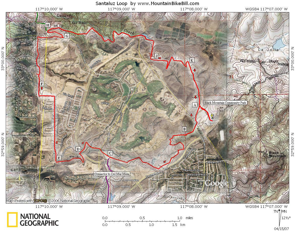
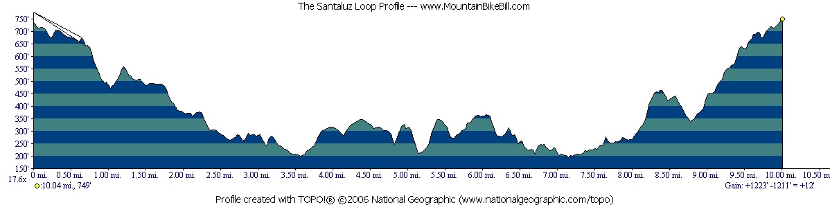
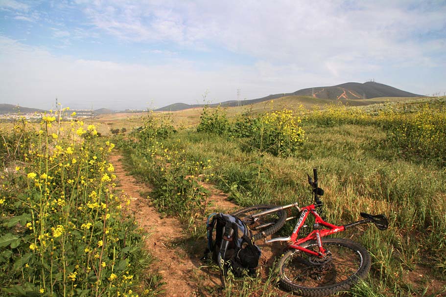
The Santaluz Loop
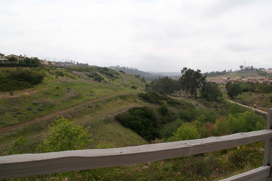
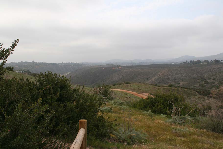
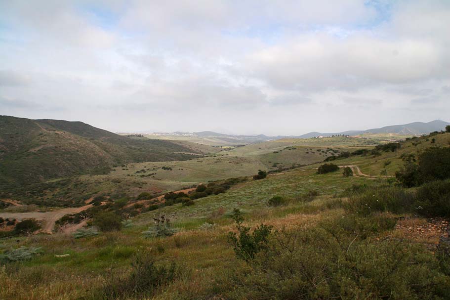
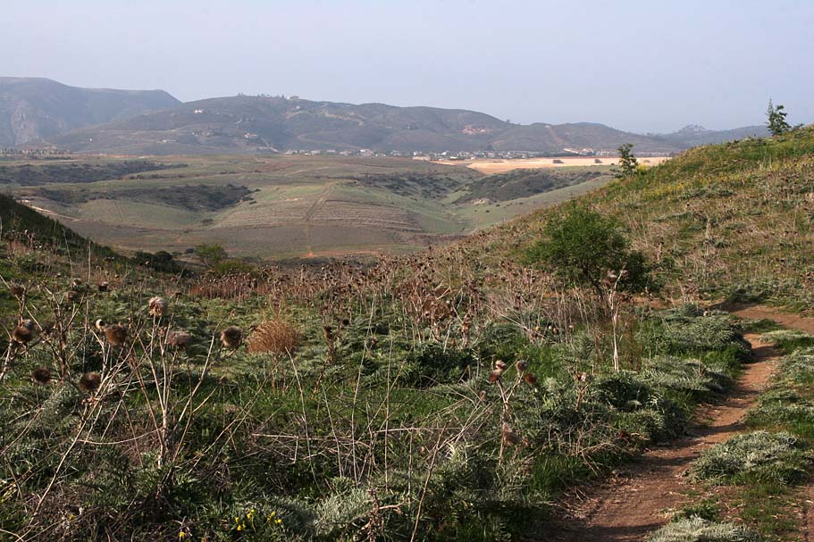
The Santaluz loop located at northwest base Black Mountain and northeast of Penasquitos Canyon has made good use of the dwindling open space in this coastal area of San Diego. This 11-mile loop is almost exclusively comprised of fire/service roads. The half mile of single track on this loop is however pretty nice (And downhill if you follow this route). This loop does go through some pretty open space sections, but the homes are never too far from view which gives most of this place a bit of a utilitarian feel. With that said, I enjoyed this loop and it does give you a descent workout as you will spend most of the first half loosing elevation while you give it all back on the second half of the loop. I am excited about the loop as it is planned to be a connector hub to at least several other riding areas. It already connects to the Black Mountain Open Space Preserve and is easily connected to Del Mar Mesa and Los Penasquitos Canyon. There also plans for a connector to Lake Hodges.
Directions: From SR56 (Ted Williams), exit Black Mountain Road. Go north on Black Mountain Road three miles to Carmel Valley Road and make a right. After about .1 miles, turn left into the Community Center.
|
| Ride Notes: (Mileage starts at the edge of parking lot and the assess road). |
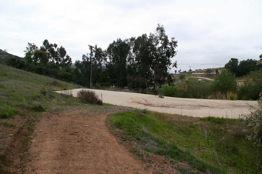
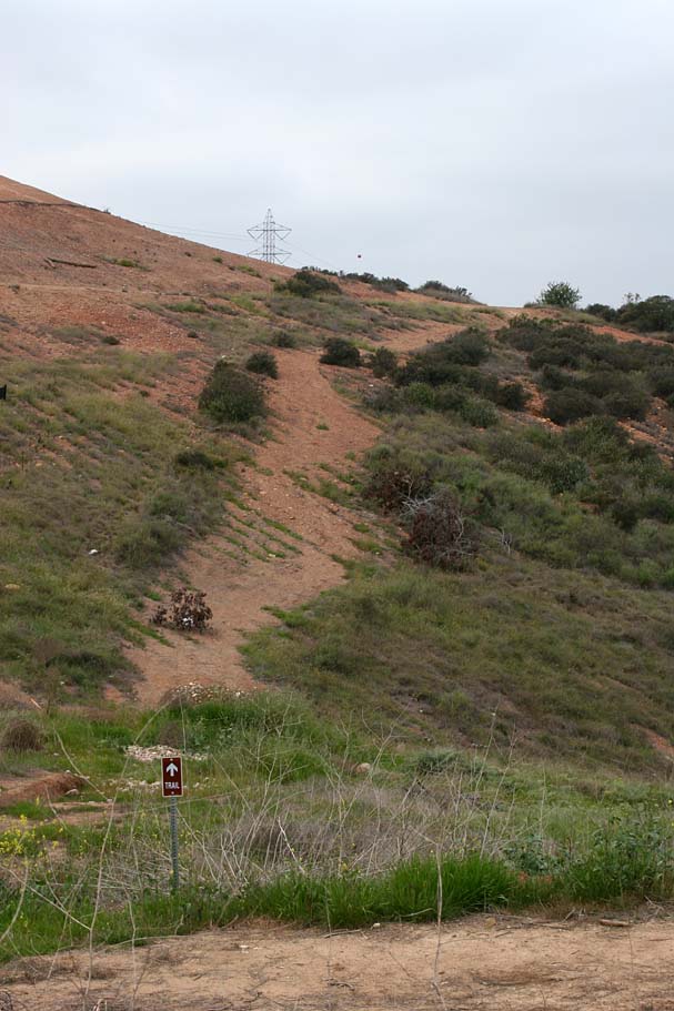
  From
the northeast corner of the parking lot take the access road that follows along the
right-hand edge of the athletic field. Look for the trail kiosk in front of you and
to the left, just beyond some power lines (Picture to the left). Follow the access road to
that that sign (Point A). To the right is a picture of the map at the
kiosk. (Mileage .25) From
the northeast corner of the parking lot take the access road that follows along the
right-hand edge of the athletic field. Look for the trail kiosk in front of you and
to the left, just beyond some power lines (Picture to the left). Follow the access road to
that that sign (Point A). To the right is a picture of the map at the
kiosk. (Mileage .25) |
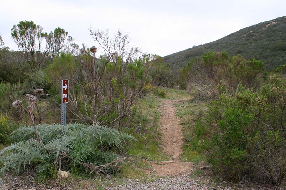  From the sign turn left and
climb up a very gradual bit of double track until at .5 miles (Point B)
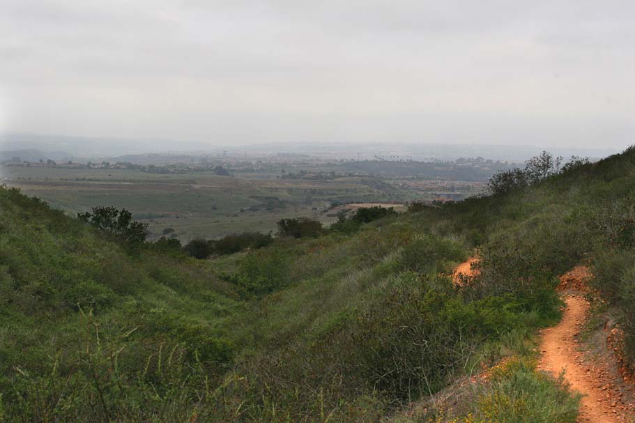
you see a signed single track on your right. Take the single
track enjoy the one-half mile of downhill single track. At 1.0
miles, the single track comes out onto a double track. Turn left
and follow double track as it gradually climbs for a bit before turning
slightly downhill. From the sign turn left and
climb up a very gradual bit of double track until at .5 miles (Point B)
you see a signed single track on your right. Take the single
track enjoy the one-half mile of downhill single track. At 1.0
miles, the single track comes out onto a double track. Turn left
and follow double track as it gradually climbs for a bit before turning
slightly downhill. |
 At
2.5 miles (Point C) you will go by an under crossing on your left (The
road is Camino Del Sur). You will notice there is a trail heading
off towards the underpass. This is a connector to the Del Mar
Mesa/Penasquitos Canyon area. I'll talk more about that at the end
of this page. For this loop stay on the double track
that bends to the right from Point C. At
2.5 miles (Point C) you will go by an under crossing on your left (The
road is Camino Del Sur). You will notice there is a trail heading
off towards the underpass. This is a connector to the Del Mar
Mesa/Penasquitos Canyon area. I'll talk more about that at the end
of this page. For this loop stay on the double track
that bends to the right from Point C. |
 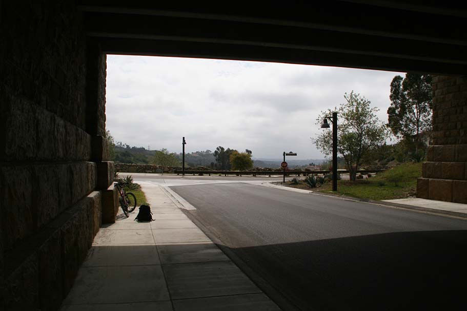 At
2.9 miles the trail pops out onto a surface street where you will see
another under crossing on your left, maybe a 10th of a mile down the
street. Turn left and head that way. After going through the
underpass, you will be at the junction of Caminito Lazanja Street (Point
D). Hang a left. At
2.9 miles the trail pops out onto a surface street where you will see
another under crossing on your left, maybe a 10th of a mile down the
street. Turn left and head that way. After going through the
underpass, you will be at the junction of Caminito Lazanja Street (Point
D). Hang a left. |
|
You will only be riding along the side of Caminito Lazanja for just a little of 1/10th of a mile. Look over to your right and you will see that trail that you will soon pick up on the right side of the road. |
 Once
you make the right and get back on the dirt you will zip downhill for
about .4 miles where you will come out at a concrete culvert
(Point E). Hang a right here and go up another dirt
service road. Your mileage at the culvert should be around 3.6
miles. Once
you make the right and get back on the dirt you will zip downhill for
about .4 miles where you will come out at a concrete culvert
(Point E). Hang a right here and go up another dirt
service road. Your mileage at the culvert should be around 3.6
miles. |
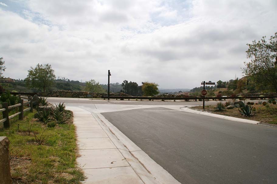
| The dirt service road will soon run into a paved street and my least liked section of this loop. The dreaded DG sidewalk, that many developers here in San Diego County try to pass off as "trails". They are basically about eight feet wide (or more) and are just shy of the smoothness of a sidewalk. The San Ellijo Hills development in north San Diego county is the worst culprit of this type of " trail spin". While the developers tout that they have 17 miles of trails in the area, the "trails" are nearly all this dirt sidewalk crap. Okay, I'm done with my rant. The dirt sidewalk parallels the street on the left side of the road. |
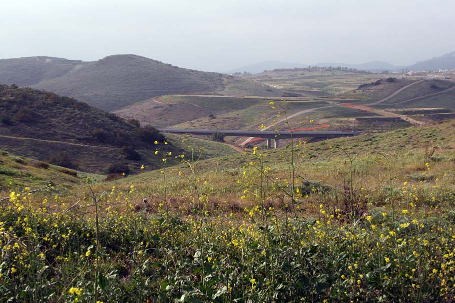
| Around 4.2 miles the street you are paralleling comes to a T-junction. Almost directly across the street you will see dirt path that goes between two developments. Take that path and continue along nearly straight until at 4.5 miles the path takes an abrupt left hand turn. |
  At
4.7 miles (Point F) you will come to the junction of a powerline
access road. Hang a right here and follow the
access road. Over the course of the next mile you are going to
have two steep hills to get up and over. These two hills are not
quite blast up hills, but they are long enough make you get into a
short-term climbing rhythm/grunting. Once you are over the
second hill there is a bit of coasting down to San Dieguito Road at 5.7
miles. Take the trail that bears off to the right and parallels
the road for about .3 miles. You will see a dirt parking lot across
the road. The trail you are on continues this side of
the road, but you will cross the road into that dirt lot. At
4.7 miles (Point F) you will come to the junction of a powerline
access road. Hang a right here and follow the
access road. Over the course of the next mile you are going to
have two steep hills to get up and over. These two hills are not
quite blast up hills, but they are long enough make you get into a
short-term climbing rhythm/grunting. Once you are over the
second hill there is a bit of coasting down to San Dieguito Road at 5.7
miles. Take the trail that bears off to the right and parallels
the road for about .3 miles. You will see a dirt parking lot across
the road. The trail you are on continues this side of
the road, but you will cross the road into that dirt lot. |
|
|
|
|
|
|
|
|
  When
you get to the top the straight trail turn left and go just a little
further to the top of this hill. (Point J) Your mileage should be
around 8.4 miles. You should start having some good views of
Black Mountain to the southeast. When
you get to the top the straight trail turn left and go just a little
further to the top of this hill. (Point J) Your mileage should be
around 8.4 miles. You should start having some good views of
Black Mountain to the southeast. |
 From Point J you should also see a set of power lines between you
and Black Mountain along the top of a ridge. The trail will
eventually work it's way up onto the powerline ridge at Point K (9.2
miles). Once on the ridge you will hang a right and continue
heading up hill and eventually come back to Point A where you
where at in
the beginning this route. Retrace your way back to the parking lot.
You should have done about 10.5 miles From Point J you should also see a set of power lines between you
and Black Mountain along the top of a ridge. The trail will
eventually work it's way up onto the powerline ridge at Point K (9.2
miles). Once on the ridge you will hang a right and continue
heading up hill and eventually come back to Point A where you
where at in
the beginning this route. Retrace your way back to the parking lot.
You should have done about 10.5 miles |
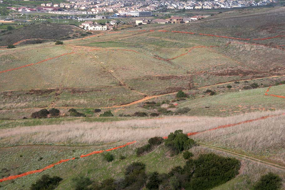
Other Options
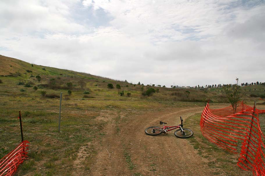
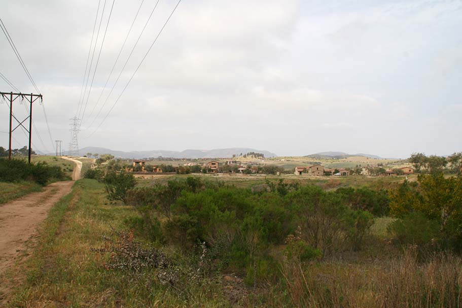
As you ride along the powerline ridge you will have some good views down into the valley below. You will see that there are other ways do this loop. I imagine that some of the other ways are either not fully legit or have an expiration date. Judging from the abundance of the dreaded orange fencing I saw across the valley, I think the expiration date is the more likely answer.

Connectors
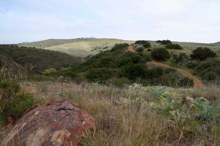
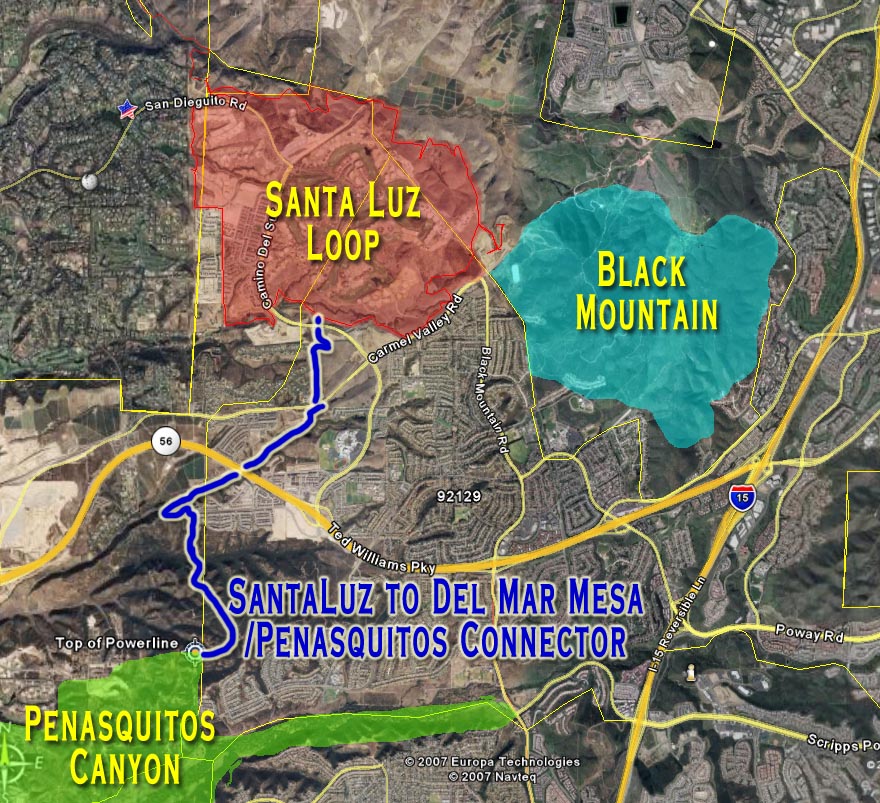 The
most awesome thing about this loop is that it can be used to connect
several areas together for some truly massive amount of miles. Fifty
plus miles is easily doable.
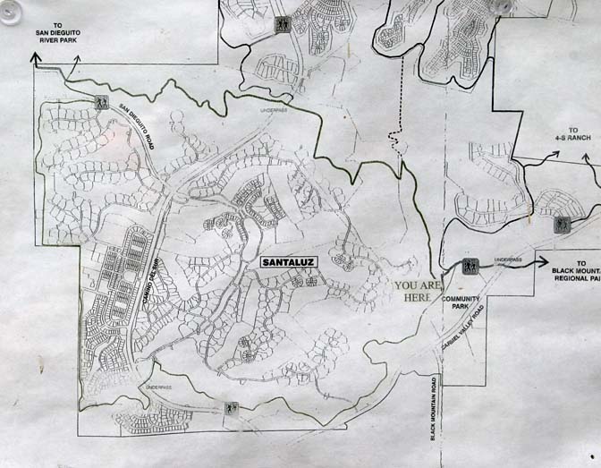
To the left is an overview map of the some the areas that connect with
the Santa Luz Loop. The
most awesome thing about this loop is that it can be used to connect
several areas together for some truly massive amount of miles. Fifty
plus miles is easily doable.
To the left is an overview map of the some the areas that connect with
the Santa Luz Loop. |
||||
Black Mountain:
|
||||
| Del Mar Mesa and Penasquitos Canyon:
(The Del Mar Mesa/Penasquitos page is currently a bit out of date.
I have not been keeping up on the trails that are going a way as a result of
development and the new trails that are being opened.) This connector described here
will get you from the top of the
powerline climb in Penasquitos Canyon to Point C on the Santa Luz
Loop From the Top of the power line climb instead of hanging a left to
stay in the Pensaquitos Canyon area, hang a right. In about 1/10th
of a mile go take the right fork in the road. Take note of the
three Eucalyptus trees ahead of you. Notice they that they are the
only significant sized trees on this entire mesa. They are easily
identifiable and make an excellent visual reference. After the
fork in the road you will follow the road towards the trees.
At another fire road crossing, (.34 miles) bear to your left to stay on
a main fireroad and start putting the trees on your right and behind
you. At .56 miles you will come to another split in the fireroad.
Take the split to the right. |
||||
Note: These directions are for the most direct route across the mesa and Deer Canyon. There are certainly much better ways to meanander your way across the mesa, down into the canyon and out the other side. The best advice I can give here is for you to dedicate some time to exploring the area. |
||||
| Just at you come up to the development, another fireroad will split off to the left. Take it and soon you will be on the edge off a mesa looking down onto some agriculture fields. Bear to the left and follow the fireroad along the top edge of the mesa. At 1.65 miles the fireroad will split again with the right-hand split going sharply downhill. The right-hand split will take you down off the mesa into McGonigle Canyon. As you roll out into the canyon into wide flat canyon bottom you will see a bridge ahead. Keep heading towards that bridge. Your mileage should be about 2.4 miles when you pass under the bridge. | ||||
| The trail is fairly well defined, but there is a least one split, where you will go to the left. It is fairly obvious as one is much more used than the other. At 3.0 miles the trail will start going uphill a bit as it comes out of the creek bottom. At 3.15 miles you should be very close to Carmel Valley road and see an underpass at your 2 o'clock position. The trail gets a little undefined around here. It looks a more defined trails is in the process of being built. Work your way towards the underpass and then go under it. Coming out on the other side follow the path back up to a gravelly service road. Your mileage should be about 3.4 miles. Follow this service road until at 3.8 miles you will see two important things: (A) The underpass mentioned at Point C in the Santa Luz loop description above, and (B) a faint singletrack coming off of the service road (to your left) and heading straight for the underpass. This singletrack is also located right where the service road bends away from the underpass sharply to the right. (Don't worry if you miss the singletrack as the service road will work right to the underpass as well but in a longer manner.) | ||||
| Take the singletrack and go under the bridge and hook up with the Santa Luz Loop. |