
Porcupine Rim - Moab
Route Notes: The goal was to do the Whole Encilada. However there was still plenty of snow up in the La Sal Mountains so we had to start lower down at the Upper Procupine Singletrack. You should check in with the local bike shops and shuttle companies to find out what your options are for the current conditions. Here is the route we did on this ride that includes the pavment back into town.![]()
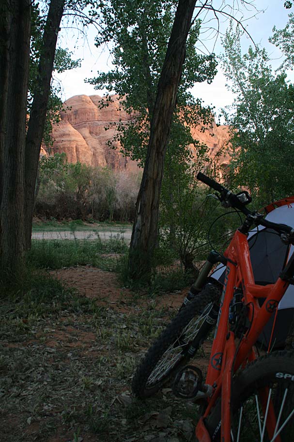
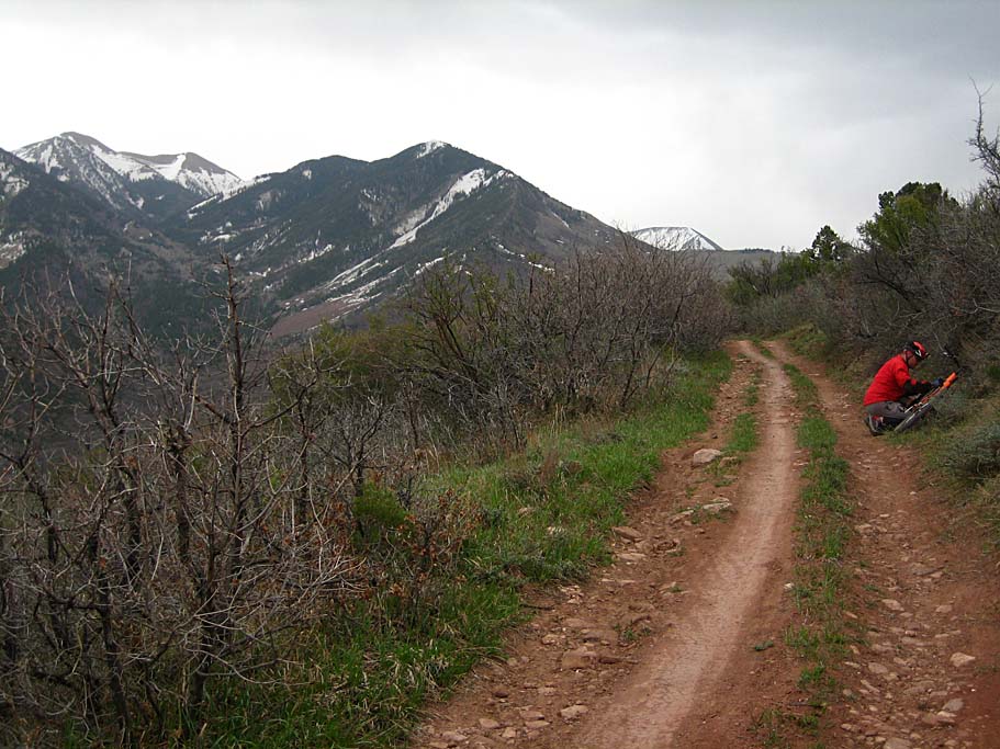
The great brews and really great 12 yr old whiskey we had around the campfire last night made for a bit of sluggish start this morning. Campsite coffee always seems to taste mighty fine to me, and I wasted no time getting a pot going this morning. While making pancakes on my trusty Coleman stove (which I am unable to recall when it last say a through cleaning) we both noticed that a few clouds were out today. While mowing down our pancakes, Bill suggested that we put on the rainflys. This would turnout to be a really great idea. After breafast and some bike tinkering, we were at the Poison Spider Bike Shop in plenty of time to catch the 10AM shuttle.

There were 13 of us in the shuttle van for the 40 minute trip. Not everyone fully appreciated my recounting the great dinner of hardboiled eggs and cabbage from the night before (totally fictitious of course). It did however spark a "I'll one-up that dinner" competition that got pretty darn creative. Before long we were up on the La Sal Mountain loop road at 8,319 feet. We were dropped at the viewpoint near Mason Draw campground which is close where the Hazard and Kokopellis trail come out onto the road. This is well above the traditional described Porcupine Rim trail. It is worth noting that you should check with your shuttle service as they maybe able to take you even further up into the mountains, weather, road conditions and snow levels permitting.
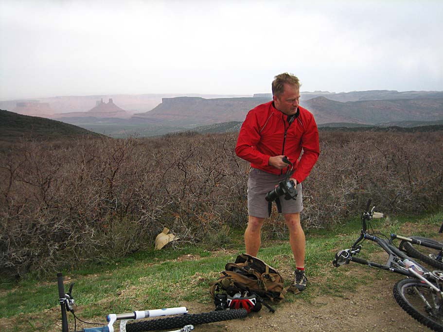

It was quite cold and windy at our drop spot. I had brought a long sleeve jersey, vest, and a windbreaker. I had not brought my warmers. Luckily I had some plastic courage strapped to my pack that would pull duty as warmers. We did not spend much time messing around at the dropoff spot before hitting the Kokopellis trail that was nearby. The opening bit of the trail is downhill doubletrack that is a real ripper. You could tell this road would be a horrific mess when wet due to the deep ruts that were obviously caused by truck tires digging way down in during wet conditions. Our shuttle driver told us of a split in the road about a mile down. I noticed the split, but taking the right fork was completely obvious as there is a smooth singletrack line down the road from the repeated bike traffic. A little further down the road is a spur off to the right and downhill sharply. Once again the well worn line in the doubletrack should key you in on not taking that spur.

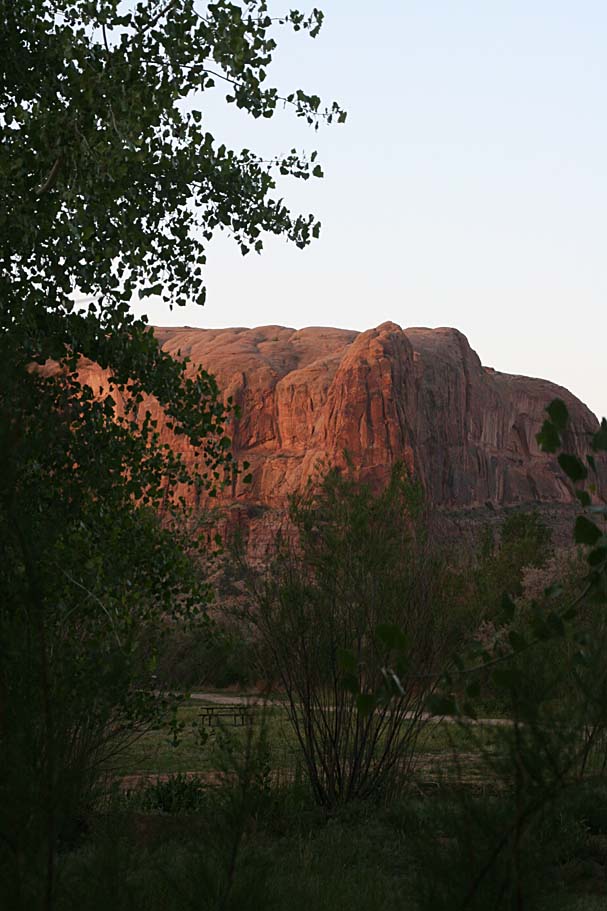
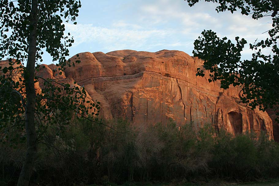
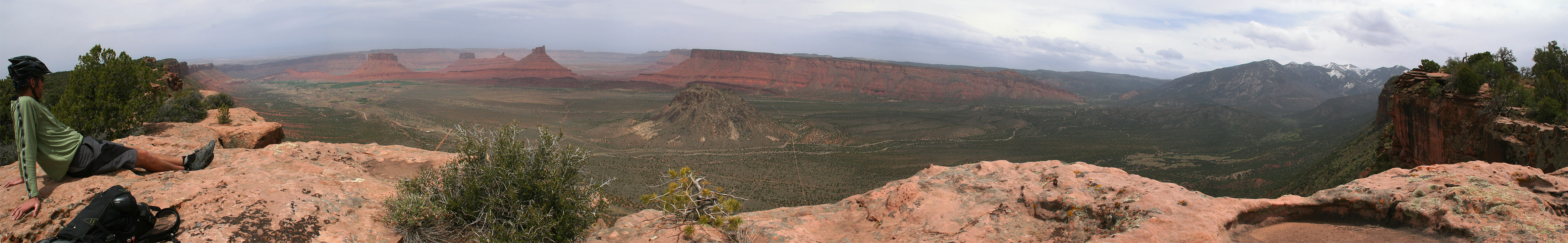
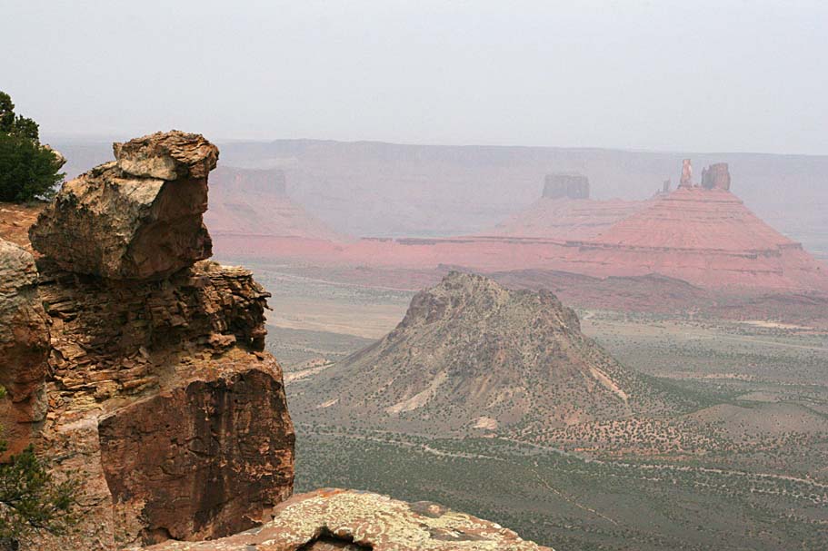
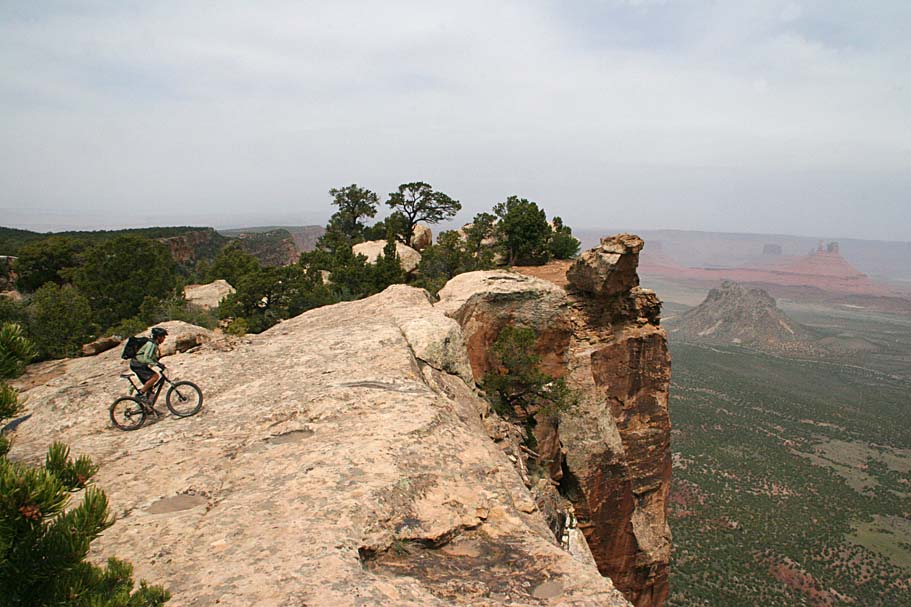
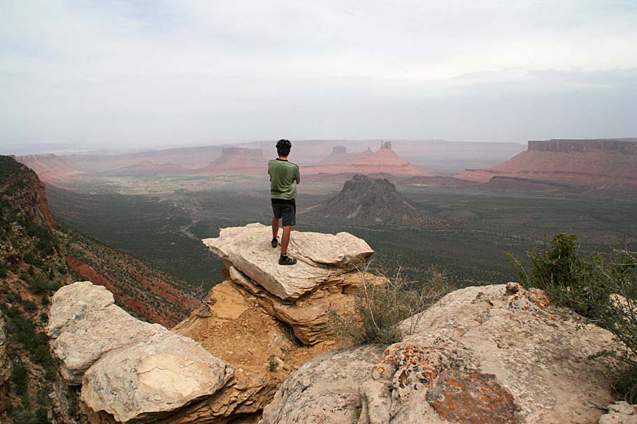
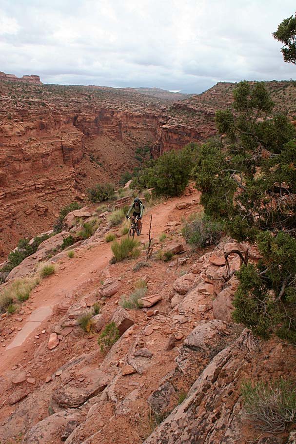
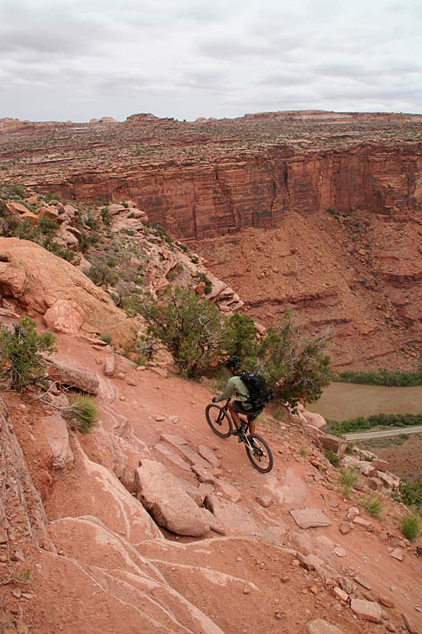
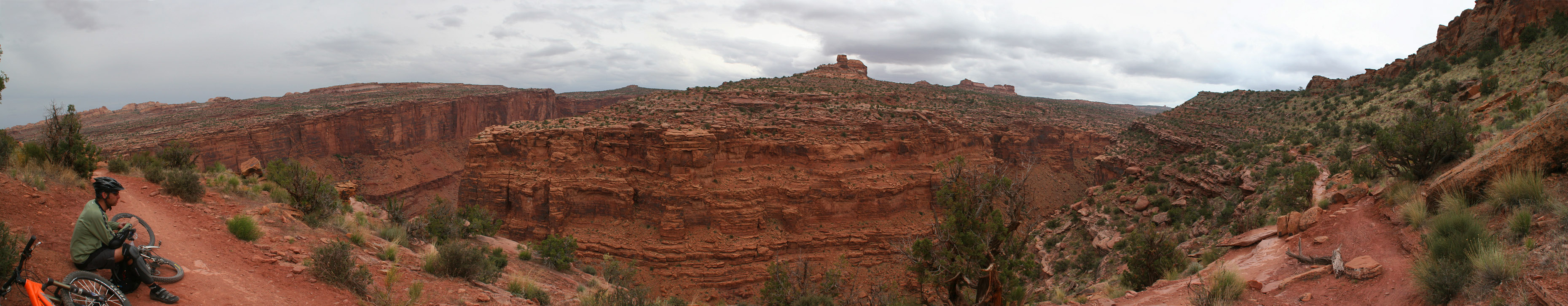
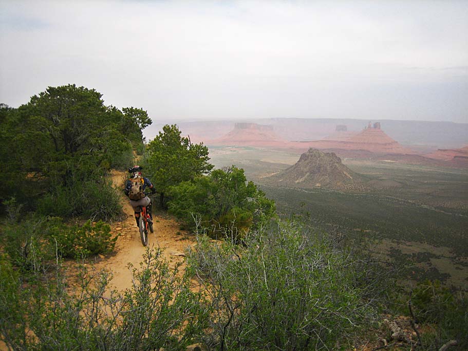
The Kokopellis trail goes along the upper end of Castle Valley known as Porcupine Draw for a ways where the first increasingly impressive views start occurring. After a bit of riding with a view the trail turns away from the rim. Pay attention in this area. There is a real treat around here that you will not find on the maps just yet. Just as you come into a small open area you will cross a smallish cattle guard/grate that is different from most that you see. Immediately after crossing the grate, look for a small singletrack heading off to the right towards the rim. Also if you look up the doubletrack you will see that it turns uphill and into the trees. Also there is a post about 30 yards up the road with a really tall sign with "UPS" on it. The most obvious tracks will take you straight out to the rim for another view of the upper end of Castle Valley . However, pay attention to the tracks that split off to the left just before the rim. This is the Upper Porcupine Singletrack.

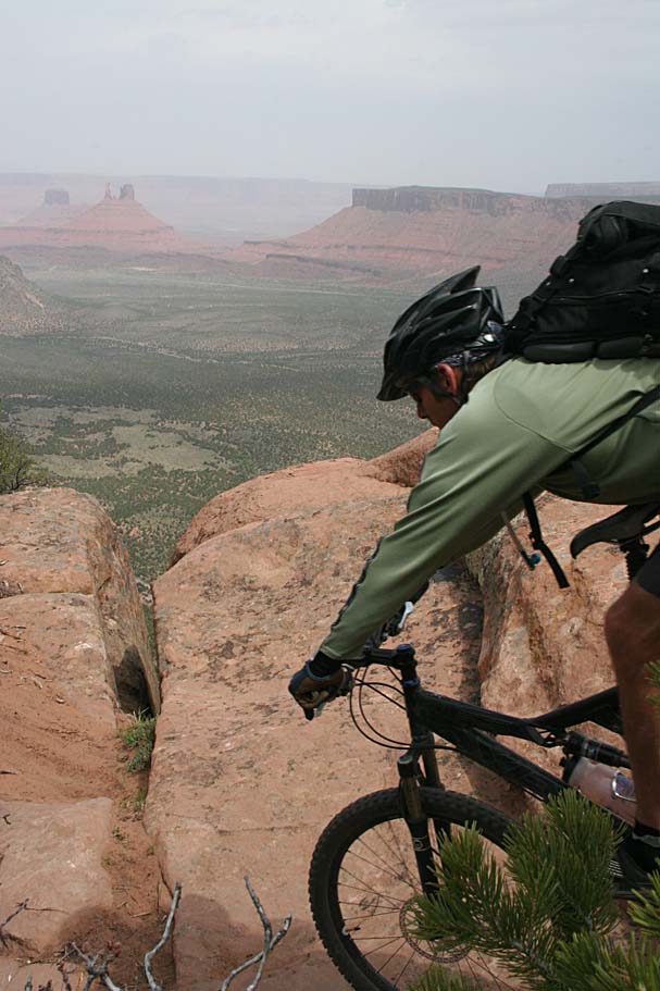


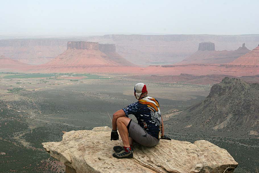
From what the folks in town told me, the reason this trail is not on the map yet is because it goes a little too close to some raptor nesting areas so the forest service wants to reroute a portion of this trail before putting it on the maps. When you get into town, check with the local bike shops to get the latest information on access to the UPS. One thing is certainly true, UPS delivers. This singletrack has some of the best views from along the Porcupine Rim that I saw along the entire route. The trail had a fantastic mix of flow, technical features, and rim-side mind blowing views. It was also pretty cool that most of the time this was a downhill affair.
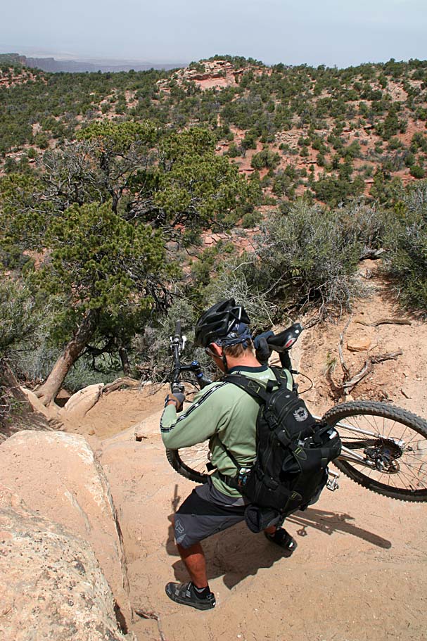
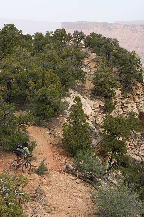
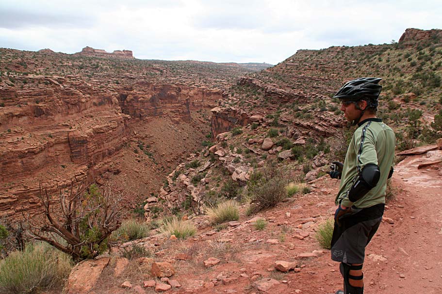
The UPS runs right into the Lower Porcupine Singletrack that is marked on the maps. It is no mistake that this also coincides where the land moves from Forest Service to BLM management. Land management aside, the fun just keeps continuing. There is one spot called “The Notch” which is a sketchy non-exposed steep hike-a-bike downhill which will certainly test the gripping power of your riding shoes. On that note, it is a good idea to leave your racer style riding shoes back at camp in favor for something with a bit more of a sole to it that will grip better on the slickrock or rocks in general. This is a good idea for all of Moab, not just Porcupine Rim. After the notch is a wee bit of climbing before you get back out onto the rim.


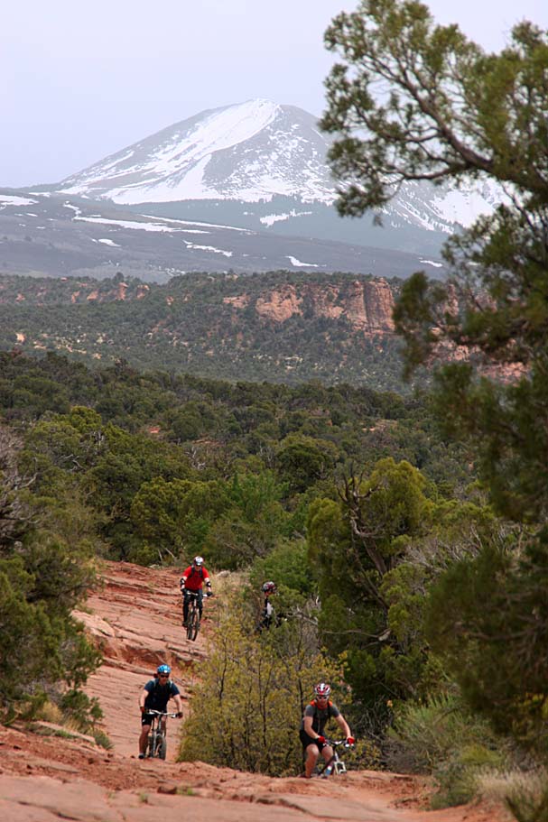
You will know when you get to the traditional Porcupine Rim Trail when you come out onto a large rocky area along the rim next to a doubletrack. From here you will take the doubletrack mostly downhill (turning to your right as you come off the large rocky area) for 10.3 miles. While there are lots of spurs here and there along the route, followed the well trammeled track will keep you going in the right direction. It is pretty well marked so getting lost should not be a problem, particularly if you have a map.


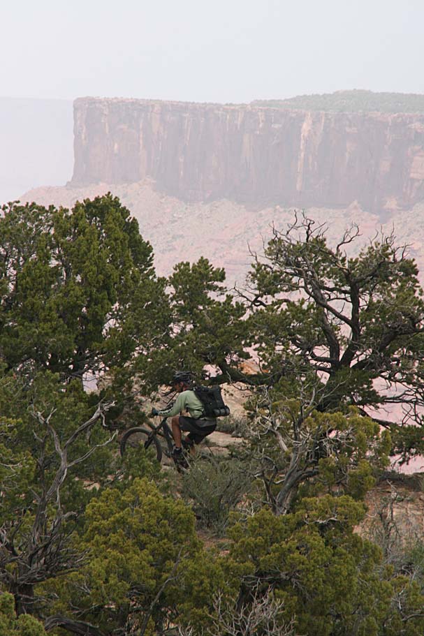
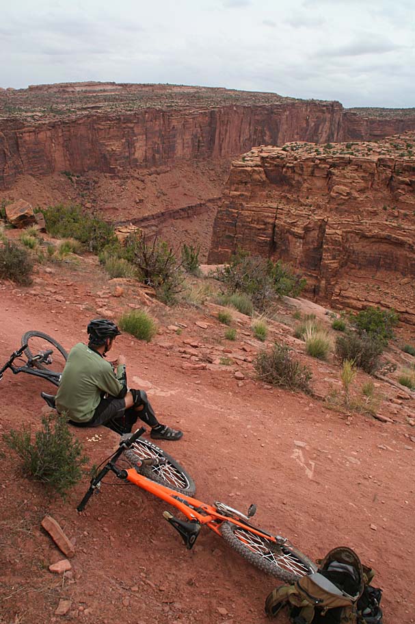
This is some pretty darn cool doubletrack. While it is not as abusive as Amasa Back from the day before, it will certainly throw plenty of rocks, ledges, drop options, and jackhammering rock gardens to keep your technical game on. This is certainly not a doubletrack cruiser track. Let up on your attention you could find yourself in a world of pain.
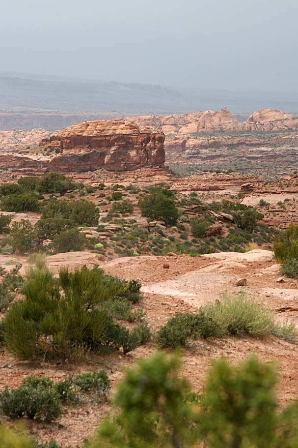
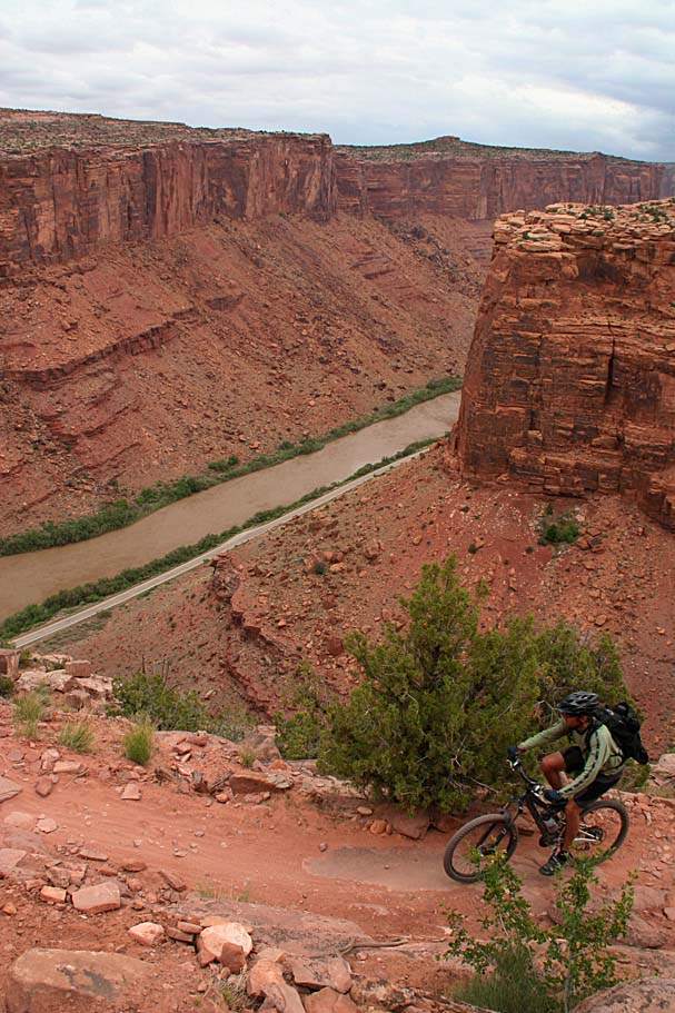
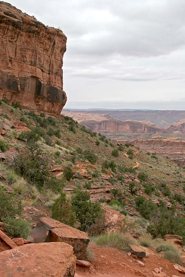
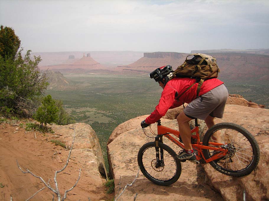
The doubletrack ends at the border of the Negro Bill Canyon Wilderness Study Area near the upper end of Jackass Canyon . The singletrack from here is really killer as it works its way along a shelf above Jackass Canyon . The views are pretty cool above this box canyon, especially as you near the end of the canyon where it joins with the Colorado Riverway. There are some exposed sections where you can look down at the river and highway 128. These exposed sections are combined with some technical features that will have prudent people putting a foot down. The penalty for failure in these couple of spots can be extreme to lethal.
 Jackass Canyon
After getting around the corner, the trail starts a gradual but technical descent off the mesa that it is just a ton of fun for those who like slower technical moves. There are plenty of zipping sections as well. There is a one spot that will be a portage for nearly all riders, but there is a line. Before long the trail makes it way out to highway 128, where you take a tunnel under the highway into the trail tail parking area. From here we took the road back into town. You most likely have noticed that the pictures from this day have varied a great deal from partially sunny to a quite drab overcast. The clouds had been growing darker as the day went on and as we were pedaling on the road a few drops where falling here and there. We had just gotten back to my truck and loaded up when the skies broke loose and it started to downpour. The route we did today was in the neighborhood of 24 miles and it surpassed all facets of my expectations with the inclusion of the Upper Porcupine Singletrack.
We snagged some grub and recounted our days conquests at the Moab brewery before heading over to a coffee/bookstore. It sounded like a better idea that setting in our tents at camp during the rain. While enjoying my coffee I noticed the people on the now semi-crowded streets of Moab looked to be the most dejected group of lost souls looking for something to do I had ever seen. The four-wheelers, hikers, bikers, rock hounds and all other manner of tourist just simply did not know what to do with themselves. They had come to Moab to do something really cool outdoors and the rain was really missing with those plans. I could not help but share my thoughts with the other shop patrons and we all got some chuckles while dejected people watching.

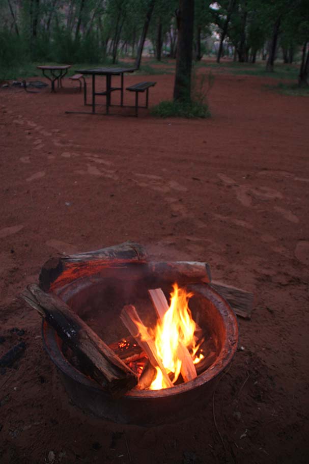
After coffee, we headed over to a bike shop to get some information on what would be a good post-rain day ride around Moab. Poison Spider Mesa was high on the list if the rained stopped soon, a breeze picked up and we waited until mid-morning or so. On our drive back out to the campsite the rain stopped so we kept our fingers crossed for tomorrow. Back at camp we managed to massage a campfire into action while tested a few of our cold beverages to ensure their flavors had survived the storm. After we were throughly satisfied that the contents of our cooler were still okay, we crashed for the night.
Here is the video from this ride. A good chunk of the footage is from the Upper Porcupine Single which starts well above the traditional listed route. The trail status may change in the future so check with the shops in town before checking it out. Right-click on the image to download the video that is 8 minute that is 109MB in size.
Onto the First Ride of Day Four, Poison Spider Mesa and the Portal Trail