
Santiago Truck Trail and The Luge
The Santiago Truck Trail and the Luge trail are on the western flanks of the Santa Ana Mountain above the communities of Lake Forest and Portola Hills. They offer some good mountain biking with plenty of climbing to get the lungs working as well some bermy downhill goodness to put and ear-to-ear grin on your face. This is a super fun 7.6 mile loop with a good pay-to-play factor on its own, but these trails provide a means to make some massive loops using trails both higher up in the mountains as well as down in suburba below.
Santiago - Luge Loop (7.6mi, 1,400'⬆)
Whiting Ranch Santiago Luge Loop (14mi, 2,000'⬆)
Harding - Joplin - Santiago - Luge (27mi, 4,700'⬆)
- Santiago Canyon Rd near Modjeska Grade Rd: This is about as close to the bottom of the Santiago Truck Trail as you can reliably park. Parking here means you finish with a climb.

- Cooks Corner: This owners of Cook's Corner let trail users park in the very back of their lot for free. Return the favor with a tasty beverage and/or grub at their place after the ride.
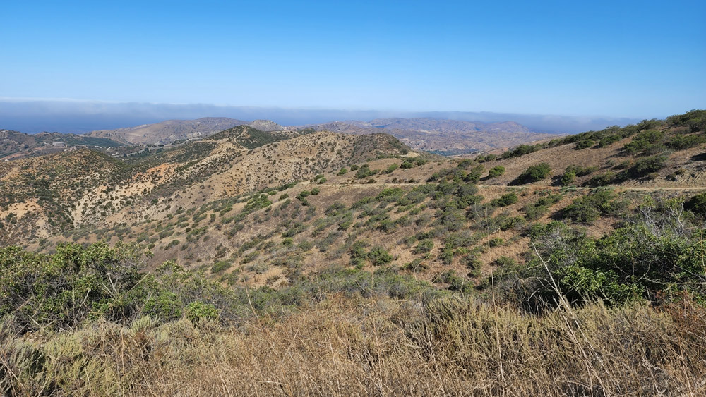
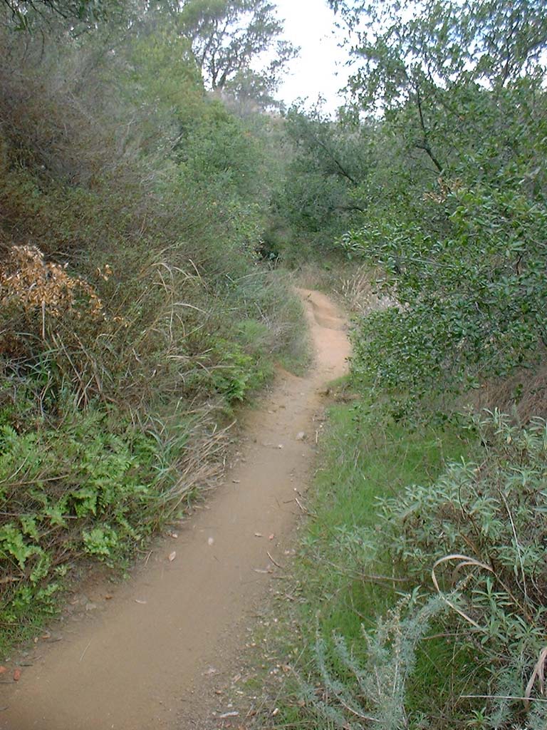
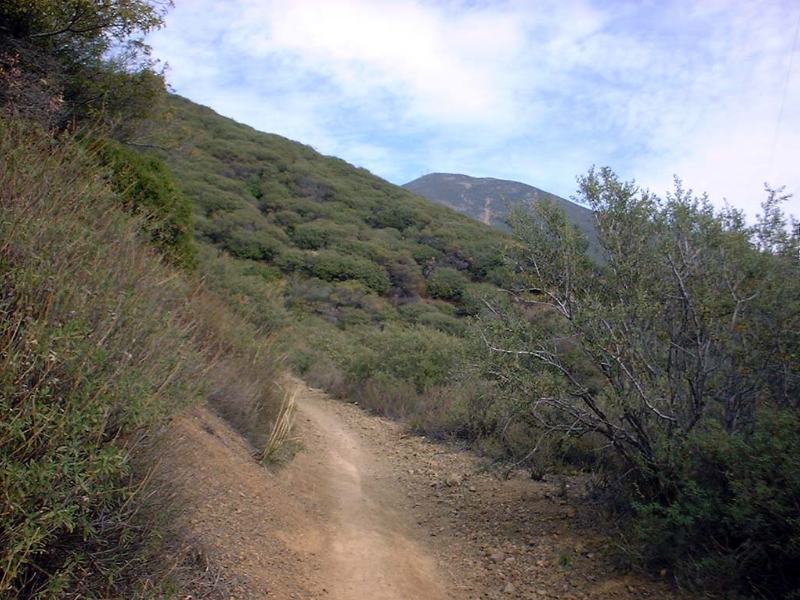
Parking: If you doing doing the base loop, you need to decide wither you want to finsih with a climb or a descent. The in the pullout on Santiago Canyon Road near Mojeska Grade road will get you onto the Santiago Truck the the quickest but if you the The Luge you will have to finish the ride off with a bit of pavment climbing. One of the ride variations folks do and Out and Back all the way to Old Camp on the Santiago Truck Trail not doing The Luge at all. This upper parking spot is the way to go for that. For the base loop I would park at Cook's Corner and get your warm up in before you hit the truck trail. If you are doing a combo ride with Whiting Ranch, use the parking recommended for that area. andThe top of this trail is known as four corners and it has a trail map on a display board as well as a water fountain. From this point we proceeded left and followed the fire road to a gate on Santiago Canyon Road at 3.0 miles. We hung a right and went down the road for maybe a 1/4 of a mile where we hung a left on Modjeska Road. We climbed up that paved road for about 1/2 mile and then peeled off the paved road onto Santiago Truck trail. We were now in the Cleveland National Forest. The truck trail has long since become single track. This is where the meat of the climb starts. The climb goes on for about 2 3/4 miles as you work your way up the trail.
Ride Report: Some of these photos are from the way back machine, AKA 2001 which predates the start of this site which happened in 2002. I have left most of the old-skool photos on this page for reference on how things have changed. In support of fire fighting efforts a handful of years ago most of the Santiago Truck Trail up to The Luge was graded to allow equipment to access the forest. It will eventually narrow back down to something like what it was when I first started riding here.

I have rarely done the base route of just Santiago Truck Trail and The Luge which is just under eight miles. Living in San Diego this is a bit of a drive for me so I am looking for a larger outing when I do come up. The Whiting Ranch and Luge Loop is the starting point for me. Doing the base loop and adding an out and back on the Upper Santiago Truck Trail is a nice option as well. If you are looking to go big, you can do the Harding Truck Trail, Joplin and Luge Loop. I am going to describe the base route and point out a few pictures at where the tie-ins are for Whiting Ranch.
The upper parking area is also near where you would be coming out from Whiting Ranch to combine the two loops. You are will do a short (maybe half a mile) but sometimes painful climb (particularly if you are not warmed up) up to the Santiago Truck Trail. Once you hit the dirt you are in the Cleveland National Forest. The truck trail had been semi-reclaimed as a single track but in 2020 the Forest Service graded the old road bed to allow for fire fighting trucks and equipment to access the mountain as well as create a fire break.
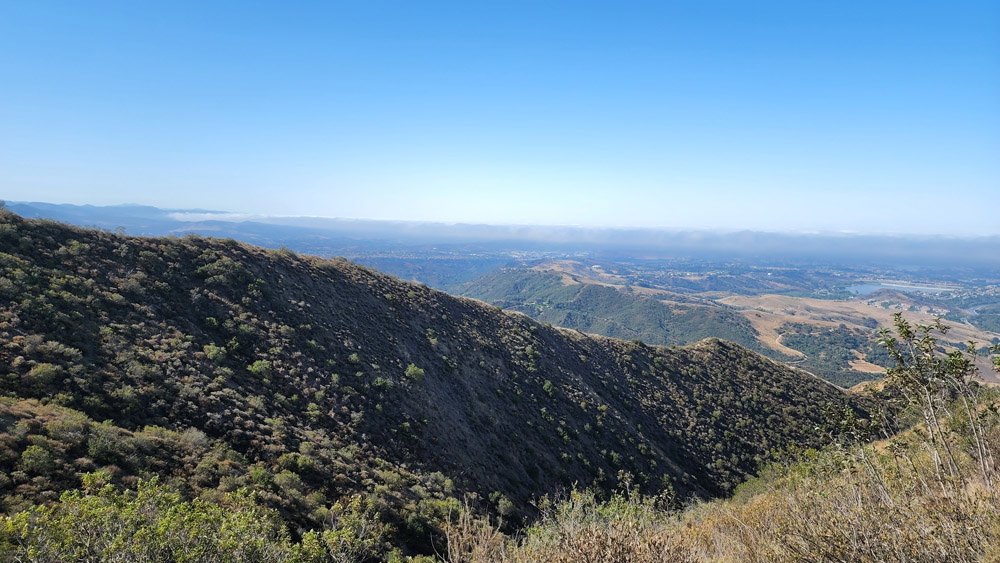
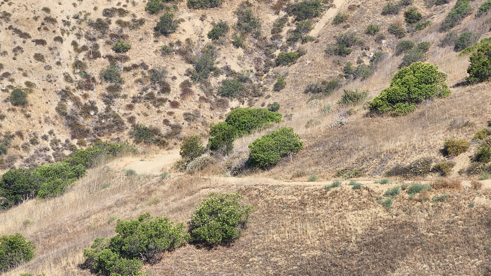
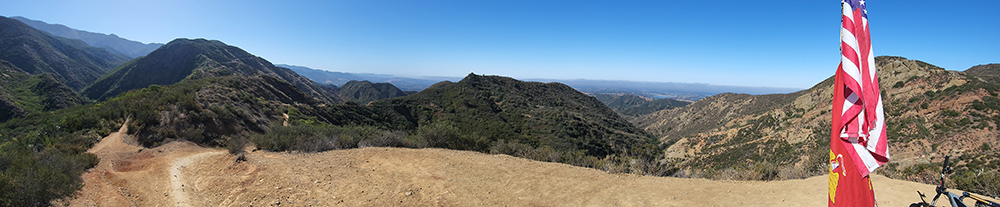
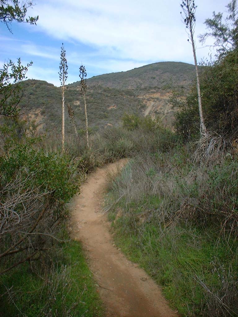
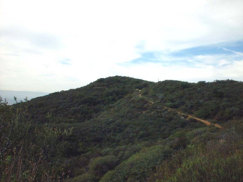
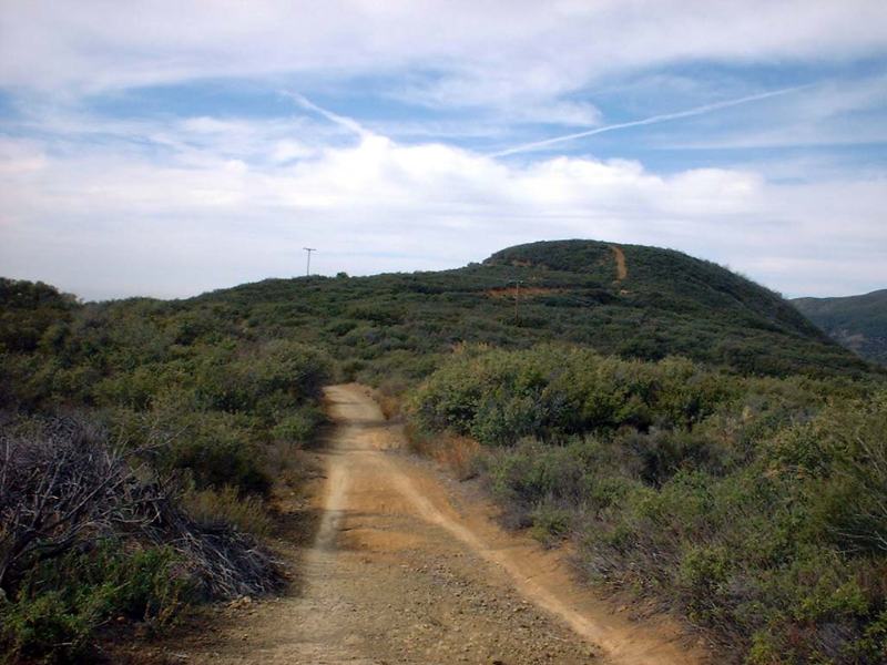
The first mile and change are fairly mellow and then meat of the climb starts as the grade kicks up is where the meat of the climb starts. The climb is not unrelenting with the occasion grade reversal as work your way onward. At 2.6 miles on truck trail you peak out and start descending. About a 1/4th of a mile past the peak you get to the end of the firebreak and trail returns to back to nearly singletrack. A little under half a mile later you arrive at the junction with The Luge marked with flag pole and Old Glory.

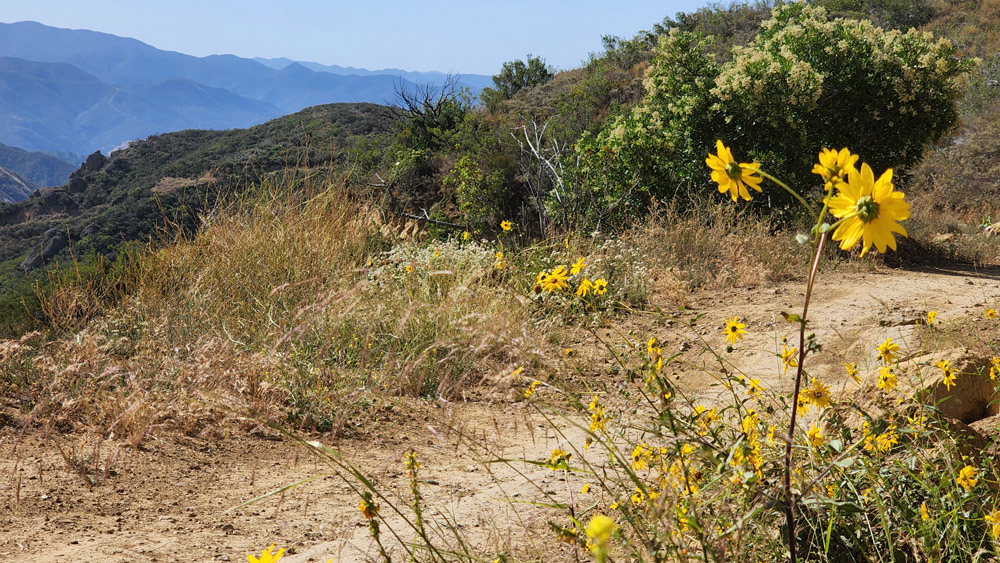
From this point you have a nice speedy downhill for about 1/2 mile down to the "The Luge". During my first ride here everyone in the group told me that whatever I did, stay on the left side of the trail about 30 yards down the trail because of a seriously nasty drop right off the trail that will land you in the house of pain if you went down that way. Well I stayed left and only got a glimpse of the drop in my peripheral vision. I was seriously following the old rule of looking where you want to go not where you don't. It is still sound advice these days
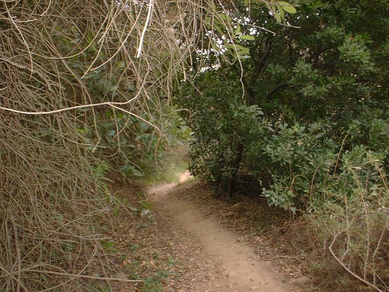
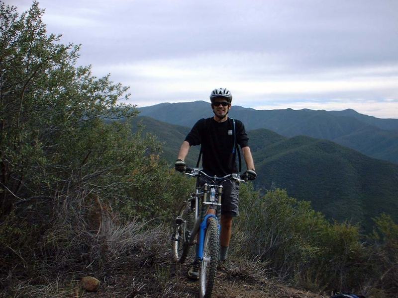
 Top of The Luge
This video is of one of the larger loops you can do using these trails. It features The Upper Santiago Truck Trail and The Luge starting at 8:50
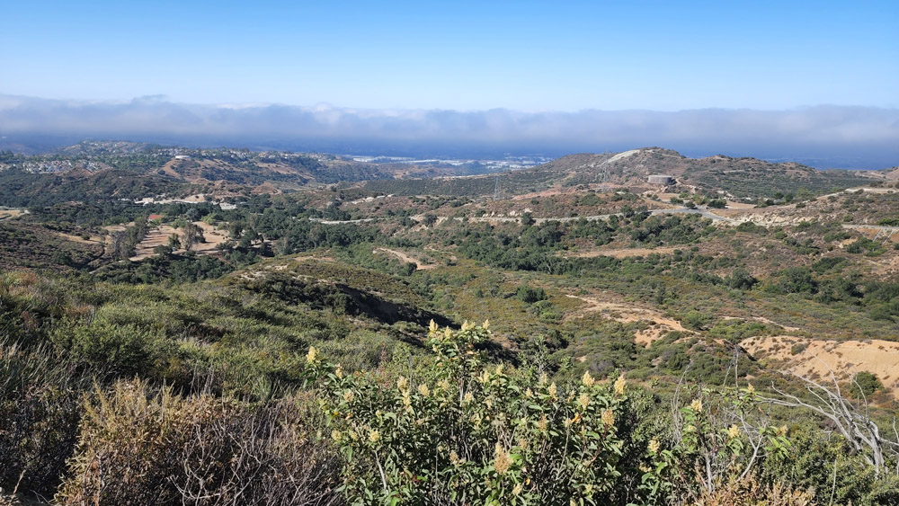
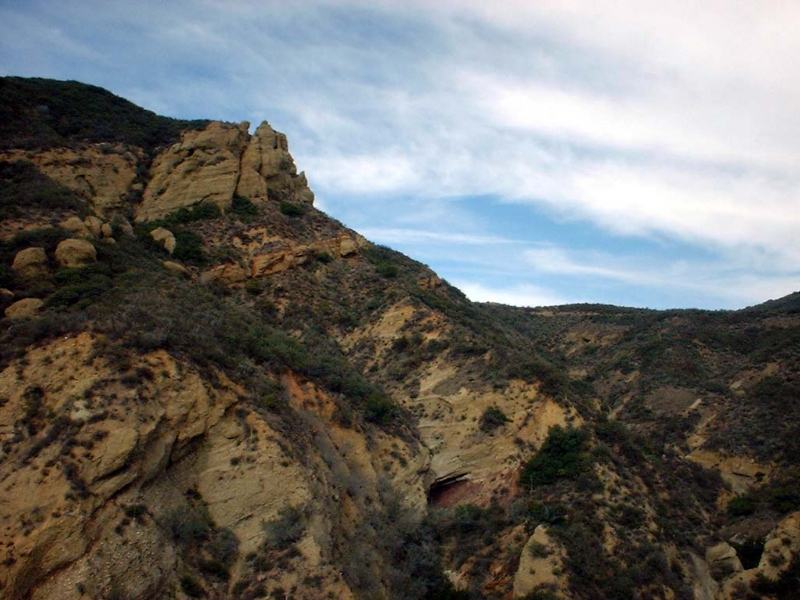
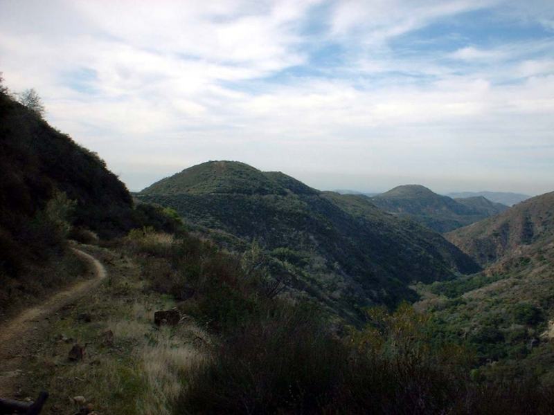
Some views of the area in 2001
Back in "The Day" The Luge was a rutted but rideable single track that was often a mess. It has seen some loving over the years and it currently resembles a "modern" MTB trail that is bermy and mostly smooth over most it length with some small rock drops here and there. The trail cashes outs over 600 feet of your elevation chips you earned on the climb in a just over a half a mile. There is plenty of vegetation on your sides and most of the time on the lower half you have a wispy canopy overhead. Of course you maybe be too busy using body English and your brakes to see much of it. The first time I rode this trail my hands had big time brake cramps and my thighs were burning from keeping my butt off the saddle, but my adrenaline meter was pegged so life was good! I'm a bit more judicous with the brakes these day and I have yet to do a run down this trail where my fun-o-meter was not pegged.

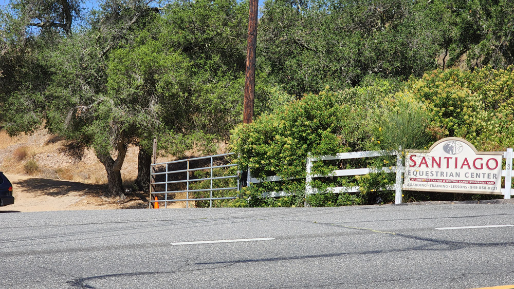
After the trail bottoms out you will have a just a little bit of climbing and a little bit more single tracking until you come out onto some old pavement where you will bear to the left and do a little more of a climb before you come out Live Oak Canyon road. Hang a right and roll down th epaved road for one mile to Cook's Corner. If you started here, You Are Done! If you did not then hang a right onto Santiago Canyon and start a gentle climb on the paved road back up to the upper park spot. If you are doing the Whiting - Luge loop, hang a left onto Santiago Ranch Road (It is a dirt farm road) located at the entrance to Santiago Equestrian Center. You will see a dirt road the goes to the right of a barn, take that and climb up to the junction of Vulture View Trail. Then proceed on the rest of the Whiting Ranch Loop.
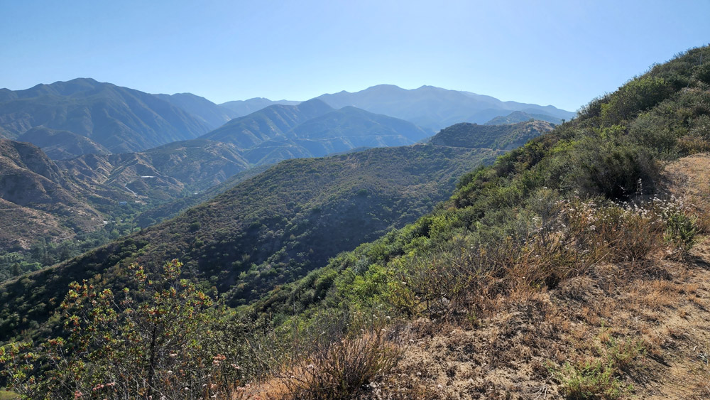
Upper Santiago Truck Trail - Old Camp Variation
Old Camp Ride Variation:
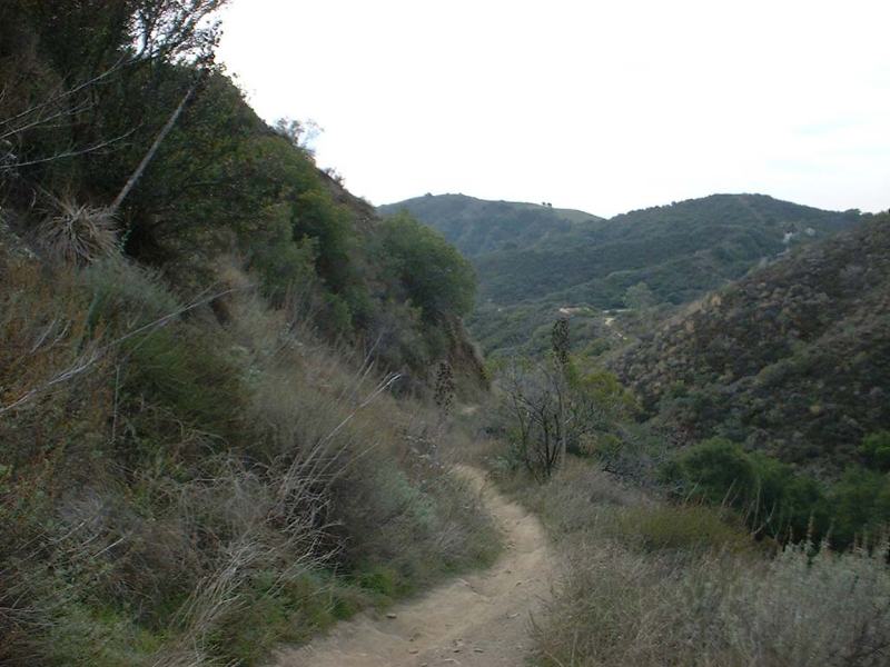
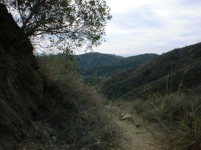
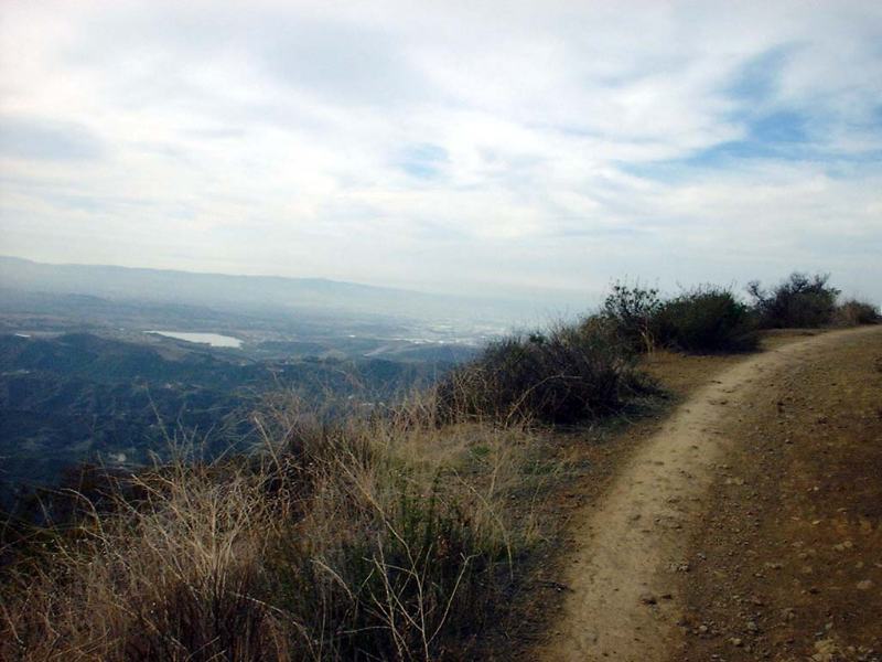
When you get to the junction with The Luge, instead of veering off to the right and going down it continue on straight up the trail. There is some debate over where Santiago ends and where Joplin begins. A few miles past the luge you pass where the lower part of Joplin trail drops off the right. The rest of the trail up is the debatable section. Either way you have some good climbing ahead of you. come out to a large open area at a highpoint. The trail that continues north and downhill is the Joplin trail. This is a good spot to turn around and head back down to the Luge.
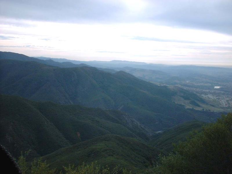

These pictures where taken on the way back down the Santiago truck trail back to the Luge.


Some more views of Santiago Truck Trail from back in the day.