Mountain Bike Bill, The Dirt on the Dirt

Killer Weekend in Hurricane Utah

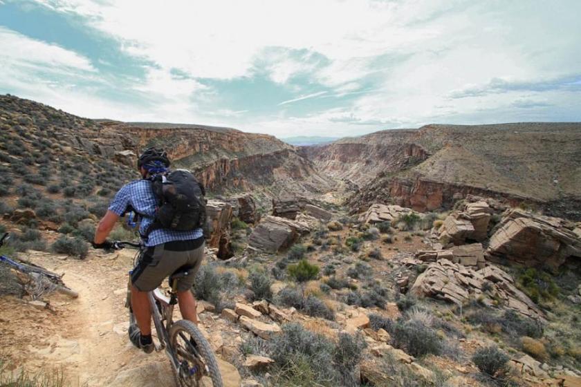
I have a mountain of pictures to sort through from this past weekend of camping and riding near Hurricane Utah. Here are a few I’m working on.

Utah-Gooseberry-29MAR13-15

Friday we drove from Socal to Gooseberry Mesa where we setup camp and got in an near sunset ride out on the North Rim Trail.

Utah-HurricaneCliffs-30MAR13-36

Saturday we did the Hurricane Cliffs Trail System Loop of Goulds Rim, JEM and the Huricane Rim Trail

Utah-HurricaneCliffs-30MAR13-27

It was a great loop of about 21.5 miles in length and with a surprisingly sizable amount of climbing.   We had plans for a late afteroon ride on Gooseberry as well but ending up enjoying tasty beers at camp instead.

Utah-LittleCreek-31MAR13-95

Sunday we went over to Little Creek Mesa.   I had only ridden the Main Loop on a previous trip so we had plans to hit up some of the other goods out there.   We ended up doing the main loop and then getting out ot the North Point.

Utah-LittleCreek-31MAR13-08

After the North Point we worked our way over to the Magic Carpet Ride trail to get back to the trailhead.   We had plans to hit up a bit of Gooseberry before sunset but tasty beverages and semi-done legs dicated chilling at camp.

Utah-Gooseberry-01APR13-115

Monday morning we got fairly early, grabbed some breakfast and headed out from camp.

Utah-Gooseberry-01APR13-120

We hit up the South Rim trail

Utah-Gooseberry-01APR13-158

As well as the Hidden Canyon trail in both directions.   I finished up the ride with nothing left in the tank and the legs completely shot.    A great way to finish off a long weekend of riding.   We soon had packed up camp and were making our way back to SoCal.    More to follow….

Snooping around South Poway

This past Friday, I went and checked out a loop in South Poway that I had heard about that contained a mix of city approved/created trails and social trails.   I really did not have much in the way of expectations when I set out on this semi-urban adventure.

SouthPoway-24MAR13-06

The first chunks of “trails” that I went on were what I typcially expect when I hear of a municipality in San Diego county being involved with creating  “Trails”.    Dirt sidewalks and bullshit existing dirt roads trying to be passed off as “trails” which provide little in the way of a quality natural outdoor experience.    After six or so miles of the this homgenized lowest common demominator tripe things picked up as I went further along on this loop.

SouthPoway-24MAR13-09

Here is a bit of an official new city of Poway trail that is a  nice singletrack.   Clearly somebody gets it in the city as it provides a nice natural outdoor experience, its sustainable and it is narrow to minimize the enviromental impact.

SouthPoway-24MAR13-14

The next section of trails I was on roughly followed the route of the planned eastern end of the South Poway trail.

og:image

According to the current city trail map the eastern end is still just planned.   I sure hope the intent is to use this trail pictured above as the eastern end of the of the South Poway trail because the trail above  it is just an awesome chunk of cross country singletrack that had great flow and contoured well.

SouthPoway-24MAR13-32

Once I got onto the “built” western portion of the South Poway trail, I was once again back onto the crappy “THIS IS NOT A F#$^^NG TRAIL”  dirt road junk.  Note in the picture above only about half the width of the road being passed off as trail is in the picture.   It is a wide barren strip of non-native gravel that is an enviromental blight that the city probably spent hundreds of thousands of dollars to “create”.    Everytime I have pulled the string on the  “who designed this”  question,  it seems to typically point back to some trail standard the governing agency has that was written by people who have a background in civil engineering (aka building roads) vice either an enviromental or forestry background (aka protecting and managing natural resources).     People (or contracted companies by the city) then blindly follow these antiquated standards to build these low quality, expensive hunks of crap.

SouthPoway-24MAR13-30

This little gem (which I think is not an offical trail), was probably built by volunteers and did not cost the city a dime.   Its enviromental impact is a mere fraction of the offical dirt road tripe that scours along the ridgeline above it.     The rest of the route I did during the day was a mix of both the offical junk “trails” and a fair amount of  well done social trails.    Overall the awesomeness of the singletracks outweighed the retardness of the dirt/gravel road abortions (referred to as “trails”  by the city) that had to be dealt with.   I did about 15 miles total that day.  I will be doing some more exploring out here.

Views from Anderson

Last week I was able to get in a mid-week ride out at Anderson Truck Trail.   I arrived quite a bit earlier than Steve today so I decided to do the climb solo and check out a few things on my way up.

og:image

Spring is just downright awesome and it was quite green out.   Being solo there was no pressure to keep moving so I stopped here and there to take pictures and snoop around.

The first stop was just after the brook/creek crossing.   This is normally dry during the summer but there has been plenty of water moving through it as of late.   I could here the sound of water going over rocks uphil of the crossing so I did some scrambling to find a nice looking micro-waterfall.

Plenty of flowers in bloom to see along the climb up.

The greenage on the hillsides around El Captain Reservor was really pretty.

I meet up with Steve and Evan up near the top.     With this being the first week of coming off of daylight saving time, it seemed like lots of folks were taking advantage of the longer daylight and coming out for a ride.  We saw lots of folks out on the trail.

There was a handful of  “Young Bucks” that were just killing it out on the trail and making it look easy.

It was not enough for them to make it look easy they we were working on maximizing there style points.   Most of the guys grew up riding and jumping BMX so they were completely comfortable in the air.   Makes me wish I had done that when I was a kid.   I think it is just best to learn those skills we when you are young enough to have no sense of how hurt you can get and heal quicker.    The final three miles of smiles was awesome and a beer at Alpine Beer Company afterwords while doing the post-ride debrief was a nice end to a longer day.

Lake Hodges – Benardo Mountain

On Sunday Jake had hockey practice over at Kit Carson park in Escondido so I took the opportunity to get in some pedal time out at Lake Hodges.

LakeHodges-10MAR13-01

  I stuck to the North Side trails on this outing.

LakeHodges-10MAR13-11

Updating the Lake Hodges pages on my website has been on my to-do list for quite some.   Now that there is a pedistrian and bike bridge connecting the north and south side of the lake there are more ride options in the area on a single outing.   Additionally, a few years ago I got a letter from some of the land owners and the western end of the easement road (known as the high road) that did not want anyone using the easement rsload for recreation and asked that I take down that information from my site.   Well obviously I’m a busy guy and have not be able to get to that yet.    It looks like it maybe all figured out by now since new signage has gone up.  Of course that new signage has made things as clear as mud.  Take a look at the picture above.   The easement road sign says “No Trespassing”  yet they installed a people tunstill beside the gate.  New signs were put up telling you it is okay to hike and bike to the right, but no trespassing to the left.    Looking at the sign above at the far western end of the easement road one would think it is okay to go through the gate and ride off to the right vice on the easement road that goes to the left.   That is not the case at all.   What the signs are trying to convey is that when you are on the easement road, everything uphill of the road is private property and everything downhill (towards the lake) is part of the park.   This is also not entirely correct as the private property owners land typically goes some number of feet/yards downhill of the road.  The park has put up private property signs at the bottom of the trails that connect the lower trails to the upper easement road.   I find it odd that some of the land owners don’t want people on the eastern end of the easement road, yet nearly all of them have gates onto the easement road from their backyard.  Presumably so they can use the easement road to get into the park.  Hmmm so it is okay for those land owners to  get onto the little sliver of the easement road they own and then trespass on their various neighbors property and then enter the park through unauthorized trails but it is not okay for the public to do so.    Hmmmm, the best advice I can give is to do your best to make sense of the various “non-truth” signs you see and make your own judgement calls.    Following the predominate and fresh foot and bike tracks is probably a safe bet.  

LakeHodges-10MAR13-14

The Benardo Mountain trail has no controversy involved with it.   It just a nice trail that will work you over on the climb up to the peak.   There are some tough grade sections and some technical bits as well that will test both skill and fitness.    There was some nice purple blooms going off on the climb.

LakeHodges-10MAR13-19

The view of the bridge connecting the North side to the South side from the peak. 

LakeHodges-10MAR13-20

Snow on the mountains to the east.

LakeHodges-10MAR13-28

After Bernardo Mountain I rode out towards the dam until it was time to turn around and get back to the rink.    I made it back just as Jake was get off the rink so two sweaty Porter Boys to funk of the truck on the drive back to Casa Del Bill.

Florida Canyon in Balboa Park

So I was tube locked for most of the day on Wednesday, but an appointment near Balboa Park gave me about an hour and half to squeeze in a quick ride in Florida Canyon.   Florida Canyon is part of Balboa Park and the canyon has trails on both sides of Florida Drive which goes down the middle of the canyon.   I have only ridden here once before about 13 years ago.  Besides that there is not much mileage out here I had forgotten my other aversion to this place.  I was obvisously overdue for a refresher.  

FloridaCanyon-06MAR13-03

While this place is very short on miles, the fact that it is bascally in downtown gives it huge bonus points.   The place is pretty and has enough ups, downs and turns to keep a beginner excited.

FloridaCanyon-06MAR13-04

Most of the trails are about sidewalk wide and while being solidly in the none technical category they do have some character here and there.  These trails are much better than the homogenized decomposed granite sidewalks that are so prevalent among most of the city and county created pathways/roads that they try to pass off as “trails”.

FloridaCanyon-06MAR13-05

There are some more narrower singletracks here and there.  The picture above is of one of the trails on the east side of the canyon.   Now I am routinely prone to taking the trail less traveled to try and figure out an area’s trail system and today was one of those days.   While over on the east side of the canyon just south of Morley Field (highlighted in yellow below) I spotted a few exceptionally narrow looking trails that seemed to not see much action so I flicked the handlebars and headed off down the second one I came across.   Turns out I was quite wrong about the whole not seeing much action assessment.  Less than 40 feet down the trail I hear somebody coughing off in the bushes in a manner that seems like they are trying to get someones attention.  I thought it wierd but kept on rolling.   Around the next corner I see some things that well (a) Ought to happen behind closed doors (b) Joe Public should not have to see in a public park  (c)  Just can’t be unseen!    Everybody (Straight, Gay, Trannies, Furries, etc…)  has to get their freak on but come on!  I should have to type in some keystrokes like C: <INSERT> ### into my computer to see some shit like that on an idle Wednesday afternoon.  I was certainly motivated  get out of this section of “social ” trails at this point so I give some extra gusto to the pedals.   These little trails seemed more  like a maze and this point and two turns later I encounter a very stylishly dressed man in surprising uncomfortable looking shoes strolling along this little trail towards me.   (Don’t ask me why I noticed the shoes,  I just did okay.   I have been paying more attention to peoples shoes ever since I saw Shawshank Redemption.  We should all be slightly suspicious of people wearing inappropriate shoes.)    He was a cordial fellow who wanted to chat while I figured out how to get around him with the minium of greetings exchanged.     The guy seemed to pick up on the fact that Homee don’t play that pretty quickly and I was soon on my way again.    A handful of seconds later I popped back onto the main trail to notice another well dressed fellow reading a book while sitting on a log seat and another guy just sort of standing around.   Weird!

FloridaCanyon-Map-Highlighted

I then remembered why I had not been back over here in over a decade. Morley Field is a “Cruising” spot for gay guys looking to hook up for casual sex in the bushes.   To each his own but the Public Service Announcement for this trail system is

“Stay on the Designated Trails in Florida Canyon”   

Once I was back the main trail and checking out the rest of the trails I could not help but chuckle as dinner plans for the evening had already been made with my girlfriend.

FloridaCanyon-06MAR13-09

We had dinner at Hilcrest Brewing Company where they not only have good food but good beers as well.    Their pizzas are awesome and we had a tough time deciding between the “BBQueer Chicken” or the “Meatpacker”.   The Meatpacker won the coin toss and it went well my girlfriends  “Hoppy Endings”  IPA and my “Pearl Necklace” Pale Ale.   It was a very memorable bike ride with plenty of laughs and snickers afterwards.

Mission Trails Northeast (Spring/Oak)

I grabbed an after work ride on Tuesday out at “Mission Trails Northeast” aka Spring and Oak Canyon.    

 SpringOakCanyon-05MAR13-13f it.

While there was some weather starting to roll in but there it was plenty nice out on the trails I was cruising on. 

SpringOakCanyon-05MAR13-16

It has been awhile since I had last been here and there was a lot more out here than I previously remembered.   The plants were blooming which made for some pretty sights while grinding climbs and grinning on descents. 

This entire area was burned out in 2003 so it was nice to see the continuing regrowth and the colors of spring out here. 

SpringOakCanyon-05MAR13-20

There were far worse things to do after work on just about any given Tuesday.

Update to the Otay Mountain Loop

It came to my attention some time ago that the segment of the California Riding and Hiking Trail that I used as part of my Otay Mountain Loop has gotten horribly overgrown.    

It was pretty faint in spots back in 2008.  I have updated my page to reflect that riders may want to go around on the road.   Or better yet, check out this route and take some pruning gear along on you. 🙂

More Alpine Playtime

It was time for another round of playing on the rocks out in Alpine yesterday.  There was going to be four of us on this ride.  Brian was going to start later in the day and meet us up top.   Jim was joining us today and this was  going to be his first excursion out here.  It was an amazingly nice day out which made the climb not too terrible.    After a big ride on Sunday and a really descent workout at the gym yesterday my legs felt flat  for the climb up to four corners.   After that point the kinks in the legs seem to work themselves out and climbing was a bit better the rest of the way up. 

I ride out here a plenty and still think a bunch of this stuff is just crazy so I had forgotten just how shell shocking the first time can be out here.    Jim seemed to be digging the place in “You gotta be f$%^ing  kdding me” kind of way.   I recognized the look and it reminded of the things that came out of my mouth during my first exposure to the technical riding of the North Shore of Vancouver BC in 2003.

We fiddle farted around on some of the features while waiting for Brian to catch up with us.

Steve messing around on the “Collar Boner” section of the “Triple Bypass”.

An Old Skool wheels on the ground line.

Jim rolling along

ATT-27FEB13-Brian

Brian boosting a rock

ATT-27FEB13-Brian-2

Brian working the 911 roll.

The trail was in pretty good shape and the descent back down the main trail was a blast. (Meaning No Pictures!)   The Exponential Hoppiness  from Alpine Beer Company after the ride was a mighty tasty beverage to enjoy while chatting up the ride and chimping pictures.    There are far worse ways to spend an idle Wednesday afternoon.

Trabuco – Holy Jim Windfest

This past Sunday I headed up to the OC to get in some riding in the Santa Ana Mountains.  The adventure of the day was going to be the Trabuco – Holy Jim which combines two really nice trails that are both great descents.   The problem is you have to climb one of them.  It has been quite a few moons since I had done this loop but I did remember that I climbed Holy Jim and descended Trabuco when I last did it. It only seemed right to give it a go in the opposite direction this time. It wias brisk and breezy when we started off on this lollipop shaped route. Instead of driving up the five mile dirt road to the trailhead we decided to ride it on the bikes on this gradual uphill as a warm up. We were only a mile or so up the road when the wind really started howling as the canyon narrowed and funneled the wind right into our faces. The weather reports later showed that the gusts were upwards of 50mph which I wholeheartedly believe was the case.  There were a couple of times when I was hunched over the handlebars and grinding on the pedals and feeling like I was going backwards. We could not help but laugh as it was just so brutal.

Things got better once we got further up the road where the oak trees difused the gusts just enough to take the edge off.   The Holy Jim and Trabuco trails share the same lower trailhead at the end of the dirt road which marks the start of the loop part of this lollipop ride.   The climb up Trabuco is not a dainty one as you around 2,8000 feet or so over 5 miles and some change.    Additionally the trails is often rocky puts a little extra bit of tax on the legs.      While we were mostly sheltered somewhat from the wind we would often got whipped around by wind gusts finding there way here and there through the canyon.

About 3/4ths of the way up we started to encounter some small patches of snow which is just down right cool here in Southern California.   I like going out to visit snow vice living somewhere where the snow just likes to come over a visit for a while (or months).

As we neared the top Trabuco Canyon we could hear the wind just ripping through the tops of the trees and howling over the nearby ridge tops.   While knocking back some snacks at the top of the Trabuco trail which is also the  junction of the Los Pinos Trail along the Main Divide Truck trail we ran into several groups of riders.   A couple of guys were doing an out and back on Trabuco while another few were doing the Holy Jim – Trabuco version of the loop.   The guys coming from Holy Jim talked about snow and ice on one of the passes we would be descending.   We had some minor debate about which  direction of the loop was worse for climbing on Main Divide Truck Trail.   The consenus was that it was uphill in both directions with only minor nuances to be noticed in the “Suck” catergory.

We soon headed off on Main Divide which included a bit of downhill fireroad action.    While we did get some wind breaks here and there we were often pummeled by a hella cross wind.    It was probably 50 degrees at this elevation with  40 mph gusts.   Tacking on another 25-30mph worth of self-imposed wind chill was enough to subdue the usual hooting and woohooing  when ripping down the exposed fireroad sections.  The views along Main Pain Divide were impressive with the mountains of San Gorgonio, San Jincinto, and San Antonio seen to the west and north.

The Pacific Ocean along with San Clemente and Catalina Islands we easily seen to the west. 

These views were not cheap on this day.   The Main Divide Truck Trail’s nickname of “Pain Divide” was certainly fitting today.   There were quite a few spots were the false summits mentally beat on you just as much as the grade hammered at quads and lungs.   The icy descent we were warned about turned out to be no where near as a big of a deal going downhill as it must have been going uphill.   There were a couple of exciting moments when the ice, my tires and my brain had to come to an agreement on our direction of travel vice the intended direction of travel.  

It is very rare that I would ever find myself cussing on a downhill, but on the final big downhill I was doing just that as I knew I would just have to start regaining nearly all of this elevation within a minute or two.  On the final climb the wind was just insanely blowing to the point that it sounded like a jet engine.    The cool thing was that the way the truck trail was cut into the side of the mountain we were nearly perfectly shielded from wind even though it was just a few feet above your head.  That section of the climb was quite surreal.  


Once we topped out on that climb it was mostly a traverse or slight descent over to the top of the Holy Jim Trail.   The Holy Jim trail certainly delivered the goods and it was well worth the effort and pain to get over to it.  The sweet flowing narrow singletrack was just awesome and the many sections where you are just flying through a vegitation tunnel did wonders to leave burning quads and wheezing lungs way far behind.   The gravity gods where smiling upon after our sizable offering we had given to them on this day.    When we got back to the trailhead and started down the dirt road back to the truck we had a monster tailwind on a gradual downhill.  We zipped by numerous vehicles tip-toeing down the road while we flew over bumps, mudholes and wheelied through the creek crosings.   We had already cracked open the first post-ride beer before the first truck caught up with us.   We did around 26.5 miles with about 4,300 feet of climbing  for the day which made the tasty post-ride beverages taste even better.  Good Times!

Variations of Palm Canyon

I spent this past weekend out in Palm Springs with my girlfriend and got in one of Southern California’s Classic Epic rides,  Palm Canyon.  I have done this ride quite a few times but the plan was to do a different variation on the route for this outing.   All of the logistics has been carefully worked out a day or so before the ride which meant that would be not be how things would actually go down.    

Everyone pretty much arrived on time and after some introductions and early morning chit chat while jostling bikes between vehicles we were on our way out of Palm Springs and up the mountain to the upper trailhead.    We met up with most of the San Diego crew at the top and were soon off and rolling through the Pinyon Pines trails which is the most commonly taken variation on the classic route.   It was really good rolling up and down singletrack goodess before getting serious about dropping into Palm Canyon.

Lance, Matt and Ben were the rabbits of the group and they were being mighty zippy with the pace.   I should have known better than to chase those guys but I’m a slow learner.  After  a few miles I found myself in cardio distress hanging over the handlebars whezzing like a 90 year old chain smoker with screaming quads and the only coherent thought I could hear in my melon over the sound of blood pounding through my temples was  “What The F$%k!”.      

After regaining some composer I was back on the peddles and was able to notice what a glorious day it was now that I was back in my proper place in the whole age/weight/fitness lineup.    The thought did not escape me that we connoisseurs of  tasty malted and hopped beverages seemed to be pushing similar paces.

Palm Canyon is known for finding weaknesses in your gear and exploiting them. Steve had one of his pedals strip out of the crankarm. We tried a variety of McGuyver options to keep him rolling but as the ride progressed the pedal got worse and worse and worse. He ultimately ended up have to do at least 6 miles of one legged pedaling, hiking and coasting across the desert before you was able to hit a bail out point and head downhill towards civilization.

The trail conditions were pretty good despite it being a fairly dry winter in these parts.   None of the stream/creek crossing had water in them.  


Here are Steve, Michael and Evan heading out on the Indian Poterro  trail.   I managed miss every catcus gauntlet on and along the entire trail but I managed to step into a cholla while getting setup for this shot.     I plucked out a good dozen spines and I’m sure I will pluck another dozen out of my leg over the next few weeks as my body works to push out the ones that broke off flush or under the skin.

Michael had a couple of the evil chollas jump out and attack his tires over the course of the day.   Evan was kind enough to donate a Slime tube after the second flat.

One of the variations on the route involves not going up the 3 mile wash climb and the follow on descent of the Hahn Buena Vista trail which represents a big cost followed by a big reward section of this route.   Instead we only climbed about 10 percent of the 3 mile Dry Wash and the hung a left onto the East Fork trail where we did some rolling ups and downs over to the Vandeventer trail before settling in for a climb along the fern canyon trail up to the saddle of  the upper end of Wildhorse and the Clara Burgess trail.   The next variation that was being thrown in on this day involved taking the Clara Burgess trail up and over Murray Hill and down into the bottom of Goat Trails with a follow on climb that would take us back up near the top of the Goat Trails again.   I have gone over Murray Hill in the opposite direction and I knew it was going to be a real beater.    After taking stock of what I had left in the tank, I along with three others opted to forgo this section and meet at the next variation point along the Garstin trail.   Above are some of the manly mens group heading up the Clara Burgess trail.

Dave and Michael making their way to the top of the Garstin trail.

The peak to the left is Murray Hill and saddle were the manly men started from is off to the right side of the frame.   If you play a little “Where is Waldo”  you can see them working their way up to the Garstin trail.  One of the manly men had to bail after Murray Hill from being completely bonked to the point of being sick.  We ladies of the shortcut crew had spent every bit of an hour changing our feminine napkins, snacking and napping.  Did I mention what a glorious day it was?

The final variation on the traditional route today had us dropping the Shannon and Henderson trail out of the Goat Trails.   Above is the top part of the Shannon trail before it gets really steep with a series of hella tight switchbacks.  It was a really cool section of trail but not for those who get a freaked out when exposure is involved.  Blowing  some of those switch backs to the outside would not make you a happy camper and could net you an appearance on “When Vacations Attack”, “Worlds Most Amazing…” or any one of those other “Awh Shit” shows.

As a bit of coolness bonus along this trail you go by Bob Hope’s house.  Its the big domed pad on the right hand side of the picture.    The Shannon and the Henderson trails dump you out on surface streets that we took back over the traditional bottom of the Palm Canyon route in Von’s Rimrock Shopping Center.      Tasty beverages were soon being had along with post-ride chit chat before more bike jostling ensued before we made our way over to Rancho Mirage for dinner at  Babe’s BBQ and Brewhouse.   I helped shuttle folks back up to top before rolling back down to the hill to finish out the weekend in Palm Springs with my girlfriend.